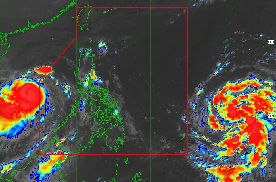
The Philippine Atmospheric, Geophysical and Astronomical Services Administration (PAGASA) confirmed on the morning of November 6 that the tropical depression outside the Philippine Forecast Area (PAR) has strengthened into Tropical Storm Fung-wong, with winds of 65 km/h, gusts of 80 km/h, central pressure of 998 hPa. The center of the storm is currently 1,715km northeast of Mindanao, moving west-northwest at a speed of 20km/h.
According to PAGASA, Typhoon Fung-wong will continue to rapidly strengthen, possibly reaching super typhoon level on November 8, before entering PAR and being locally named Uwan. The agency warned that there is a high chance of the storm making landfall in northern or central Luzon on November 10, coinciding with the time of reaching its strongest intensity in its life.
The storm has a strong wind area extending up to 550km from the center, with a storm radius expected to reach about 300km when approaching land, meaning the entire Luzon, including the capital Manila, will be affected by level 8-12 storm winds and very heavy rain.
The storm forecast shows that the level 5 wind warning signal - the highest in the Philippines - may be issued from November 8, as Samar provinces and the eastern Luzon area begin to experience strong gusts of wind, heavy rain and dangerous high waves.
PAGASA warned that bad weather will start from Sunday, November 9, with extremely heavy rain in northern and central Luzon for the next two days. The eastern coastal area could see dangerous storm surges, up to more than 3 meters high, threatening deep flooding in coastal provinces such as Isabela, Cagayan and Aurora.
Meteorological expert Huang En-hong of the CWA weather forecast center in Taiwan said that Taiwan will be most affected in the two days of November 11-12, when Fung-wong moves through the Strait of Si.
The northern, eastern and southern regions of the island may experience extremely heavy rainfall - 200mm in 24 hours or 100mm in just 3 hours, along with the risk of landslides, flash floods and strong winds of level 12-13.
Mr. Huang warned that in addition to the direct impact of the storm, the outer circulation of Fung-wong could also interact with the northeast monsoon, creating a "double-rain" effect, causing heavy rain even before the center of the storm approaches.
Meanwhile, the Hong Kong Observatory (China) forecasts that Typhoon Fung-wong is likely to approach the East Sea early next week, combined with the intensification of the northeast monsoon, causing strong winds and heavy rain along the coast of Guangdong (China).
According to the typhoon forecast of the Chinese meteorological AI model Fuxi, after making landfall in the Philippines, super typhoon Fung-wong may enter the East Sea on November 10, becoming the 14th typhoon, then moving near the Hong Kong (China) area - Hainan Island on November 11.
If this scenario occurs, the northern East Sea will have strong winds of level 14-16, gusting above level 17, seriously affecting maritime activities and offshore fishing.
Regarding storm No. 13 Kalmaegi, according to the Vietnam National Center for Hydro-Meteorological Forecasting (NCHMF), at 6:00 a.m. on November 6, the center of the storm was at about 13.2 degrees north latitude; 112.5 degrees east longitude, about 360km east-southeast of Quy Nhon (Gia Lai).
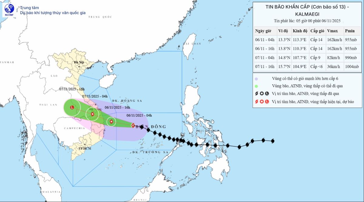
The strongest wind is level 14 (150-166 km/h), gusting to level 17. It is forecasted that in the next 3 hours, the storm will move mainly westward, at a speed of about 30 km/h.


