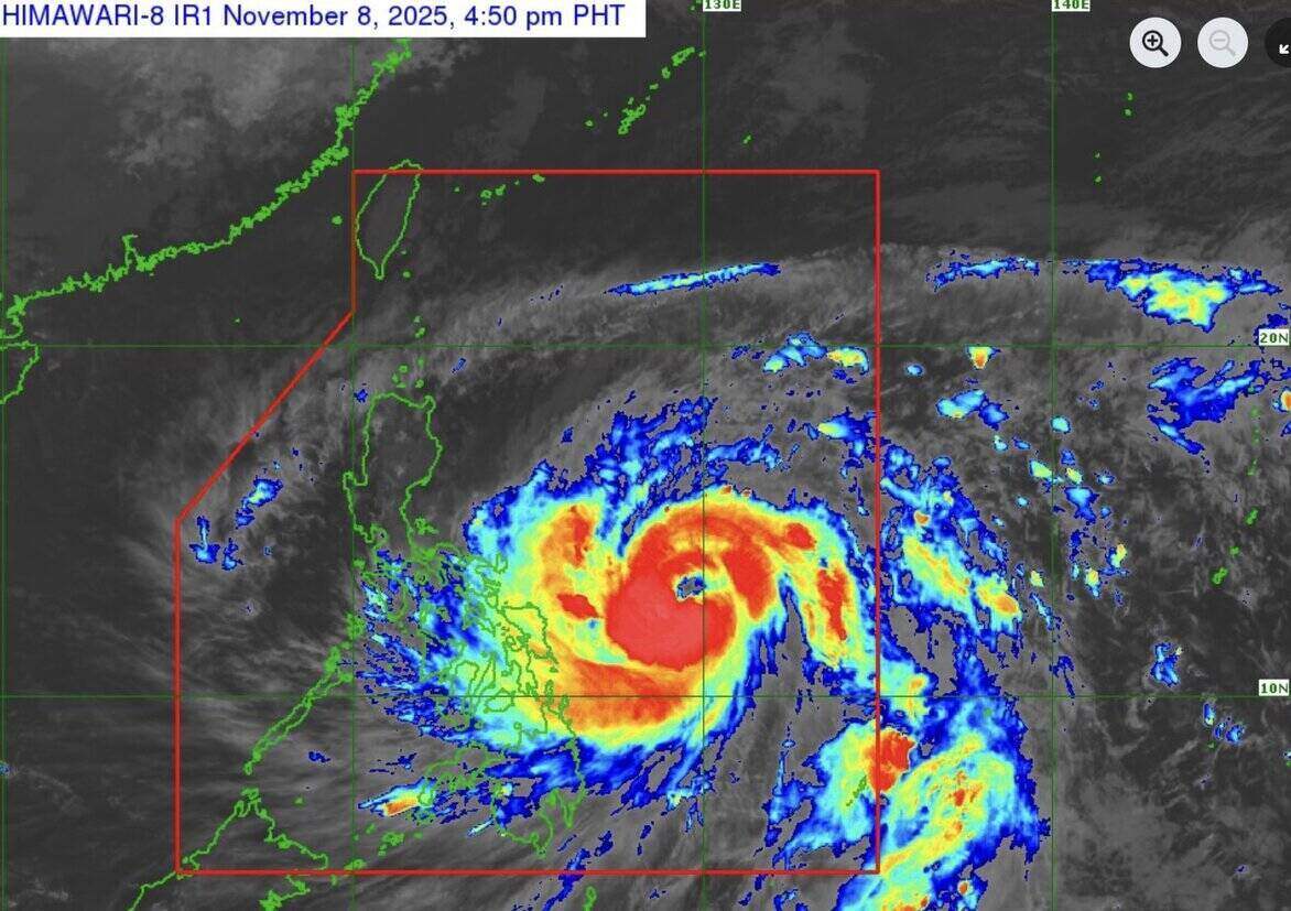
The latest storm information on the afternoon of November 8 from the Philippine Atmospheric, Geophysical and Astronomical Services Administration (PAGASA) said that typhoon Fung-wong (called Uwan in the Philippines) is continuing to rapidly increase as it moves over the Philippine Sea.
The center of the potential storm No. 14 in the East Sea is 620km east of Catarman, Northern Samar, Philippines 575km or east of Virac, Catanduanes, Philippines.
Typhoon Fung-wong is on track to strengthen into a super typhoon in the next few hours, with maximum sustained winds of 150 km/h near the center, gusts of up to 185 km/h.
The storm is moving west-northwest at a speed of 30 km/h, with strong typhoon-level winds extending up to 800 km from the center of the storm.
Philippine typhoon forecasters said Typhoon Fung-wong will move west-northwest on November 8 and 9 before turning northwest on November 10.
According to the forecast track of Typhoon Fung-wong, the center of the storm could pass near Catanduanes on the morning of November 9 and make landfall south of Isabela or north of Aurora on the evening of November 9 or early morning of November 10.
Notably, there is a possibility of Typhoon Fung-wong moving slightly south, which could lead to the possibility of the typhoon affecting or making landfall in Catanduanes.
After making landfall in the Philippines, the predecessor of Typhoon No. 14 will pass through the mountainous terrain of Northern Luzon and enter the Lingayen Gulf or coastal waters of Pangasinan or La Union in the morning or afternoon of November 10, officially starting to enter the East Sea.
In terms of intensity, Typhoon Fung-wong is forecast to rapidly strengthen, reaching super typhoon level on the night of November 8 or November 9, but typhoon experts in the Philippines also do not rule out the possibility of Typhoon Fung-wong strengthening faster due to favorable weather.
The Fung-wong is forecast to make landfall when it reaches or is close to peak intensity. The storm is expected to maintain typhoon intensity throughout the sweep of the Philippines.
Fung-wong is the second typhoon in a week heading straight towards the Philippines, after Typhoon No. 13 Kalmaegi, which killed nearly 200 people in the central Philippines and affected Vietnam.
As Fung-wong is forecast to strengthen into a super typhoon before making landfall in the Philippines, people on the path of the typhoon are being evacuated.
PAGASA weather forecaster Benison Estareja warned that the circulation of Typhoon Fung-wong, which stretches 1,500km, has caused heavy rain and strong winds in many areas of the Philippines. "The storm could cover almost the entire country," he said.
PAGASA has called on people in low-lying areas and coastal areas to evacuate to higher ground and temporarily suspend all activities at sea, while warning of strong winds and large waves causing heavy damage in Luzon - the most populous island in the Philippines, where the capital Manila is located.
According to the Civil Aviation Authority of the Philippines, a number of airlines, including Philippine Airlines, have canceled many flights due to the impact of Typhoon Fung-wong, the 21st typhoon in the country this year.


