The latest storm forecast from the Philippine Atmospheric, Geophysical and Astronomical Services Administration (PAGASA) on the afternoon of November 4 said that this potential super typhoon is a tropical depression outside the PAR.
The tropical depression is currently 1,985 km east of northeast Mindanao, Philippines, with sustained winds of 55 km/h near the center and gusts of up to 70 km/h.
PAGASA said that this tropical depression is moving west at a speed of 20 km/h and is expected to eventually move west-northwest, entering PAR on the evening of November 7 or November 8.
In terms of intensity, the system is forecast to strengthen over the Philippine Sea throughout the forecast period. The system could eventually reach typhoon status on November 6 and become a super typhoon by the end of the week," PAGASA forecasters said in a statement.
PAGASA later stressed that, based on the storm's threat forecast, the likelihood of a super typhoon making landfall in the Philippines is becoming more likely. However, the exact time and location of the landfall is still difficult to determine.
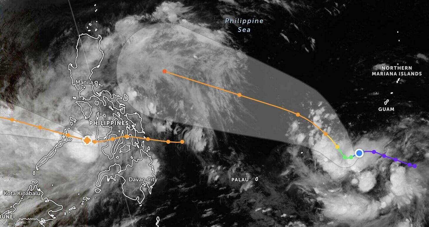
The Philippine weather agency noted that this potential super typhoon has not yet affected the country, but rough seas may appear in the northern and eastern coasts from November 7. When it reaches typhoon level, it will be named Uwan in the Philippines.
Currently, the Philippines is being affected by Typhoon Tino (international name: Kalmaegi). Typhoon Kalmaegi is forecast to continue sweeping the Western Visayas and northern Palawan until it entered the South China Sea on the morning of November 5, becoming the 13th typhoon in the South China Sea. Although the storm is expected to weaken, it is likely to remain at typhoon strength.
Typhoon Kalmaegi is causing thunderstorms in Palawan, Western Visayas, Negros Island and Central Visayas. Strong winds are also occurring in Eastern Visayas, Northern Mindanao, Albay, Sorsogon, Masbate and other parts of Mimaropa (Mindoro, Marinduque, Romblon, Palawan), while the trough or the expansion zone of the typhoon is causing scattered rains in the remaining areas of Mindanao and Bicol.
Along with Typhoon Kalmaegi, the Philippines is under the influence of the northeast monsoon and wind shear, causing rain in northern and central Luzon. In particular, wind shear will cause scattered showers and thunderstorms in the urban areas of Manila, Calabarzon, Central Luzon, Isabela and Aurora. Cloudy weather forecast, showers due to the northeast monsoon in Ilocos, Cordillera and other areas of Cagayan Valley.
Due to different weather systems, flooding and landslides are possible across the Philippines.


