
On September 21 (local time), according to storm news, the latest low pressure from the US National Hurricane Center (NHC), Typhoon Polo is rapidly strengthening over the Pacific Ocean and is forecast to reach large typhoon intensity in the coming days.
Typhoon Polo has sustained winds of about 150km/h and is located about 470km south-southeast of Mexico's Manzanillo city, about 290km south-southwest of Zihuatanejo.
The NHC forecasts Polo will have a strong shift to the west-northwest or northwest at the end of September 22, moving along the west coast of Mexico but still offshore.
Notably, Polo is forecast to undergo a very rapid intensification process. The storm's wind speed may increase from about 129km/h on the morning of September 21st to 193km/h on the morning of September 22nd and is likely to reach 257km/h by the end of September 22nd, equivalent to a Category 5 storm.
The NHC assesses Polo's ability to increase in intensity at a particularly high level. According to the agency, "rapid intensification" occurs when the strongest sustained wind of a tropical cyclone increases by at least 56km/h in 24 hours.
Sea surface temperatures above 30 degrees Celsius, weak winds and abundant moisture supply are creating a favorable environment for Polo to strengthen. The US National Oceanic and Atmospheric Administration (NOAA) also recorded widespread sea heat waves in the eastern tropical Pacific region.
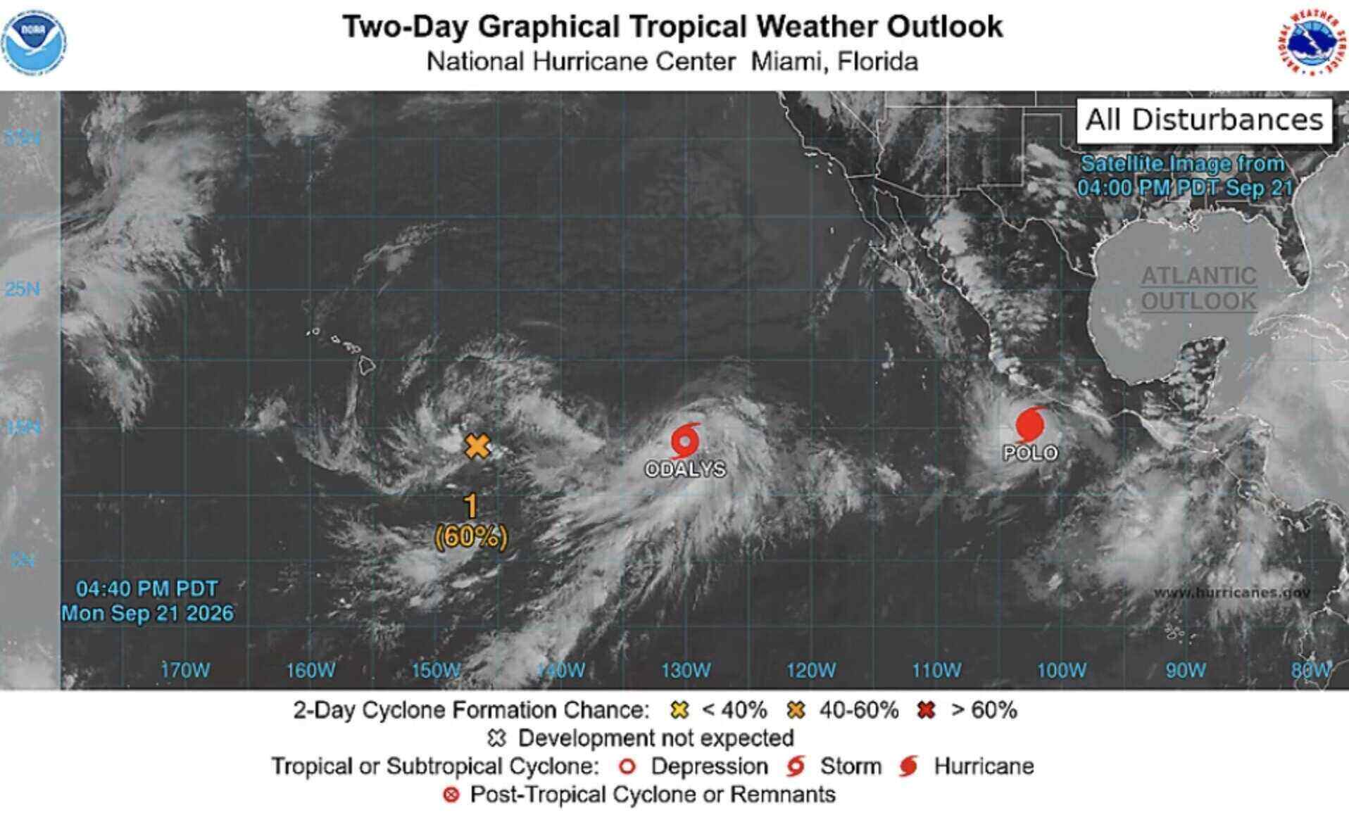
In Mexico, the NHC forecasts that coastal areas of Guerrero and Michoacán may experience rainfall of 100-200mm, with a maximum of about 300mm, from now until September 24. Heavy rain may cause flooding and landslides. Strong tropical storm winds may appear from the night of September 22 or early September 23, while large waves and offshore currents may begin from September 22.
In the western Pacific, tropical storm Odalys is also forecast to continue to strengthen in the middle of the week. Odalys has winds of about 85km/h on September 21 and is located more than 2,250km south of the southern tip of the Baja California peninsula of Mexico.
The NHC is also monitoring a low pressure area near Hawaii, with a 90% chance of developing into a tropical depression in 7 days. The developments of Polo, Odalys and the system near Hawaii are still uncertain, especially regarding the path in the coming days.


