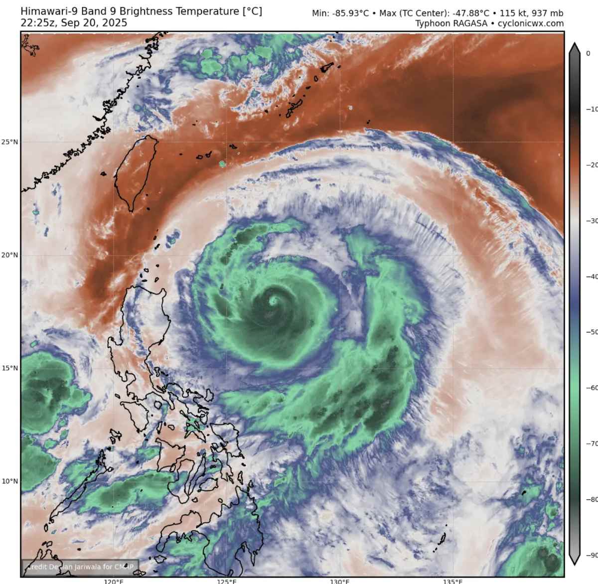
The Northwest Pacific this week is becoming the focus of meteorological attention as two storms Ragasa and Neoguri simultaneously increased to extremely rapid intensity, both reaching super typhoons with winds of 222-231 km/h. The central pressure of both storms fell below 940 mbar - a typical level of monster storms, which is very rare in the Northwest Pacific typhoon center.
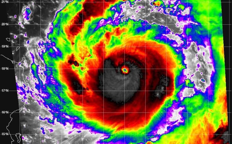
Satellite imagery on the morning of September 21 showed that super typhoons Ragasa and Neoguri both have a giant, symmetrical structure and clear eye, signaling that the storm is in the phase of maximum intensity.
Super Typhoon Ragasa is a real danger. The latest storm information from the Philippine Atmospheric, Geophysical and Astronomical Services Administration (PAGASA) said that at 2:00 p.m. on September 21, the center of the storm was at 17.9 degrees north latitude, 127.6 degrees east longitude, about 620km east of Luzon Island.
The strongest wind near the storm center is 175km/h (level 14-15), gusting over 215km/h (level 17). The storm is moving west-northwest at a speed of about 15-20km/h.
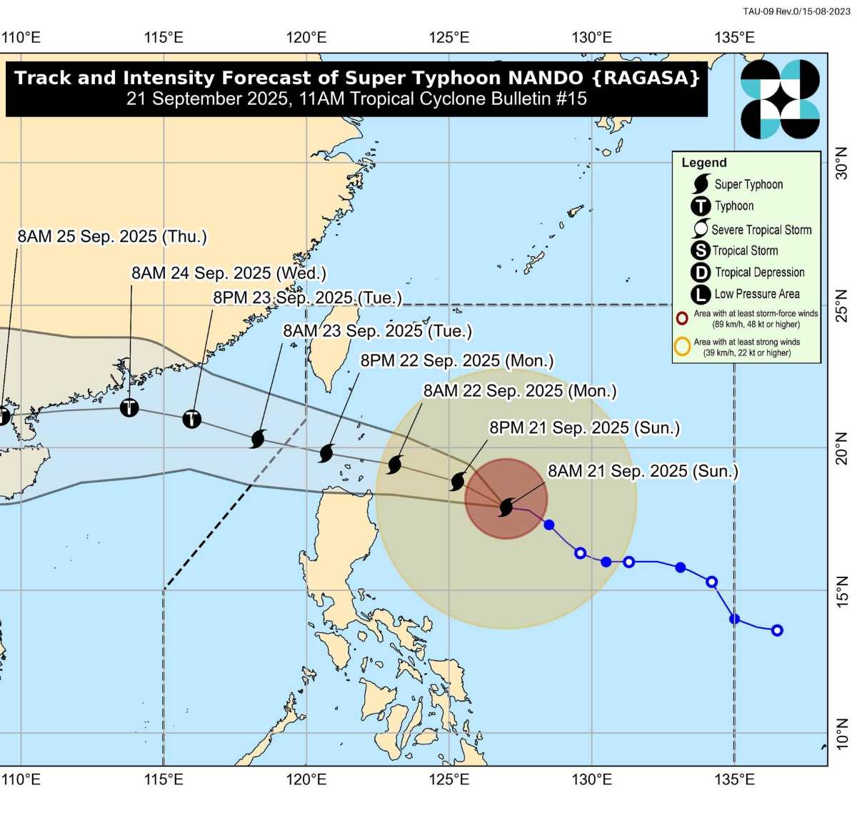
Unlike Typhoon Neoguri, which remains off the southeastern coast of Japan, Super Typhoon Ragasa is forecast to sweep across northern Luzon Island on September 23 before heading towards Hong Kong (China) on September 24.
Analysis data shows that super typhoon Ragasa has the potential to strengthen, possibly reaching the super typhoon level above level 17 - the highest level of destruction. The maximum sustained wind zone currently covers 530km around the center of the storm.
People in the northern provinces of the Philippines are being warned to face strong gusts of wind, heavy rain, high waves and the risk of flash floods and landslides. After overtaking Luzon, super typhoon Ragasa is expected to maintain its strength as it approaches Hong Kong (China) and the coast of Guangdong (China).
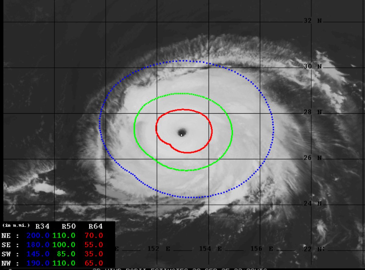
Meanwhile, super typhoon Neoguri continues to move in the sea southeast of Japan. Thanks to the unusually high sea surface temperature of 30-32 degrees Celsius (2-3 degrees Celsius higher than the average), this storm is strengthening its structure with winds of 250-259 km/h.
The pink photo on the morning of September 21 shows Neoguri having a large storm eye, a closed convective cloud circle and a cold cloud peak of -83°C, typical of a standard super typhoon. However, as it has no mainland on its way, Neoguri will only cause large waves offshore, then turn northeast and gradually weaken in the middle of the week.
Meteorological experts point out that the abnormality of sea surface temperatures in the Northwest Pacific this year is the main cause of the explosion of Typhoon Ragasa and Typhoon Neoguri. The hot water of 30-32 degrees Celsius, even 5 degrees Celsius above average in eastern Japan, provided huge energy for the storm, accelerating the rapid intensification.
According to the storm forecast of the Vietnam National Center for Hydro-Meteorological Forecasting, at 1:00 p.m. on September 23, Typhoon Ragasa entered the eastern sea of the North East Sea, becoming storm No. 9, with an intensity of level 16-17, gusting above level 17.
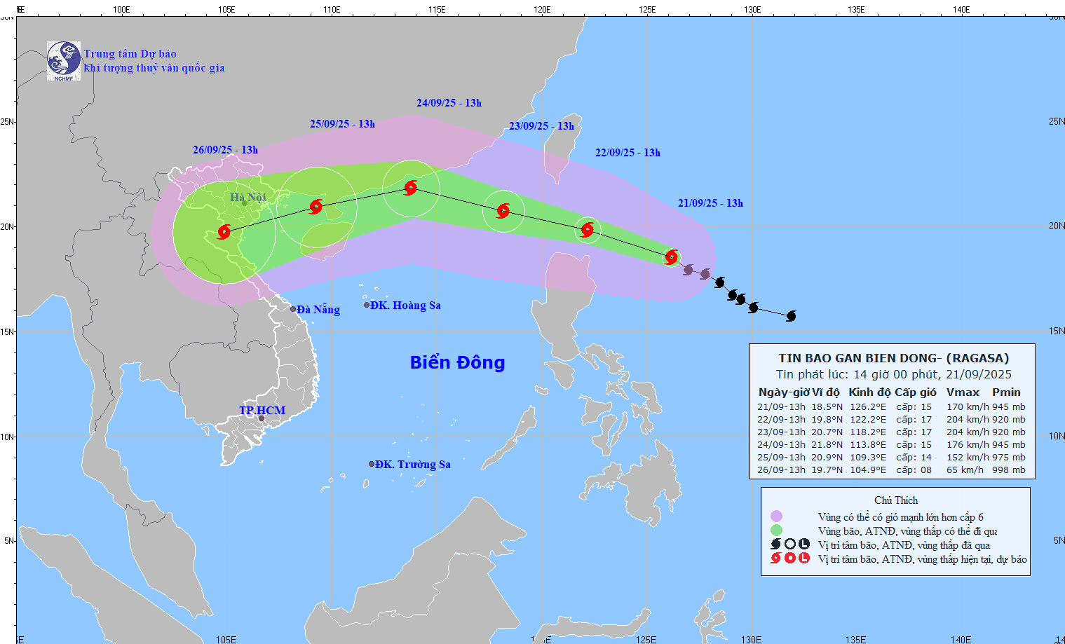
It is forecasted that by September 26, the storm will enter Northern Vietnam.