Polar vortex - originally a strong cyclone with a giant low pressure, continuously rotates on the average layer near the Arctic during the cold season.
Currently at an altitude of 11-50 km, it acts as a "city wall" to keep cold air in the north, preventing it from overflowing into densely populated areas in North America and Europe.
When the tornado is extremely strong, round and in the right position, the possibility of frost spreading is often much lower.
But when it weakens, is deformed or is pulled away from the Arctic, the scenario is often reversed. The cold air has the opportunity to "crosse the fence" to the south, causing prolonged cold spells.
The phenomenon of extreme cyclone deformation is often associated with a sudden warming of the average water level (SSW) - when the temperature can increase by a few dozen degrees in just a few days.
The unusual point is that: A strong SSW is forecast to form in late November. In data from the late 1950s, the phenomenon has only occurred so early twice, in 1958 and 1968 respectively.
If the forecast comes true, this will be one of the earliest cosmetic cyclones in 27 years, which is considered by scientists to be particularly rare.
Scientist Judah Cohen ( MIT Institute of Technology) said that this extremely weak tornado could last for a long time, making it difficult for the meteorological model to predict the level of impact. If the SSW is strong enough, it could increase the risk of more severe winter weather, but the impact is not immediate.
According to Professor Jason Furtado (University of Oklahoma), the US often has a 2-4 week delay between the time when tornadoes become extremely weak and when strong cold spells actually come.
This means December could become a period of accelerating cold air, especially in the central and eastern United States.
In addition, La Nina - the phenomenon of cold ocean waters moving over the Pacific Ocean - also adds signals for a colder-than-average winter in northern states.
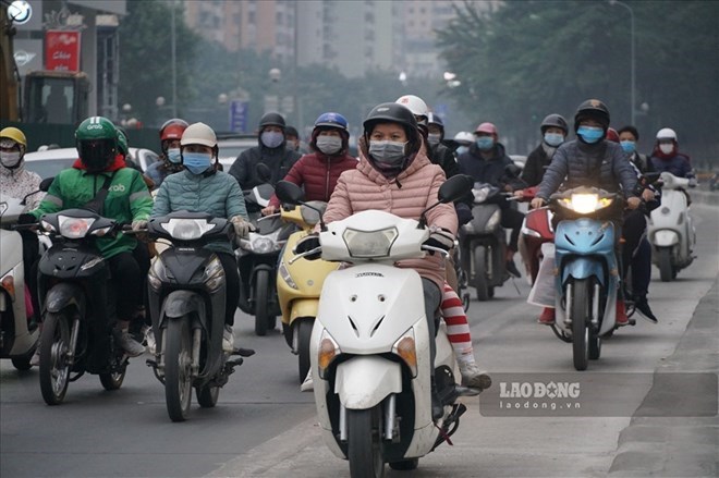
Meanwhile, in Vietnam, from the night of November 18, cold air has affected most of the North Central region and some places in the Central Central region. In the North and North Central regions, there will be rain and showers.
According to the Vietnam National Center for Hydro-Meteorological Forecasting, on November 19, cold air continued to affect other places in the Central Central region, then affected the South Central region.
On land, the northeast wind is strong at level 3-4, coastal areas are strong at level 4-5, some places are at level 6, gusting to level 7.
Due to the influence of the strengthening cold air, in the Northern region, Thanh Hoa and Nghe An, there will be rain, showers and thunderstorms in some places.
In the North and North Central regions, it will be cold; in the mountainous and midland areas of the North, it will be very cold, in the high mountains, there will be severe cold, and in the Northern Delta, there will be severe cold. From November 19, in Quang Tri province and Hue City, the night and morning will be cold.
Lowest temperature in cold air:
Northern and North Central Plains: 12-15 degrees Celsius.
Northern mountainous and midland areas: 9-12 degrees Celsius.
High mountainous areas: Some places below 5 degrees Celsius.
Quang Tri and Hue City: 17-19 degrees Celsius.
Hanoi area: There will be rain, showers. Cold weather, some places are very cold. The lowest temperature is commonly 12-14 degrees Celsius.


