The low pressure area that appeared in the central and northern United States last weekend and the extremely strong cold air mass from Canada are creating an unusually intense early snowstorm covering the Big five in the United States.
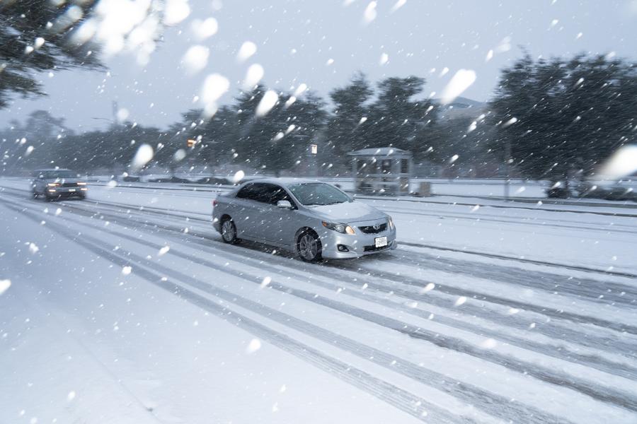
The phenomenon left visibility almost zero, traffic paralyzed and forced the National Weather Service (NWS) to issue the first emergency winter storm warning in November in many years.
According to NWS, this phenomenon could cause snowfall of 60cm to 1.2m thick in some areas along Lake Michigan, making traffic almost impossible. This is the first snowfall of the year in many states in the midwest and northeast of the US, signaling that a harsh La Nina winter has arrived earlier than expected.
The NWS warned of dangerous travel conditions as snowstorms continue to operate strongly around Lake Michigan, Lake Erie and Lake Ontario.
Wind gusts can reach speeds of 50-60 km/h, creating a phenomenon of fog flying, blocking visibility.
In Chicago ( Illinois), the NWS has issued a Winter Typhoon Warning - the first time in the past 7 years it has been activated in November. The local meteorological office said that the extended fixed snow lines could create extremely dangerous and life-threatening situations in areas with the heaviest snowfall.
According to the FOX Weather Forecast Center, on the evening of November 9 (US time - morning of November 10, Vietnam time), the center of the low pressure is located in the central state of Illinois, sucking more moisture from the south and pulling down the cold air from Canada, creating conditions for heavier snowfall.
Michigan, Indiana, New York and Pennsylvania are forecast to see 20-60cm of snow, with the northwest Indiana likely to see more than 60cm, while northern New York expected to see 20-30cm of snow.
On the morning of November 10, the depression continued to move eastward, causing more snow in Lake Erie and Lake Ontario during the day, before weakening.

Meteorologists say the La Nina phenomenon has appeared early, increasing the frequency and intensity of cold air flowing into the midwest and northeastern United States.
When the cold air from Canada meets the lake's water while it is still warm, it sucks in moisture and creates heavy snowfall, concentrated in fixed bands.
This is a typical type of La Nina winter, when the cold air falls early, the snow falls heavier and lasts longer than usual, said NWS meteorologist.
Heavy snowfall has caused many expressways in Michigan and Illinois to be congested, hundreds of flights in Chicago and Detroit have to be delayed or canceled.
The authorities have warned people to limit going out, stock up on necessities and prepare a backup heating source in case of prolonged power outages.
This is an extremely dangerous snowstorm. Just a few minutes outdoors in these conditions can cause serious hypothermia, the NWS warned.
This low pressure combined with strong cold air is considered an early signal for a severe winter on a large scale.
Meteorologists predict that many new low pressure areas may continue to overflow in December, prolonging snowstorms, frost and strong winds in the central and northeastern regions of the US, while affecting the weather in the entire Northern Hemisphere in the coming weeks.


