Latest typhoon news from the Joint Typhoon Warning Center (JTWC) of the United States Air Force and the United States Navy predicts that a new low-pressure system in southern Japan has the potential to strengthen into a typhoon.
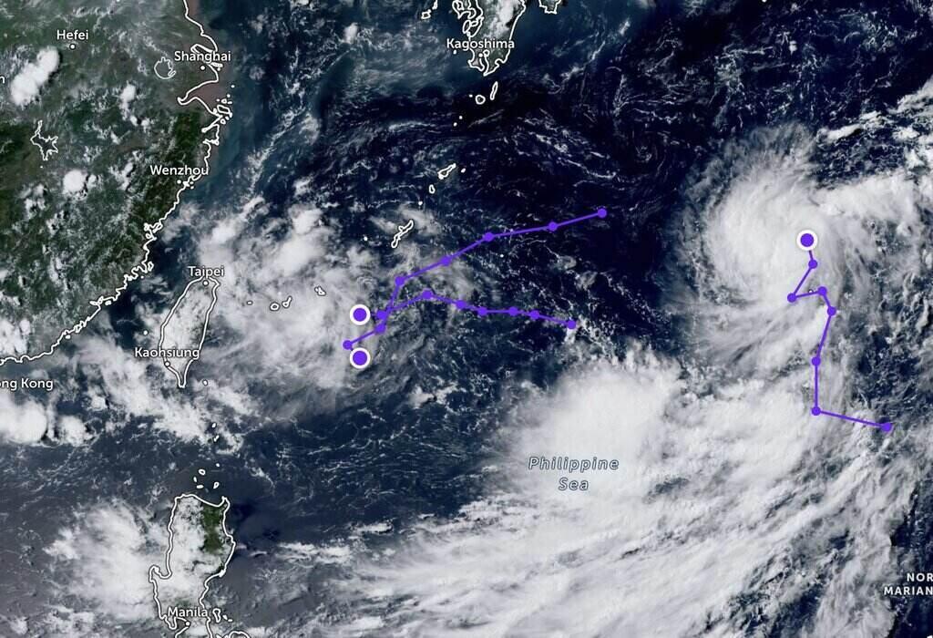
The Joint Typhoon Warning Center (JTWC) is monitoring the developing low-pressure system Invest 94W in southern Japan.
Forecasters predict that this low-pressure system has the potential to strengthen into a typhoon within the next 24 hours. The Joint Typhoon Warning Center reports that the low-pressure system has a maximum sustained surface wind speed of approximately 35-45 km/h, with a minimum estimated sea level pressure of around 1003 hPa.
All models typhoon forecast agree that the low-pressure system Invest 94W will move more to the northwest in the next 24 hours with stronger winds concentrated along the eastern edge.
In the meantime, two low-pressure systems have appeared in the South China Sea in recent days. One low-pressure system is located within the Philippine Area of Responsibility (PAR) and the other is outside the PAR.
According to the typhoon report, the latest tropical depression from the Philippine Atmospheric, Geophysical and Astronomical Services Administration (PAGASA), South China Sea low-pressure system is approximately 835 km away from Northern Luzon. Meanwhile, the low-pressure system outside the PAR of the Philippines is located to the east of Luzon.
PAGASA's typhoon forecasting expert Obet Badrina stated: "We do not expect these two low-pressure systems to strengthen into typhoons, at least based on the latest data we have.
These two low-pressure systems will not have a direct impact on any area of the Philippines, but we will continue to monitor them. We do not rule out the possibility that the low-pressure system may strengthen into a typhoon".
Manila Standard reports that PAGASA predicts that there will be 2-3 typhoons forming or making landfall in the Philippine Area of Responsibility (PAR) in August.
According to Manila Standard's report, the Philippines will use a $1 million grant from the United States to respond to the damage caused by Typhoon Butchoy and Typhoon Carina and support communities in Bulacan, Ilocos Norte, Ilocos Sur, Lanao Del Sur, Maguindanao del Norte, Maguindanao del Sur, the National Capital Region, and Pampanga.
Earlier, the National Risk Reduction and Management Council (NRRDMC) reported that the total agricultural losses in the Philippines reached PHP 1.08 billion (approximately $18 million USD) due to the combined impact of Typhoon Butchoy (internationally known as Prapiroon) and Typhoon Carina (internationally known as Gaemi) and the southwest monsoon.
The typhoon information from the Philippine Atmospheric, Geophysical and Astronomical Services Administration (PAGASA) notes that the Philippine Area of Responsibility (PAR) is the area where the most typhoons occur in the world.
With an average of 20 typhoons in the region each year, approximately 8-9 of these typhoons will make landfall in the Philippines. "The peak of typhoon season is from July to October, when nearly 70% of the total number of typhoons form during this period" - PAGASA notes.


