Prolonged landslides, requiring a review of the land preservation problem
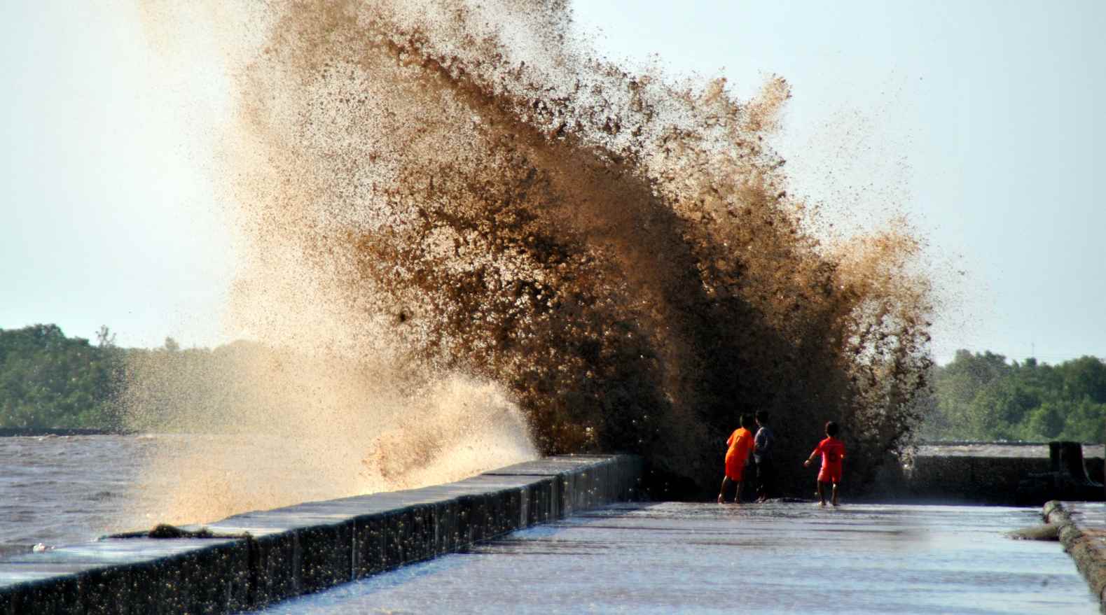
Ca Mau is the locality with the longest coastline in the Mekong Delta, about 310km, stretching along both the East Sea and the West Sea, and is also a place heavily affected by climate change, high tides, strong storms and land subsidence, landslides...
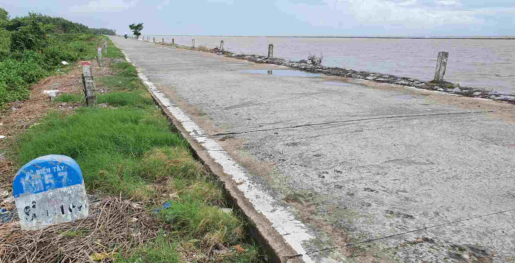
According to statistics from the Department of Agriculture and Environment, more than 110km of Ca Mau coastline is being eroded, in which many sections are identified as particularly dangerous, in some places the sea encroaches deep into the mainland from 20 to 45m each year. In the East Sea coast area alone, historical data and satellite images show that for more than a century, kilometers of coastal land have been lost.
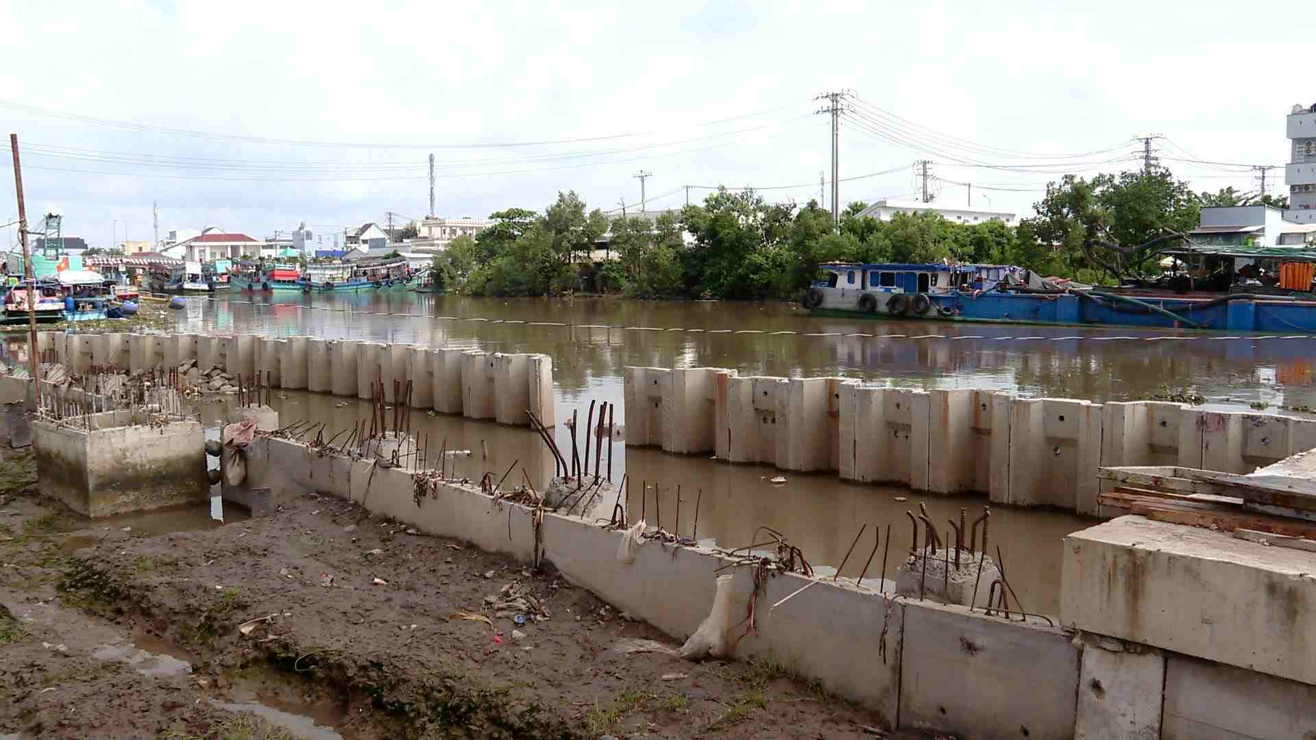
Over the past time, the province has implemented many coastal protection solutions such as hard embankments, soft embankments, siltation, planting and restoring mangrove forests. These works contribute to limiting landslides, protecting coastal residents and restoring protection forest areas. However, in the face of increasingly complex developments of natural disasters and sea level rise, individual defense solutions are no longer capable of creating long-term stability for the coastline.
That reality forces the locality to re-set the problem of keeping land in a more proactive direction, not only defending inshore but also gradually restoring the coastal space that has been eroded.
Solving difficulties for the sea encroachment problem
According to the provincial plan for the period 2021–2030, vision to 2050, Ca Mau determines that sea reclamation is not an intrinsic goal, but a comprehensive technical solution to restore the coastline, create a coastal protection corridor and form a new development land fund, initially concentrated in the East Sea coast area.
The draft project to restore the East Sea coastline is built in two phases. Phase one focuses on disaster prevention and control and climate change adaptation through a system of landslide prevention embankments, wave-breaking embankments combined with viaducts, solutions to cause mud and sand accumulation and restore mangrove forests. The land area formed behind the embankment is the result of a controlled natural accretion process.
Phase two: socio-economic development on land is restored, associated with ecosystem conservation, development of marine economic infrastructure, logistics, coastal urban areas and eco-tourism, while arranging national defense and security works in suitable locations.
The total land area expected to be formed after the embankment is nearly 2,900ha, concentrated in areas such as Khai Long - Dat Mui, Rach Goc - logistics area serving Hon Khoai General Port and part of Nha Mat beach. This land fund is expected to create resources for reinvestment in landslide prevention and control and climate change adaptation.
One of the major obstacles currently is the legal framework related to sea encroachment and shoreline restoration activities. Due to the lack of specific regulations, Ca Mau Provincial People's Committee has proposed to competent authorities to allow the application of special mechanisms and policies or both adjust planning and implement projects.
At the same time, the province is considering capital mobilization options, including the state budget, bidding for land use rights formed after the embankment and the public-private partnership model, in order to reduce budget pressure and attract social resources.
From the reality of prolonged land loss, Ca Mau is choosing a more proactive approach to retain land and stabilize the shoreline. The study of sea reclamation in seriously eroded areas, if implemented cautiously and in accordance with regulations, is expected to create a foundation for marine economic development associated with environmental protection and climate change adaptation.


