The National Center for Hydro-Meteorological Forecasting has issued a forecast of notable weather trends in August.
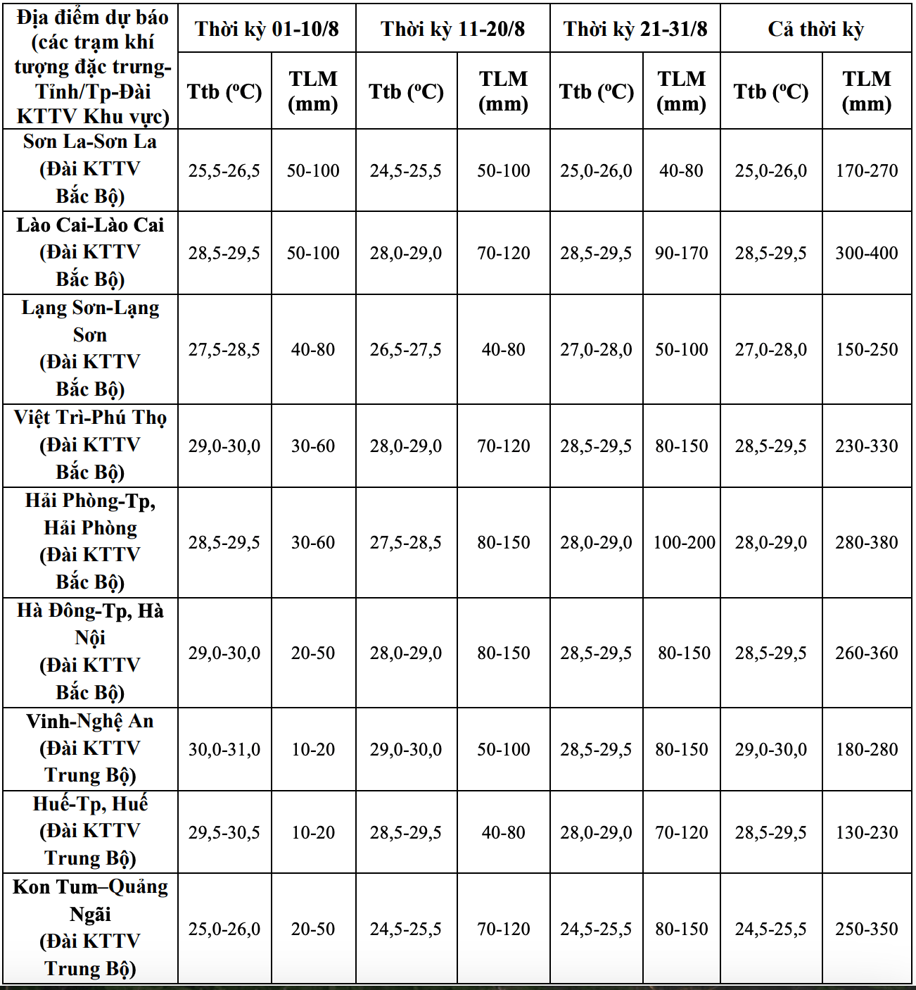
Regarding temperature trends, the average temperature is generally approximately the same as the average of many years in the same period.
Hot weather continues to occur in the Northern regions, from Thanh Hoa - Hue and the South Central Coast, concentrated in the first half of August 2025, then gradually decreases.
Previously, in July, there were 3 hot weather periods in the Northern region from July 8 to 9; from July 17 to 19 and from July 28 to 31, with the highest temperature of the day generally from 35 to 38 degrees Celsius, in some places higher.
In the provinces from Thanh Hoa to Da Nang, the eastern areas of the provinces from Quang Ngai to Dak Lak and Khanh Hoa, there were 3 hot weather periods on July 8 - 9; from July 16 - 19 and July 29 - 31, with the highest temperature of the day generally from 35 - 38 degrees Celsius, some places higher.
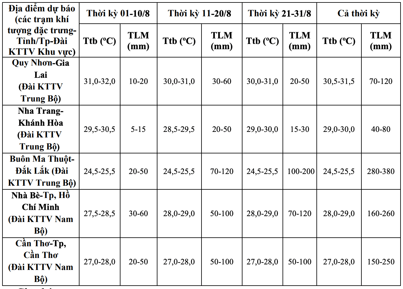
Regarding the rainfall trend, nationwide, total rainfall is generally at the same level as the average of many years, especially in the South Central Coast region, the total rainfall is 10 - 25% higher than the average of many years in the same period.
The Northern region and the provinces from Thanh Hoa to Hue are likely to experience some widespread heavy rains. In the Central and Southern Plateau, there are many days of the month with showers and thunderstorms, mainly in the late afternoon. In particular, some days may have moderate to heavy rain.
On a national scale, there is a continued possibility of dangerous weather phenomena such as thunderstorms, tornadoes, lightning, hail and strong gusts of wind.
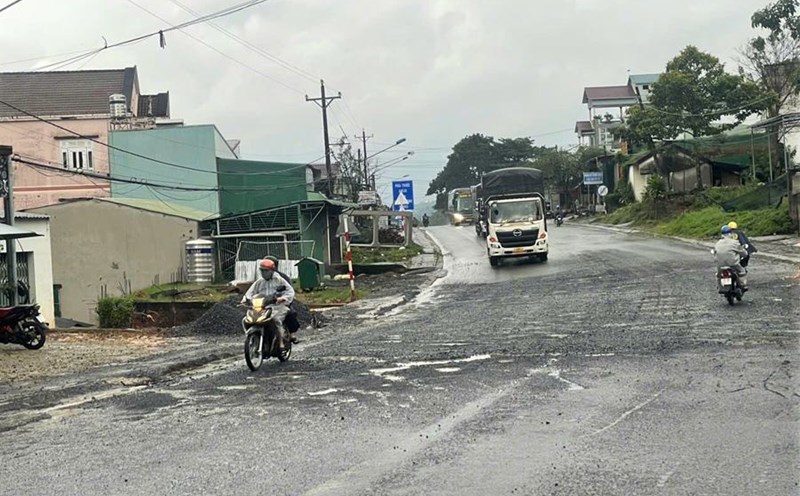
The phenomenon of heavy rain and thunderstorms, whirlwinds, and lightning can negatively affect production activities and public health. In particular, beware of localized heavy rains that can cause floods, inundation in low-lying areas and landslides in mountainous areas.
Previously, in July, there were many rainy days in the Northern provinces, including 3 large-scale heavy rains. Notably, the rain from July 19 to 27 was affected by storm No. 3, then by the influence of the tropical convergence zone, so the total rainfall was generally from 150 - 230mm, in some places higher such as in Song Ma (Son La) 373mm, Mai Chau (Phu Tho) 290mm, Van Ly (Ninh Binh) 422mm, Nam Dinh (Ninh Binh) 288mm, Yen Dinh (Thanh Hoa) 404mm, ...
Thanh Hoa to Hue and the South Central Coast have 4 widespread showers and thunderstorms. The Central and Southern Highlands region will experience many days of showers and thunderstorms, including days of moderate to heavy rain.
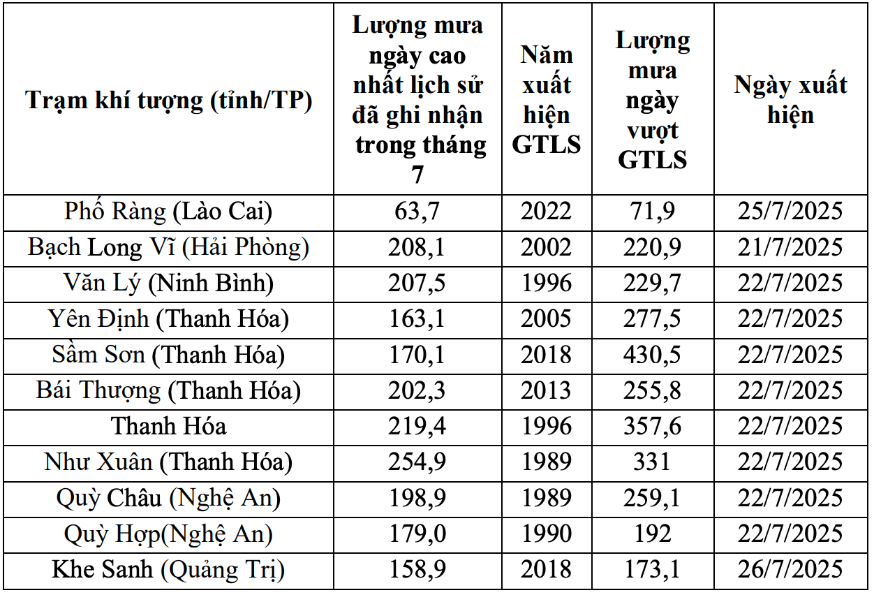
Some stations recorded the highest daily and monthly rainfall values exceeding historical values.
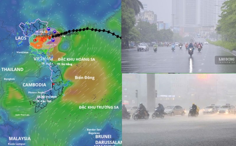
Regarding dangerous phenomena at sea, during the August period, it is forecasted that there will be 1 - 2 storms/tropical depressions appearing in the East Sea and may affect the mainland of Vietnam. According to the average data of many years, in August of the same period, there will be about 2.4 storms or tropical depressions in the East Sea, 0.8 of which will make landfall in Vietnam.
Storms, tropical depressions and the southwest monsoon are likely to cause strong winds, large waves at sea and affect the activities of ships.
Previously, in July, there were 3 storms in the East Sea, including storm No. 2 Today, storm No. 3 Wipha and storm No. 4 Comay.