As Lao Dong reported, recently, due to the influence of the low pressure trough, it gradually moved south because the northern continental high pressure has an axis through the North, combined with the high-altitude wind convergence area, on May 22 and 23, Lao Cai and Yen Bai provinces had heavy rain.
Heavy rain caused local flooding, landslides in the above two localities, floods caused water in streams and streams to rise, flooding the spillways, and the temporary Sim San bridge in Y Ty commune ( Bat Xat, Lao Cai) was swept away; the center of Yen Bai city recorded flooding in many places...
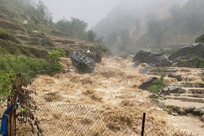
Upstream heavy rain, floodwaters from the sau and poured into the Red River, causing the water level of this river to increase significantly. As noted by the Lao Dong Newspaper reporter on the morning of May 25, the water level of the Red River in Phu Tho province has rising.
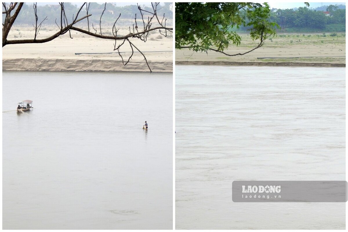
In many river sections, just a few weeks ago, there were still sand dunes, giant alluvial plains, and overgrown grass in the middle of the river when the water level was low, now covered by floodwaters. The Red River returns with the image of a large, cloudy flow.
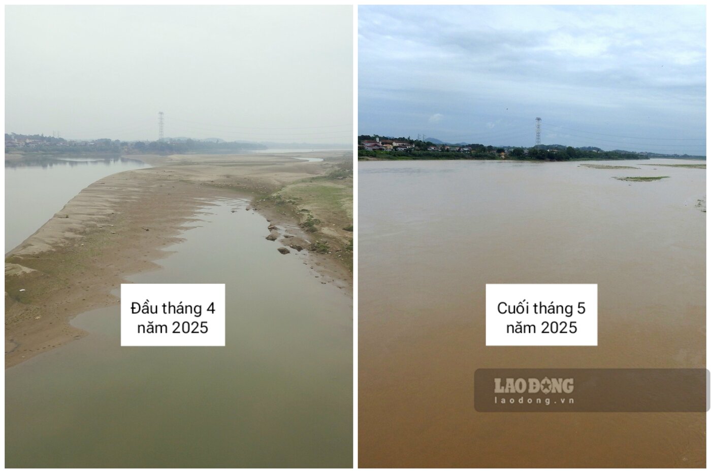
In the Ngoc Thap bridge area passing through Ha Thach commune, Phu Tho town - where the reporter once recorded the narrowing water flow, at first glance as walking, now the water level has risen, the difference is obvious.
With the current river flood level, up to now, no impact has been recorded on the crops and the lives of people on both banks. The fact that the river is "thirsty" after many months of drought has made ferry terminals operate better to serve people.
Mr. Tran Van Ton - Owner of Tinh Cuong ferry terminal connecting Nhat Tien commune, Cam Khe district with Thanh Ha commune, Thanh Ba district - shared: "The water level of the Red River has risen in recent days, ferry terminal travel is easier than before, there is no need to go around or reinforce the terminal to the middle of the river to pick up and drop off customers like when the river was low, saving operating costs".
According to the National Center for Hydro-Meteorological Forecasting's Short-term Hydrological Forecast and Warning bulletin No. 145 dated May 25, the water level on the Red River in Yen Bai will continue to decrease, the water level in Phu Tho will rise in the first 12 hours and then fluctuate according to the downward trend.

The actual water level measured on the Red River at Phu Tho Station was 13h on 23.5 was 11.81 m, until 7am 24.5 was 12.19 m, until 7am on 25.5 was 13.55 m. It is forecasted that until 19h tonight, the water level will rise to 13.80 m and then down.
According to the previous forecast, in the 11 days from May 21 to 31, on the Red River, the Lo River is likely to experience a concentrated flood from May 24 to 27 with a flood amplitude of 1 - 3 m. The peak flood level of the rivers is still below alert level 1.
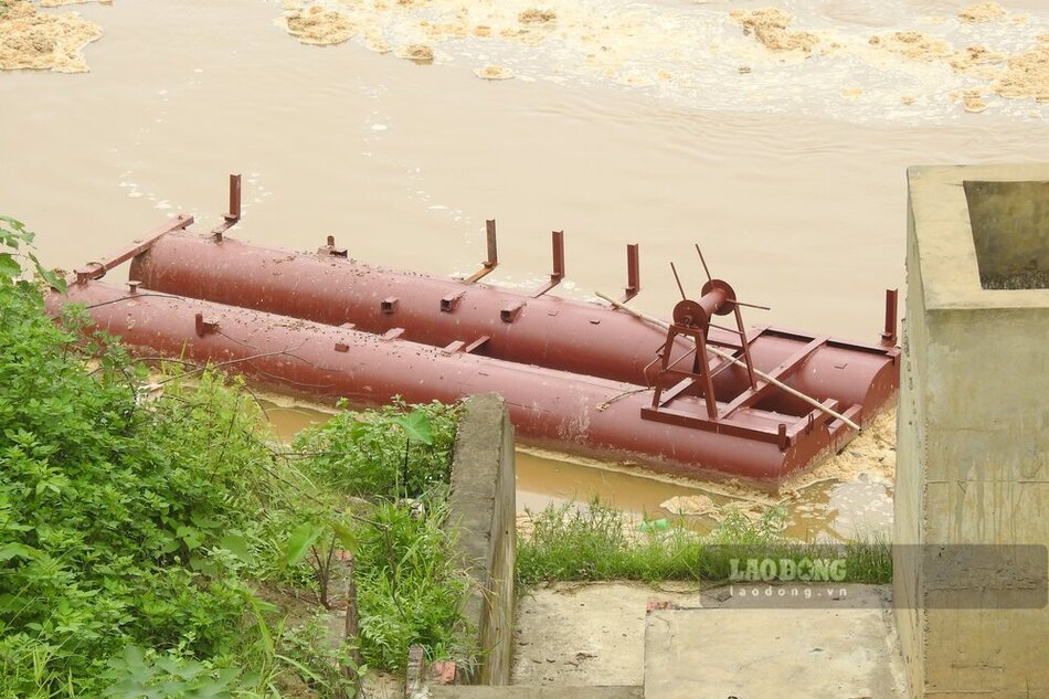
As reported, at 5:00 a.m. on May 25, due to the rising water level of the Red River and the high flow rate, the Phong Chau pontoon bridge operator cut the pontoon bridge to ensure safety.


