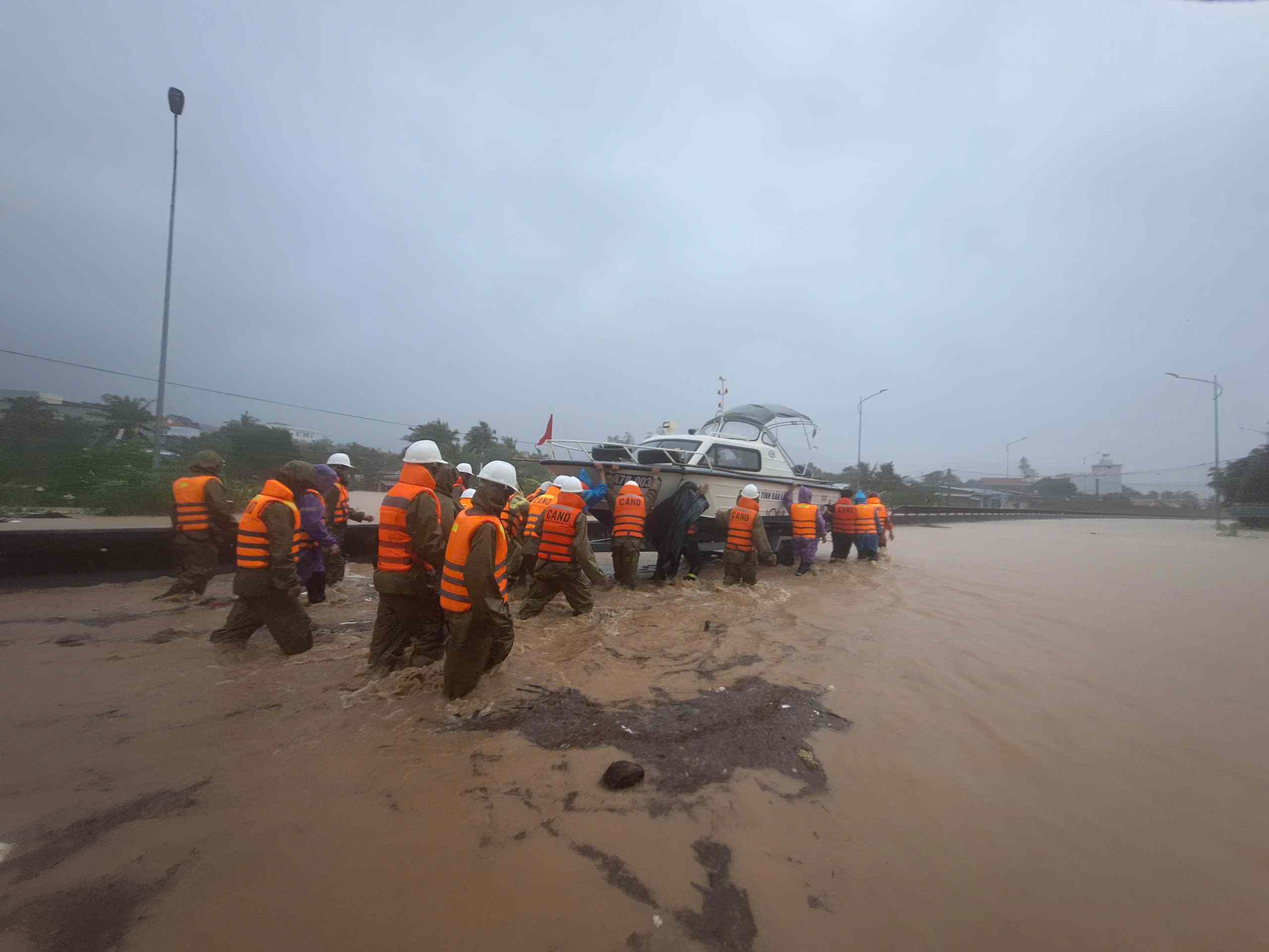
On the afternoon of November 19, many communes and wards in the eastern area of Dak Lak province are suffering heavy damage due to rapidly flowing floodwaters. Local authorities are organizing forces to evacuate people to safe places.
According to research, on the Serepok River, the water level at 10:00 at stations: Krong Buk above alert level 1 is 0.31m, Giang Son station - Krong Ana river above alert level 2 is 0.08m, Ban Don below alert level 2 is 0.6m.
On the Ba River, the water level fluctuates according to the regulation of hydropower plants and irrigation lakes. The water level at 10:00 at Cung Son station was above alert level 3 at 3.01m, Phu Lam below alert level 3 at 0.73m. On Ban Thach River at Hoa My Tay station, it reached alert level 3.
In the next 6 - 12 hours, floods in the Ky Lo, Tam Giang rivers and the downstream of the Ba river will continue to rise.
On Ban Thach River, the level from alert level 3 to above alert level 3 is 1.6m. In the Serepok River basin, the flood level continues to rise and fluctuate at a high level, at Ban Don station it is likely to reach approximately alert level 2 and Giang Son station will fluctuate at a level 0.2 - 0.4m above alert level 2.
Ms. Nguyen Nhu Bao Tram (residing in Dong Xuan commune, Dak Lak province) shared: "This morning, floodwaters poured in heavily, causing many areas in Dong Xuan commune, along the Ky Lo river to be submerged in water. Many level 4 houses in the country have reached the roofs, causing people to be stuck. Floodwaters have surpassed the historical mark in 2009, many people have fled to the mountainous areas and railway tracks to avoid flooding".
Currently, the authorities have evacuated 96 households in Dong Xuan, Xuan Lanh communes... to safety. Many flooded sections of the road have been blocked, prohibiting people from passing.
According to the Traffic Police Department of Dak Lak Province Police, National Highway 29 is flooded from 0.5 to 1m, causing traffic disruption at some locations at km49, km65, km72.


