
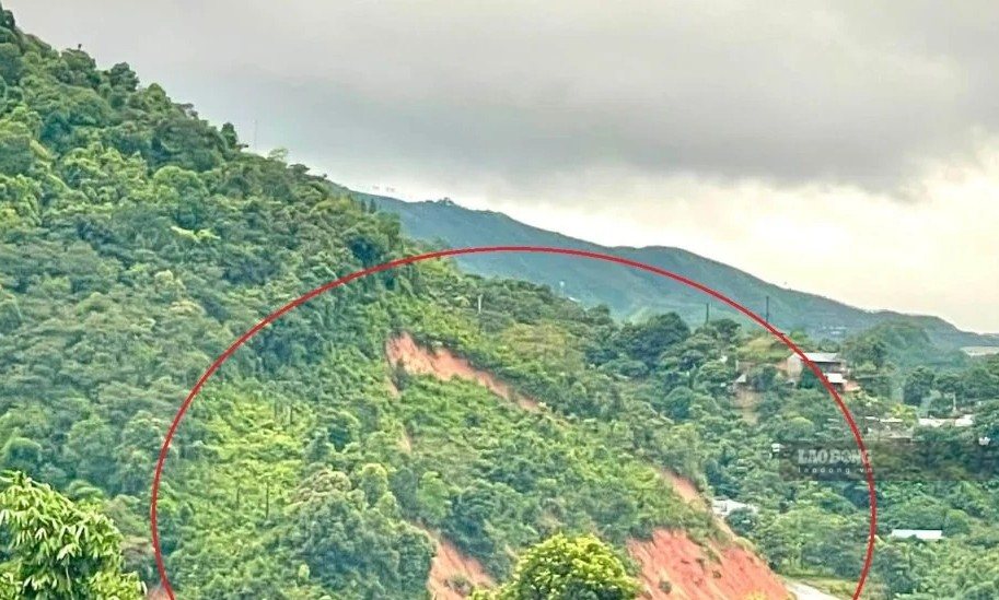
On August 24, Nhi Son Commune People's Committee said that due to prolonged heavy rain, cracks and subsidence appeared in the mountain area above the road to Keo Huon village production area, posing a risk of landslides of large volumes of soil and rock at any time.
Faced with the above situation, local authorities have sent forces to inspect, guard, and at the same time barricade and prevent people and vehicles from passing through landslide-prone areas to ensure safety.
According to a quick report from Nhi Son Commune People's Committee, at Km72+800 National Highway 15C, soil from the positive taluy continued to drift down to the road surface. The Commune People's Committee has coordinated with Traffic Department No. 9 to handle and ensure traffic through the area.
On the road from Nhi Son commune to Tan Huong village, Tam Chung commune, there was also a positive taluy landslide, soil and rocks spilled onto the road with a volume of about 25m3.
Nhi Son Commune People's Committee has requested specialized departments to coordinate with relevant units to continue monitoring dangerous points, urgently handle soil and rocks, ensure traffic and safety for people.
Meanwhile, according to the Northern Hydrometeorological Station, the Thanh Hoa area in the morning of August 24th will continue to have moderate to heavy rain, with rainfall from 7am to 11am commonly 15 - 30mm.
At 10:00 AM on August 24, the center of storm No. 4 was at about 20.3 degrees North latitude; 107.6 degrees East longitude, in the sea area northwest of Bach Long Vi special zone, about 125km east-southeast of Quang Ninh, about 120km east of Hai Phong.
The strongest wind near the storm center is level 9, equivalent to 75 - 88km/h, gusting to level 11. The storm moves in a South-Southwest direction at a speed of about 5km/h.
Forecast from noon, afternoon of August 24 to morning of August 26, Thanh Hoa will continue to have moderate rain, heavy rain, in some places very heavy rain and thunderstorms; total rainfall is commonly 30 - 70mm, in some places over 100mm.
The meteorological agency warns that heavy rain may cause flooding in urban areas, industrial parks and low-lying areas; and at the same time increase the risk of floods on small rivers and streams, flash floods and landslides in mountainous areas.
Heavy rain can also be accompanied by thunderstorms, tornadoes, lightning, hail and strong gusts of wind; tornadoes and high waves are likely to appear at sea, affecting trees, houses, traffic works and infrastructure.
In Thanh Hoa sea area, coastal wind level 3 - 4, offshore level 5, sometimes level 6, gusts level 7, rough seas. Coastal waves are 1.5 - 2m high, offshore level 2 - 3m high.
Dangerous weather conditions can cause capsizing, sinking or damage to fishing boats, transport boats, tourist boats and vehicles operating at sea; and also affect aquaculture cages, boat anchorage areas and coastal works.


