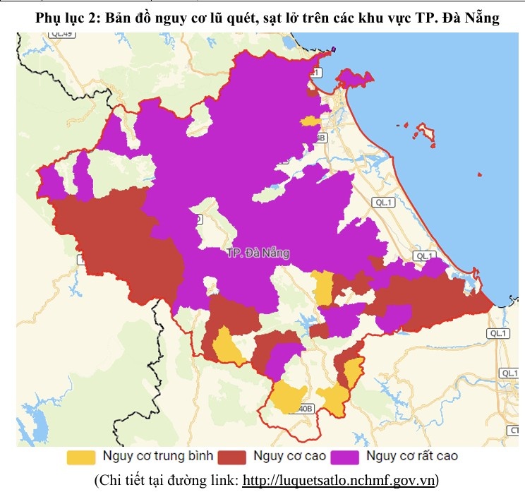
After many consecutive days of heavy rain, on the morning of November 3, the Central Hydrometeorological Station issued a warning of flash floods, landslides and subsidence with a level 2 natural disaster risk level, covering 60 communes and wards in Da Nang city.
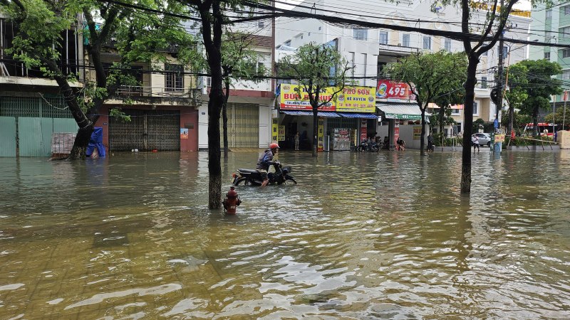
According to the meteorological agency, the rainfall measured in the past 24 hours in many places reached very high levels: Ba Na 521.6mm, Thang Binh 389mm, Hoi An 298mm, Tam Ky 283mm. The soil moisture in most mountainous areas of Da Nang has been nearly saturated over 95%, significantly increasing the risk of landslides and flash floods on steep slopes and small streams.
In the next 6 hours, the northern area of Da Nang is forecast to continue to have heavy to very heavy rain, with common rainfall of 60100mm, some places exceeding 130mm. The south of the city has had less rain, at 1030mm, but there is still a risk of landslides at areas that have been soaked with water for many days.
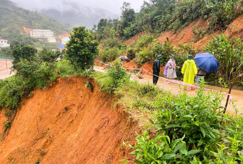
The areas warned of danger include 60 communes and wards stretching from the plains to the midlands and mountainous areas, especially areas with steep terrain, slopes of Hai Van pass, Hoang Sa - Truong Sa route, and Ba Na - Suoi Mo tourist area. The authorities also advise people not to go through spillways and steep passes in heavy rain; proactively evacuate from mountainside areas and slope foothills, where there are signs of cracking or unusual explosions.
"The soil moisture has reached an extremely high level (over 95%), just one more heavy rain is enough for landslides to occur very quickly. We are coordinating with local authorities to review and promptly warn of each risk point," said a representative of the Central Business Central Station.
People are advised to closely monitor further warnings and contact local authorities when they need relocation or emergency response support.


