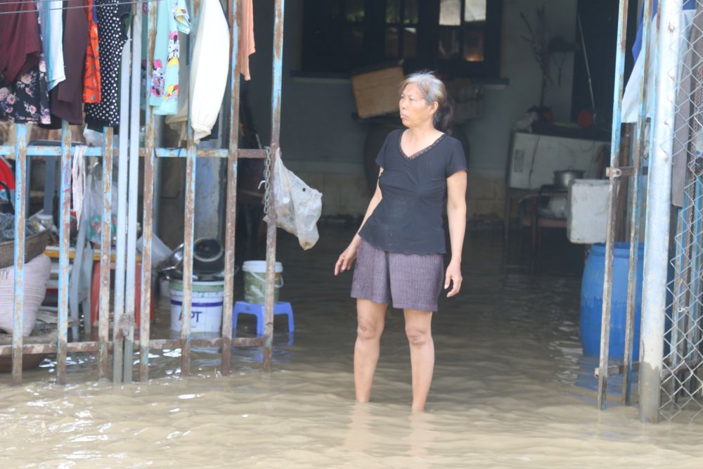
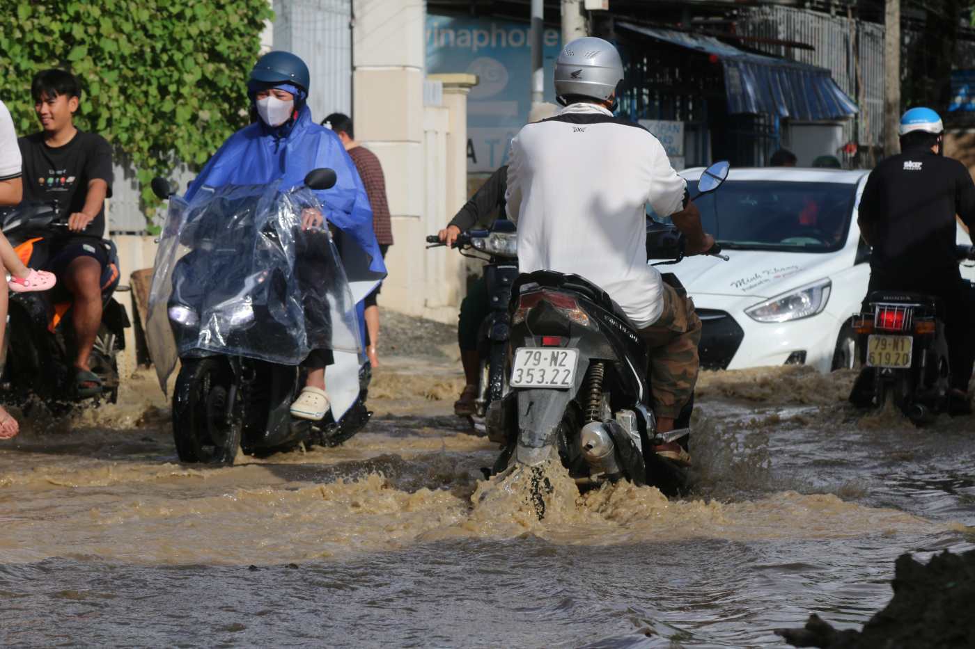
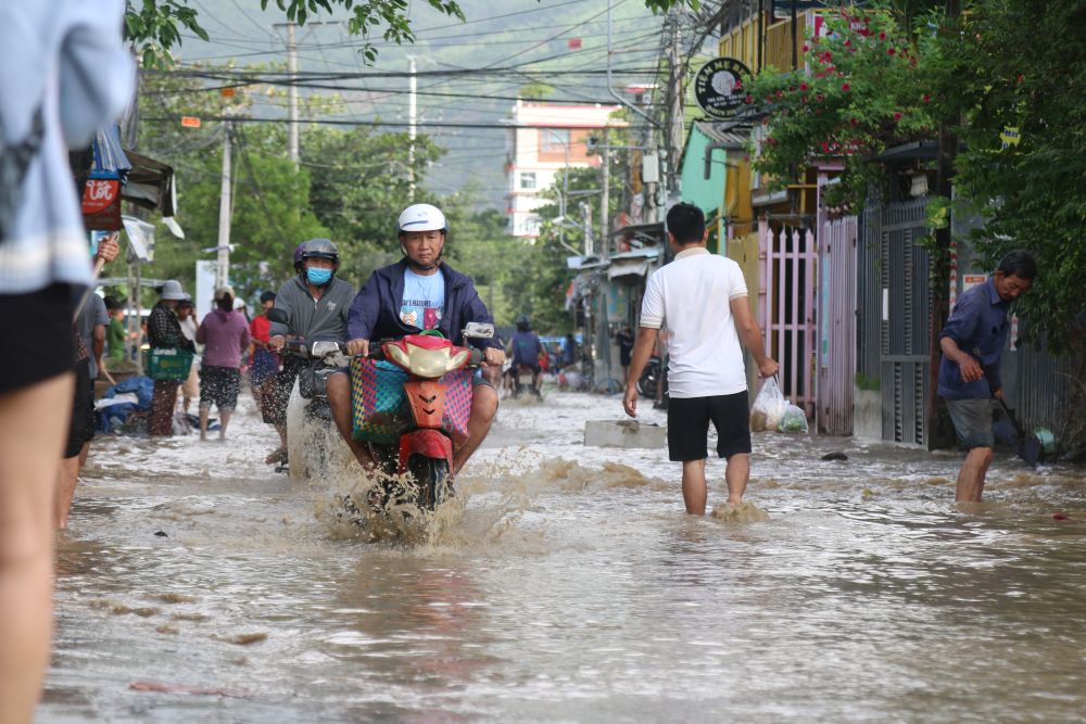
From this morning (December 4), many residential areas in Tay Nha Trang ward began to be flooded again after last night's heavy rain.


The Civil Defense Department of Tay Nha Trang Ward has issued a warning to people living along the river to urgently raise their belongings and be ready to relocate when ordered by the authorities.
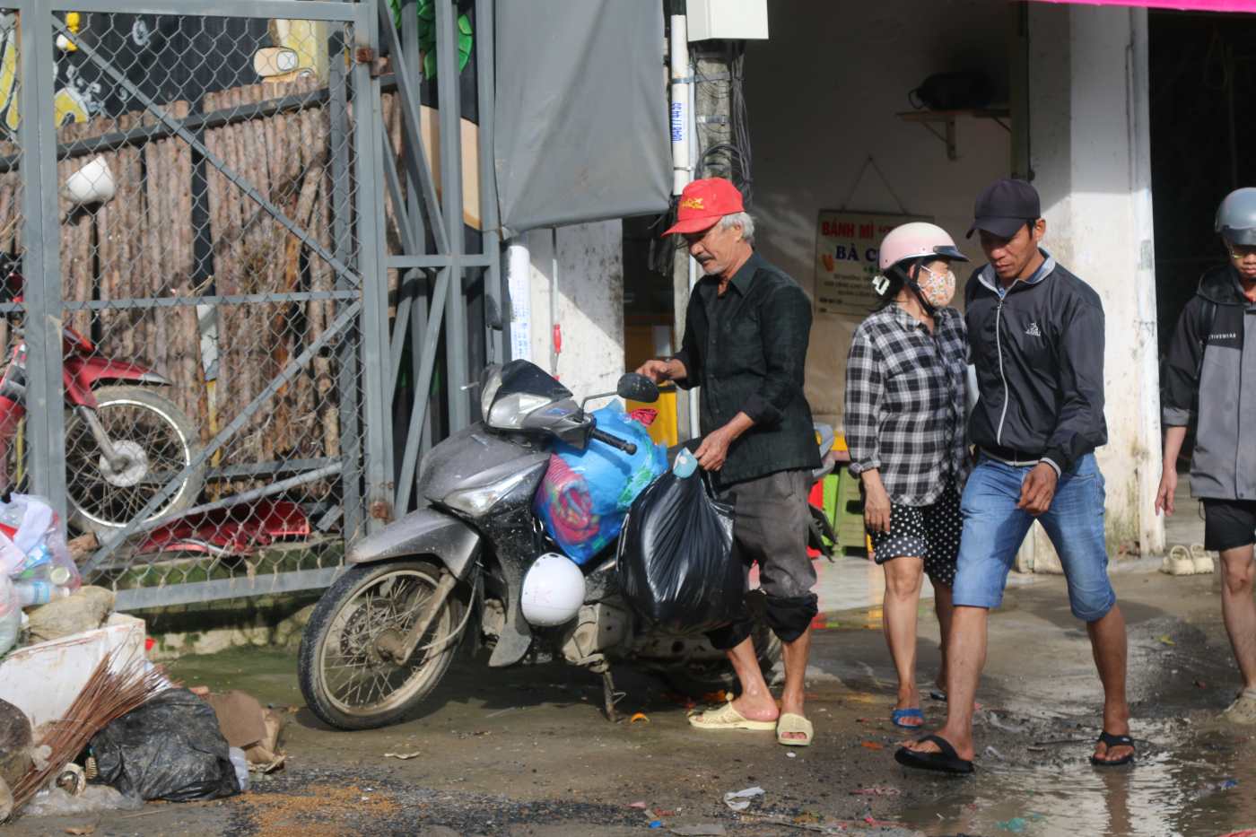
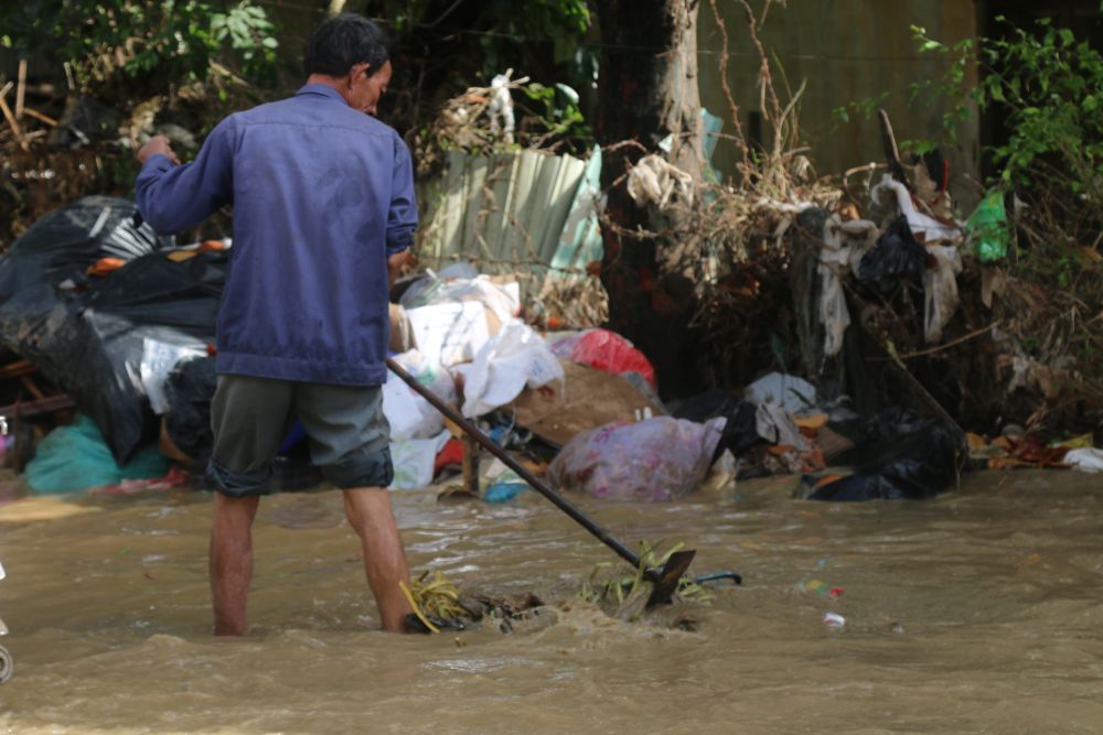
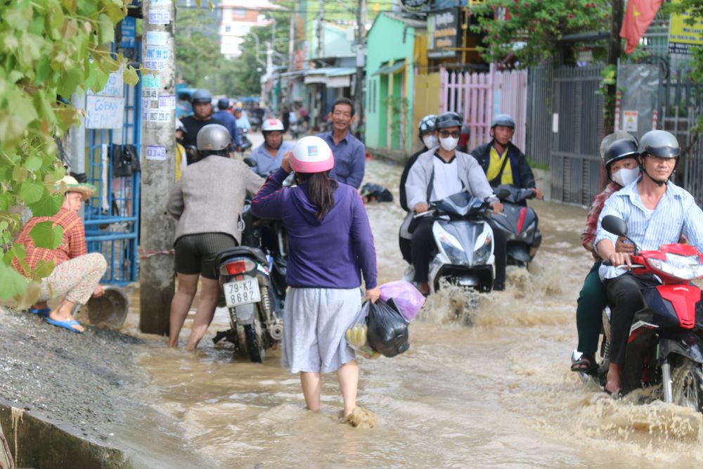
On Nguyen Luong Bang Street, Trung Village, Bac Nha Trang Ward, people had not yet finished clearing the flood on November 19-21, but now they are continuing to cover the water.
Ms. Luong Thi Thuong, resident of Bac Nha Trang ward, said, "the water has been entering again since 3am this morning, my house after the old flood is almost up to the roof, now the water is almost half a meter high".
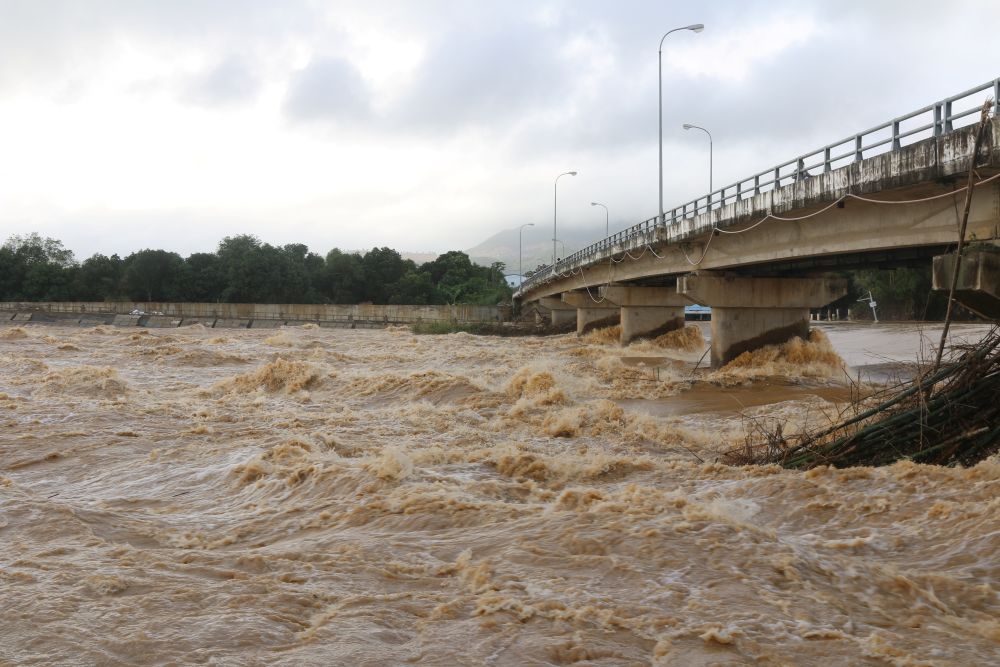
Along Nguyen Luong Bang Street, about 200m of water from Cai River flooded deeply.
The authorities had to block off a number of small alleys to ensure safety for people not to travel due to the strong water flow.
According to the Provincial Hydrometeorological Station, from the night of December 3 to the morning of December 4, Khanh Hoa recorded moderate to heavy rain.
Many places had rainfall exceeding 120mm, Khanh Hiep alone reached 200.150mm, Son Thai 135mm, Da Nhim 134.4mm, Khanh Phu 129.4mm. Heavy rain caused the water level of rivers to rise rapidly and many reservoirs had to be operated to regulate.
Many hydrological stations recorded increased water levels. In the Dinh River, Cai Nha Trang River, Cai Phan Rang River... the water level has increased compared to December 3. Some stations are close to or exceed alert level II, especially in Tan My and Dien Phu.
In the next 24 hours, a flood is forecast on the province's rivers, with flood peaks reaching approximately alert level I. Cai Phan Rang River (Tan My Station) and Cai Nha Trang River (Dien Phu Station) are likely to be higher, at approximately alert level II.

By 6:00 a.m. on December 4, 2025, the total water volume at 64 reservoirs in the province reached 621.19 million m3, equivalent to 82.6% of the designed capacity.
Of which, large lakes (>10 million m3) reached 3998%; many lakes reached over 75% such as Da Ban, Suoi Dau, Song Cai, Song Sat, Song Trau.
Many lakes must be operated at a regulated level to ensure safety. In the southern area: Cai River (19.67 m3/s), Tra Co (103.78 m3/s), Tan Giang (156.59 m3/s), Than River (93 m3/s); in the northern area: Hoa Son (11.8 m3/s), Da Ban (7.6 m3/s), Suoi Trau (5.51 m3/s), Suoi Dau (20.45 m3/s), Cam Ranh (15.2 m3/s), Ta Ruc (28.76 m3/s).


Due to prolonged heavy rain, the provincial hydrometeorological agency warned of the risk of flash floods and landslides in a series of communes and wards of Van Ninh, Ninh Hoa, Khanh Vinh, Khanh Son, Cam Lam and Ninh Son districts.
Localized flooding may occur in low-lying areas of Dien Khanh, Suoi Hiep, Dien Dien, North - West - South Nha Trang wards, Phan Rang, Ninh Phuoc, Phuoc Dinh, Thuan Nam, Cam Ranh...


