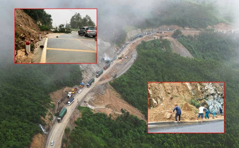
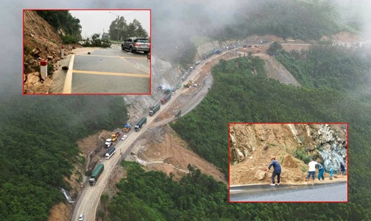
At noon on November 1, a representative of Mang Den Commune People's Committee said that they had handled the incident of landslides and rock slides on National Highway 24, Ba Tang slope.
However, this location still has a high risk of further landslides. Every day, many people and vehicles pass from Mang Den Eco-tourism Area to Kon Tum (old) and Quang Ngai City.
The cracks in the mountain, about 50 m long, caused about 1,000 m3 of rock and soil to fall onto the road. The road management unit mobilized workers, excavators, and bulldozers to work for many hours to clear, handle, and ensure the route was opened.
The People's Committee of Mang Den commune has put up warning signs at Ba Tang slope; road management staff are on duty at the scene to monitor and promptly handle any further landslides.

"If it rains heavily, about 3,000 m3 of soil could flow onto National Highway 24, which is very dangerous. Therefore, the commune and the road management unit continue to assign people to monitor and respond, avoiding damage to people's lives and property," said Mr. Nguyen Nhat Truong, Vice Chairman of the People's Committee of Mang Den commune.
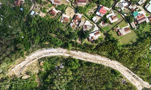
Mang Den is located at an altitude of 1,200 m above sea level, the climate is cool all year round, the forest cover is more than 75%, and is considered the "second Da Lat".
In 2024, the locality welcomed more than 1.2 million visitors; it is expected to reach 1.5 million visitors in 2025, with an estimated revenue of 1,345 billion VND. The commune aims to become a national tourist area and a nature resort center by 2030.