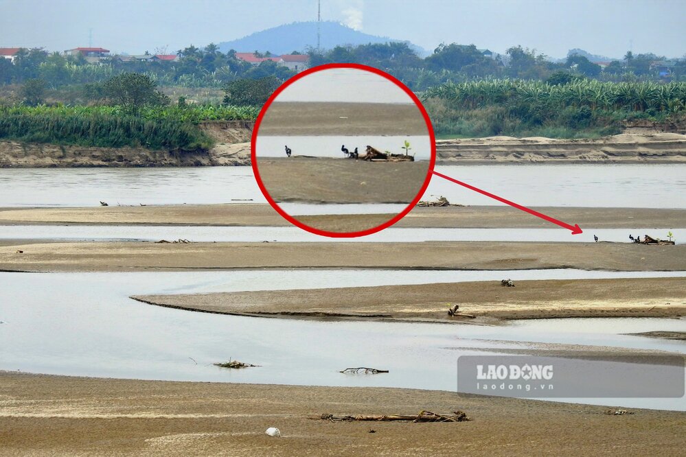
As Lao Dong has reported, in recent weeks, the water level of the Thao River (Red River) passing through Yen Bai and Phu Tho provinces has decreased. In reality, the Red River water has dried up, there are countless alluvial plains, huge sand dunes on the river, the river flow has narrowed... In some places, people can even stand in the middle of the river fishing.
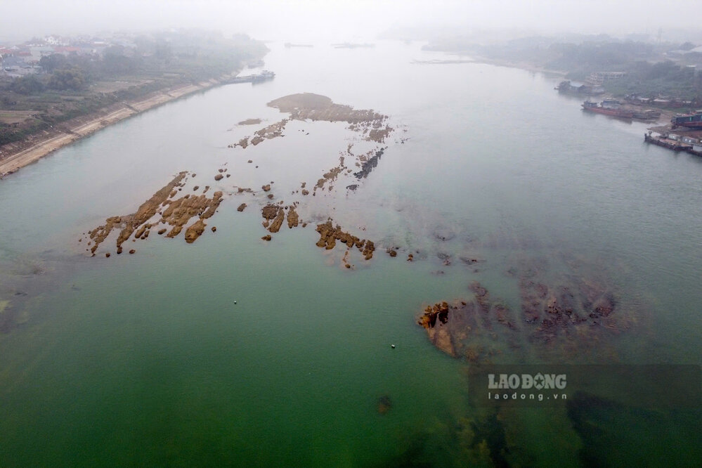
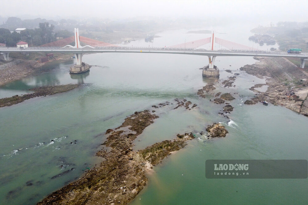
Similar to the Red River, the Lo River section passing through Tuyen Quang and Phu Tho provinces has been dry in recent weeks. Actual records show that the water level has dropped, and there are many large underground rock fields appearing on the river, hidden under the emerald green water like a matrix. In the area near Vinh Phu bridge (connecting Phu Tho with Vinh Phuc), there have been cases of ships stranded in the middle of the river due to impact with underground rock.
On March 1, the National Center for Hydro-Meteorological Forecasting (under the General Department of Hydro-Meteorology) issued the Long-term Hydro-Meteorological Forecast and Warning Newsletter No. 03 (from March 1 to 31, 2025), outlining the hydrological developments in recent times, and at the same time issuing forecasts and warnings in the coming time.
In particular, there are statistics and forecasts that the water level of the Red River in Yen Bai, Phu Tho, and the Lo River in Tuyen Quang and Phu Tho - 2 rivers with very low water levels as mentioned above.
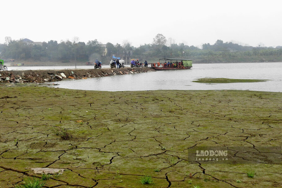
According to the bulletin, in February, the water level on the Thao River changed slowly. On the Lo River, because Tuyen Quang and Thac Ba lakes have increased power generation to serve the first winter-spring flood (from February 8 to 14), the water level downstream of the Lo River has risen to an amplitude of 1.5 to 2.2 m; then changed slowly and was affected by the hydropower plants on the above route.
In February 2025, the actual water level measured on Thao River at Yen Bai station was 25.00 m, the lowest was 23.76 m, the average was 24.17 m; at Phu Tho station, the highest was 11.52 m, the lowest was 10.55 m, the average was 10.90 m.
For the Lo River, the actual water level measured at Tuyen Quang station is 14.42 m, the lowest is 11.70 m, the average is 12.83 m; at Vu Quang station (Phu Tho), the highest is 6.60 m, the lowest is 4.20 m, the average is 5.01 m.
It is forecasted that in March, the highest water level of the Thao River at Yen Bai station will be 25.20 m, the lowest will be 23.80 m, the average will be 24.10 m; at Phu Tho station, the highest will be 12.00 m, the lowest will be 10.60 m, the average will be 11.00 m.
Thus, the water level on the Thao River in March is forecast to increase by only a few kilometers compared to February, the scene of the river being dry at the bottom has not been improved.
For the Lo River, it is forecasted that in March, the highest water level at Tuyen Quang station will be 13.50 m, the lowest will be 11.50 m, the average will be 12.40 m; at Vu Quang station, the highest will be 5.20 m, the lowest will be 4.00 m, the average will be 4.40 m.
Thus, compared to the actual measurement data of February, the water level of the Lo River in March is forecast to decrease quite significantly, the scene of the river water being dry and exposed to underground rocks will continue.


