In Phu Tho province, the Lo River flows through Doan Hung, Phu Ninh districts and Viet Tri city. This is a river with a very high density of waterway vehicles.
During the historic flood caused by storm No. 3 Yagi in mid-September 2024, the water level of the Lo River recorded at Vu Quang station (Doan Hung district, Phu Tho province) at 7:00 p.m. on September 11 reached 21.21 m, 0.71 m above Alert Level 3.
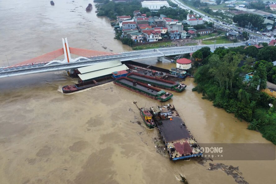
At that time, many communes along the Lo River were flooded. The rising floodwaters even caused some ships to be stuck at Vinh Phu bridge ( north of the Lo river connecting Viet Tri city with Song Lo district, Vinh Phuc province), posing many risks of sinking barges and ships and affecting the bridge's infrastructure.
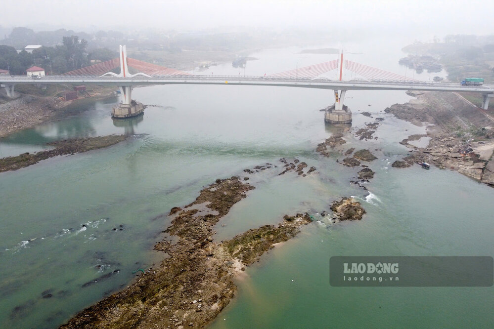
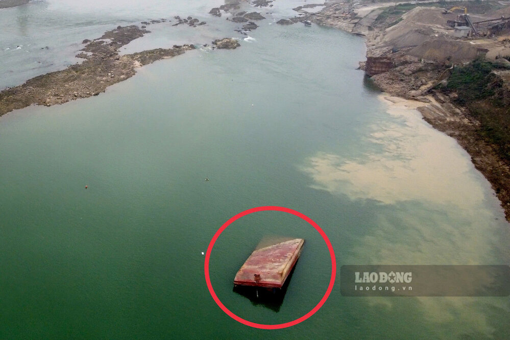
Returning to the Lo River section passing through the Vinh Phu bridge area after more than 5 months, Lao Dong Newspaper reporters were surprised to see the difference of this river in the dry season.
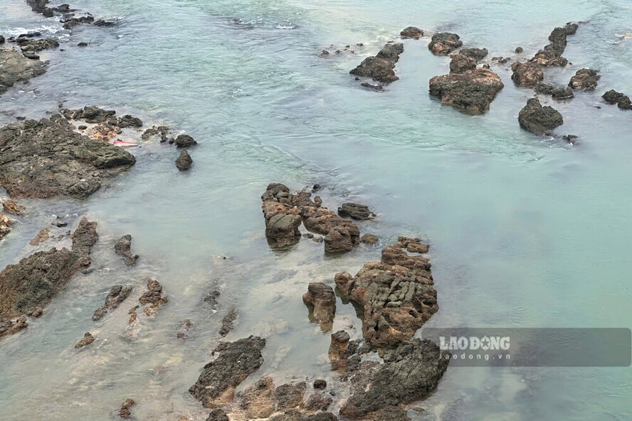
It can be seen that the water level of the Lo River has dropped, in the middle of the water is as clear as a pearl, appearing giant underground rocks, hundreds of meters long and as dense as a "matrix"...
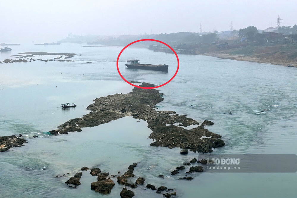
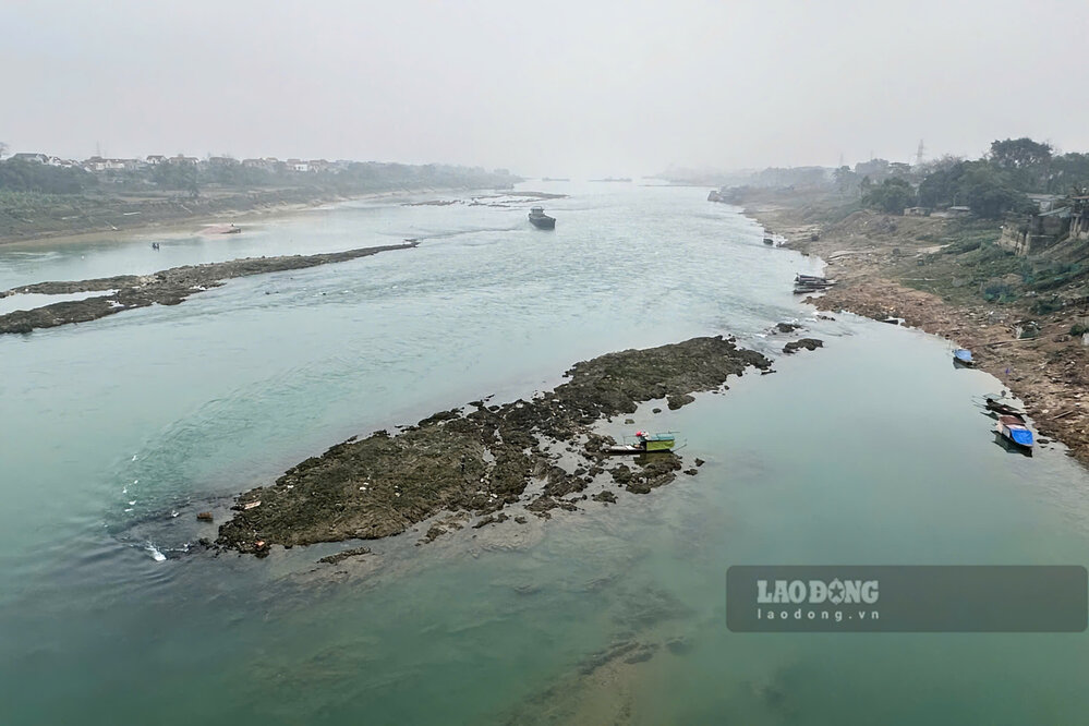
Where there were boats stuck due to rising floodwaters, there are now more boats stranded because the river water level is low. According to records, a ship in this area is stranded in the middle of the river due to a collision with a reef, the boat's duck leg is broken and cannot continue moving.
In the coming time, if the water level of the Lo River continues to dry up, it will not only cause unsafe waterway traffic but also make it difficult to collect water for agricultural production.
According to the National Center for Hydro-Meteorological Forecasting's Forecast and Warning bulletin for the past time on February 21 (from February 21 to 28), the water level of the Lo River has changed slowly, the highest actual water level measured at Vu Quang station was recorded at 6.60 m, the lowest was 4.26 m.
It is forecasted that the water level of the Lo River will continue to change slowly according to the regulation of the above hydropower plants. In the next 10 days, the water level at Vu Quang station is forecast to have the highest level of 4.50 m, the lowest is only 4.20 m.