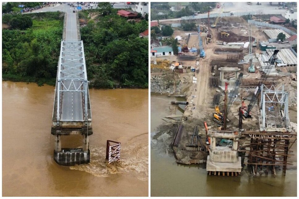
On September 9, 2024, Phong Chau bridge on National Highway 32 across the Red River suddenly collapsed. At that time, due to the impact of storm No. 3 Yagi, the flood water on the Red River (Thao River) rose very high, the water level recorded at Am Thuong (Ha Hoa district) was over 27.25 m (1.25 m above alert level 3).
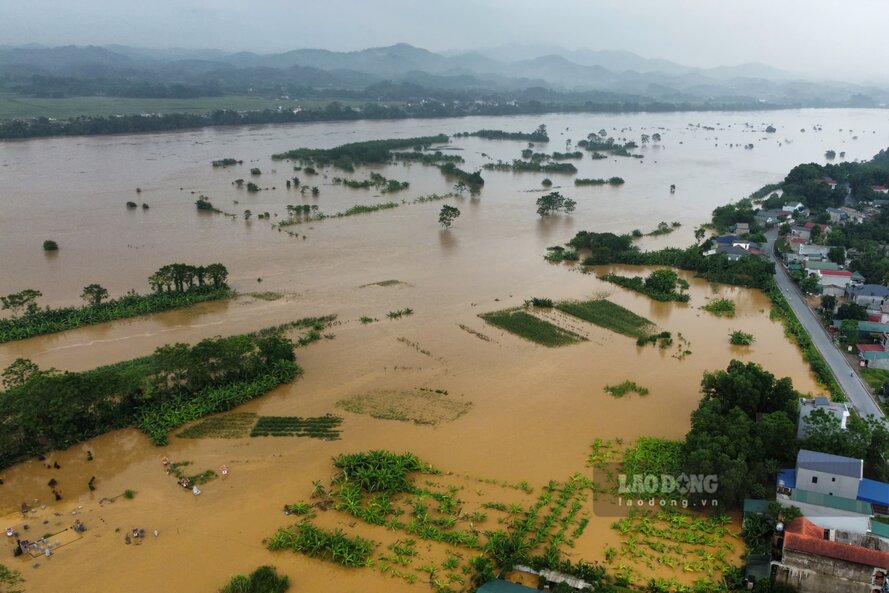
In the following days, the floodwaters of the Red River continued to rise. In Am Thuong, there was a time when the flood rose nearly 28 m, as at 6:00 a.m. on September 11, the water level was recorded at 27.90 m, 1.9 m above Alert Level 3, exceeding the historic flood in 1971 (27.32 m)...
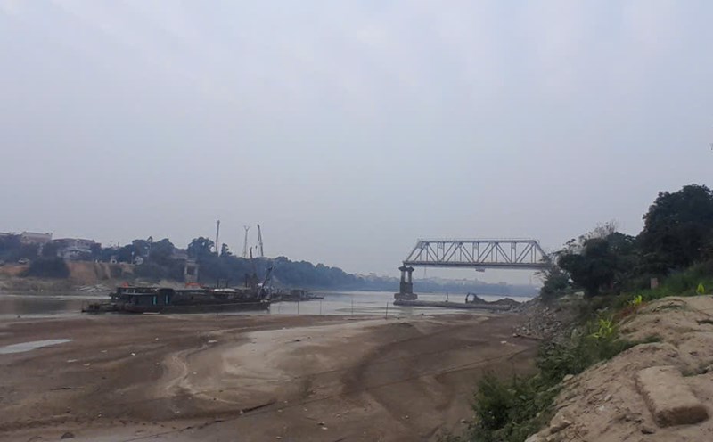
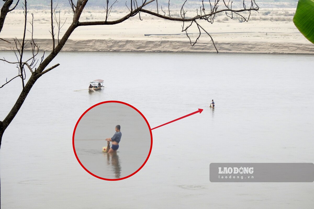
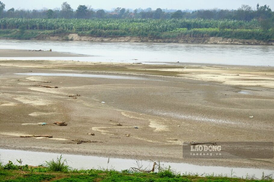
According to the reporter of Lao Dong Newspaper in mid-February 2025, more than 5 months have passed since Phong Chau bridge collapsed, the water level of the Red River has now dropped, in some places it is so low that people can stand in the middle of the river to fish.
Along the dike road along the Red River, reporters can easily record images of sand dunes and alluvial plains for kilometers appearing on the river after the water has dried up, so the flow is narrowed a lot, in some places it seems as if it can be walked.
In the Phong Chau bridge area, the already narrow riverbed is now even narrower when the water is low, a large sandbar has also appeared, approaching the left bank of the river (in Lam Thao district).
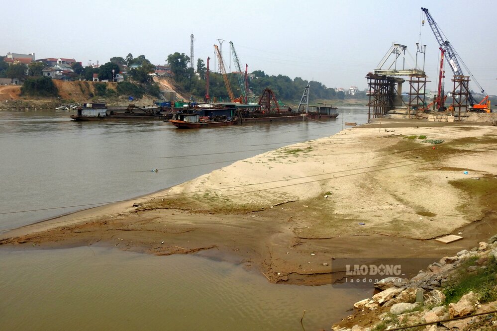
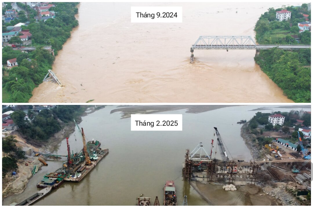
Looking back at the current images of the Red River compared to more than 5 months ago, it can be seen a clear difference, the river that used to be full of flood water now reaches the foot of the old bridge piers.
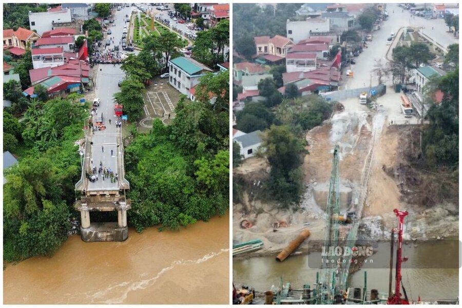
For Phong Chau pontoon bridge, after being installed and serving the people, in early October 2024, due to high water levels and high flow speeds, to ensure safety, functional units had to cut the pontoon bridge and use military ferries to replace it.
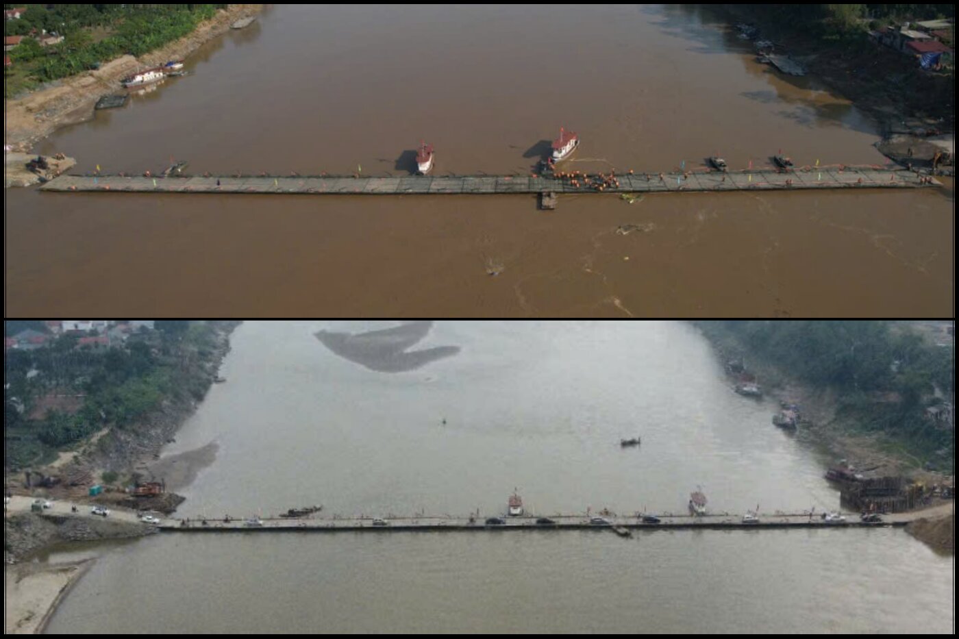
However, just a few days later, the water level of the Red River had decreased, and the pontoon bridge was reinstalled. Since then, over the past few months, Phong Chau pontoon bridge has been operating stably, effectively serving the travel of tens of thousands of people living in Tam Nong and Lam Thao districts...
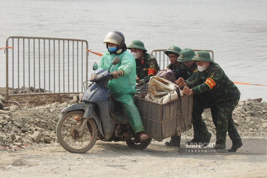
The Red River water is low, the entrance to Phong Chau pontoon bridge has a larger slope, many people when crossing the pontoon bridge carrying heavy goods or weak vehicles (except for cars) have encountered difficulties, often having to ask soldiers on duty at the bridgehead for help.
According to the National Center for Hydro-Meteorological Forecasting's Forecast bulletin on February 16 (from February 16 to 28) the developments of the past 2 weeks show that the flow on the Thao River has decreased, the total flow on the Thao River in Yen Bai (Phu Tho in the downstream) is 40% lower than the average of many years in the same period. It is forecasted that during the above period, the total river flow in Yen Bai will be 52% lower than the average of many years in the same period.
According to the Short-term hydrological forecast and warning bulletin on February 17, the water level on the Thao River in Yen Bai and Phu Tho continues to change slowly, the actual water level measured at 7:00 a.m. on February 17 at Phu Tho station is 10.67 m. It is forecasted that by 7:00 a.m. on February 18, the water level at Phu Tho station will be 10.65 m.