Causes of subsidence
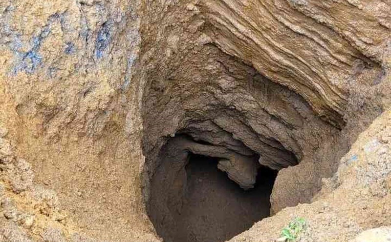
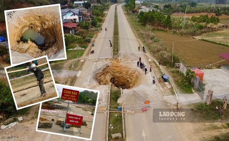
From the end of March 2025 to now, in Kim Lu commune (Na Ri, Bac Kan), 7 sinkholes have appeared, directly threatening the lives and property of people in the area. Of which, the largest hole has a diameter of nearly 5m, about 10m deep and the holes are being cordoned off, with warning signs to limit the danger to people.
According to the preliminary assessment of the Institute of Geological Sciences and Mineral Resources, the subsidence phenomenon in Bac Kan occurs in the area of sedimentary rock distribution mixed with limestone or dolomite, a type of rock with carbonate origin, which is easily dissolved in natural conditions.
Talking to Lao Dong Newspaper, Dr. Nguyen Dai Trung - Head of the Department of Science, Training and International Cooperation, Institute of Geological Sciences and Mineral Resources - said that the phenomenon of sinkholes, also known as "death holes", often appears in limestone areas and there are many reasons for this phenomenon.
In particular, it is common that the areas where subsidence holes appear are often in valleys - the product of a prolonged phong hoa process due to the activity of the Earth's crust, creating a broken system. system failures when appearing in limestone areas often create underground caves (also known as Karst caves).
In densely populated residential areas, excessive underground water exploitation from the Karst cave system also causes land to be unstable. Earthquakes can cause immediate subsidence in limestone areas.
Warning signs of subsidence
One of the easy to recognize signs is when there is unusually heavy rain. In areas with limestone geological foundations, rainwater does not accumulate on the surface but quickly seep into cracks and underground caves. The sudden deep underground water can emptiness the stone foundation structure, collapse the ceiling of the cave and create unexpected sinkholes.
Geological earthquakes such as earthquakes, at certain intensities, in areas where Karst fields are developing, can also break the cave arches, increasing the risk of landslides.
Another sign is when the exploitation of groundwater for daily life and agriculture reaches the alarm level. Pumping water in large quantities, especially during the dry season, causes the water level to drop rapidly, reducing the pressure to stabilize the caves.
Mr. Nguyen Dai Trung stated that localities need to build a mechanism to control exploitation flows, while disseminating and disseminating knowledge to the community about safe exploitation thresholds and how to respond when there are unusual signs of the land.
The construction of 3D geological models combined with geophysical technology can allow a clearer image of the cave structure, cracking system and load-bearing capacity of the cave ceiling. This is the basis for developing response scenarios and early warnings when there are signs of abnormality.
Regarding measures to handle subsidence, temporary measures include placing warning signs, filling down holes, temporarily reinforcing and warning people to temporarily suspend or reduce underground water exploitation activities to the maximum extent possible, especially near residential areas. In particular, it is necessary to carry out steps of investigation, survey and detailed research on the geology of the subsidence area.
The results of the study will be an important scientific basis for determining the causes, proposing sustainable solutions and supporting the planning and management of natural disaster risks in localities.