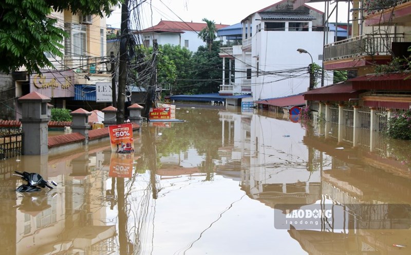
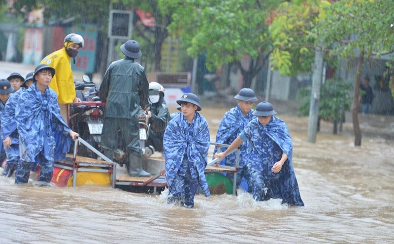
On October 8, according to the National Center for Hydro-Meteorological Forecasting, on the same morning, floods on Cau River and Thuong River (Bac Ninh) continued to rise; floods on Cau River at Gia Bay Station (Thai Nguyen) peaked at 29.90m (3:00 a.m. on October 8), exceeding the historical mark in 2024 (28.81m) and are currently receding slowly.
At Phu Lang Thuong station (Bac Ninh), the water level of Thuong River is continuing to rise rapidly and is likely to exceed the historical level in 1986 (7.52m).
Meanwhile, the Trung River (Lang Son) is also rising slowly, forecast to peak at noon or this afternoon, then gradually decrease.
The flood in the upstream of the Lo River at Ha Giang station is currently at 102.59m (at 6:00 a.m. on October 8), only about 0.41m below alert level 3.
In the next 12-24 hours, the water level in many main rivers of the North will remain above alert level 3, posing a potential risk of prolonged deep flooding in low-lying areas, riverside residential areas and aquaculture areas.
The National Center for Hydro-Meteorological Forecasting said that in the past 24 hours, the Northern region has had heavy to very heavy rain, many places recorded extremely heavy rain: Trinh Tuong (Lao Cai) 136.4mm, Ho Thau (Tuyen Quang) 132mm, Boc Nhieu (Thai Nguyen) 171.2mm, and especially Xuan Huong (Bac Ninh) 213.4mm.
Soil moisture models show that many areas are nearly saturated or have reached a saturated state of over 85%, significantly increasing the risk of flash floods, landslides and geological subsidence in Lai Chau, Lao Cai, Tuyen Quang, Thai Nguyen, Cao Bang, Lang Son and Bac Ninh provinces.
In the next 6 hours, the risk of flash floods on small rivers and streams and landslides on steep slopes is warned at level 1 natural disaster risk, with Cao Bang and Thai Nguyen at level 2.
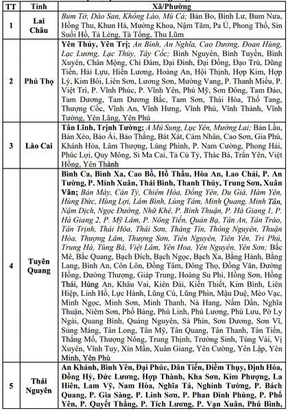
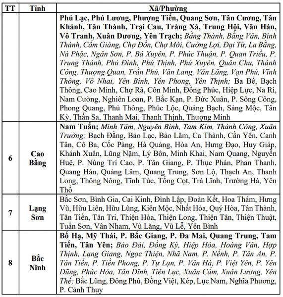
Localities are warned of flash floods and landslides: