Information from the Da Nang Civil Defense Board said that the Da Nang sea area recorded winds of level 4-5, gusting to level 7 in the Cu Lao Cham area. Wave height in Son Tra reaches 0.75m. It is forecasted that in the next 24 hours, the wind in the Da Nang sea area will gradually increase to level 6, sometimes level 7, gusting to level 8-9; rough seas, waves from 2.5-4.5m high. In the Hoang Sa sea area, the wind reaches level 7-8, near the center of the storm is strong at level 9-11, gusting to level 13, the sea is rough, waves 5-7m high.
On the day and night of October 21, Da Nang area will have scattered showers and thunderstorms; Hoang Sa sea area will have storms, during thunderstorms, it is necessary to be on guard against tornadoes and strong gusts of wind. Forecast on October 22, the wind at sea in Da Nang will increase to level 7-9, gusting to level 11, the sea will be very rough; level of natural disaster risk due to strong winds: level 2, especially in Hoang Sa area, level 3. Ships operating in areas at high risk of being affected by large waves and strong winds.
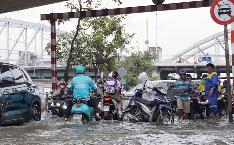
At the same time, the water level on the Da Nang rivers is only below alert level 1, but from October 23 to 28, there is a possibility of a flood. The flood peak ranges from alert level 2 to 3, with some places exceeding alert level 3. Risk of flooding in low-lying areas, urban flooding, flash floods and landslides in mountainous areas. Flood disaster risk level: level 2-3.

In Tra Linh commune, since last night, the police and military forces have promptly evacuated 8 households with 34 people from the area with a 50m long crack, high risk of landslides. During the heavy rain night, soldiers brought people to safety, ensuring their lives and property in the face of the complicated developments of storm No. 12.