The feature of viewing satellite photos and photos of old streets is becoming a trend that has been widely shared on social networks in recent days. While not a new feature, the old photo review tool on Google Maps is suddenly becoming a trend.
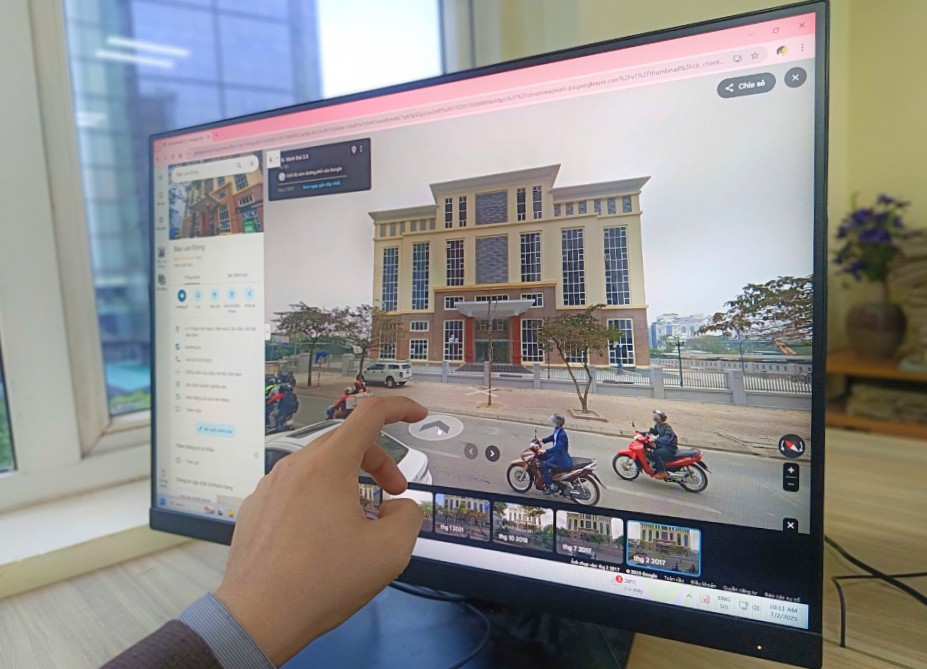
Users just need to go to Street View mode, click on the left-hand clock icon to choose a time frame like 2019, 2020, 2022... Immediately after that, familiar images from the past immediately appear.
This trend is spreading on social media platforms, with millions of views with hashtags such as #googlemaps2019. Many people have found images of old houses, streets in their childhood, or locations that have been changed due to clearance or construction. Many videos record emotional emotions when looking back at a place that seemed lost.
Ms. Nguyen Thu Huyen (Ninh Binh) shared: I found the image of my grandparents old house on Kim Ma Street before the demolition. It was just a static photo, but it made me feel stuck all day.
Ms. Nguyen Thu Hang (Hanoi) emotionally shared: My family has lived in Cau Giay for more than 20 years. Although I know that house is no longer there, when I look back at the photos on Google Maps, I feel like I am returning to the summer afternoons sitting in front of the house. Technology made me so excited for the first time.
Not only entertaining, this feature is also of practical value to urban, planning, and architectural researchers when they can monitor the changes of an area over time. Since then, many have compared Google Maps to a giant photo album of Vietnamese urban areas for nearly a decade.
Tran Minh Hoang, a 4th year student majoring in Urban Planning, shared: Previously, we often had to find old documentary photos in libraries or social networks, but many places did not have them. Now, just use Google Maps, tracing back to previous years to see the current status of the area before clearing it, which is very useful when making a project to analyze urban spatial changes".
Hoang also added that looking back at each stage's image helps students better understand the development over time, instead of just looking at the current map. It not only serves the profession but also helps us understand the value of preserving and reading the story behind each change, Hoang said.
According to Lao Dong, many areas in big cities such as Hanoi, Ho Chi Minh City, Can Tho, Da Nang... can see photos from 2015-2023. Some locations are updated regularly every year, while others only have photos at a few time points.
Not only a social network trend, the trend of " looking back at the past" using Google Maps is touching a real need: to remember and see familiar things in a city that is changing every day. Amid the urgent pace of life and continuous development, just a simple chuot click is sometimes enough to revive a whole period of youth.