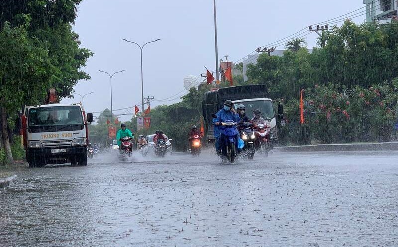
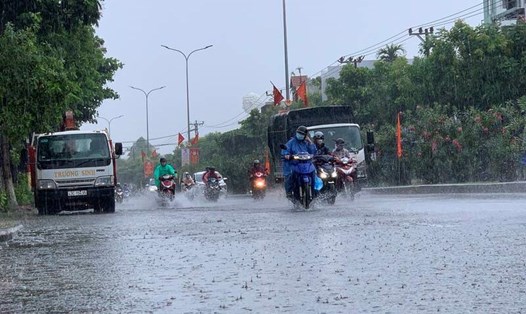
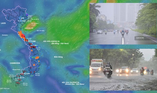
According to the National Center for Hydro-Meteorological Forecasting, in the past 24 hours (from 2:00 p.m. on October 30 to 2:00 p.m. on October 31), the provinces and cities from Ha Tinh to Gia Lai have had moderate to heavy rain. Rainfall recorded in some places such as: Ky Phong 219.2 mm (Ha Tinh); Ho Be 240.2 mm (Quang Tri); Ho Hoa My 58.8 mm (Hue city); Kham Duc 108 mm (Da Nang city); Hoai Duc 85.2 mm (Gia Lai)...
Soil moisture models show that some areas in the above provinces are nearly saturated (over 85%) or have reached a saturated state.
In the next 3 - 6 hours (from 2:30 p.m. on October 31), the above provinces and cities will continue to have rain with common accumulated rainfall in Ha Tinh and Quang Tri from 20 - 50 mm, some places over 100 mm; in Hue city, Da Nang city, Quang Ngai and Gia Lai from 10 - 20 mm, some places over 50 mm.
In the next 6 hours (from 2:30 p.m. on October 31), there is a risk of flash floods on small rivers and streams, landslides on steep slopes in many communes and wards.
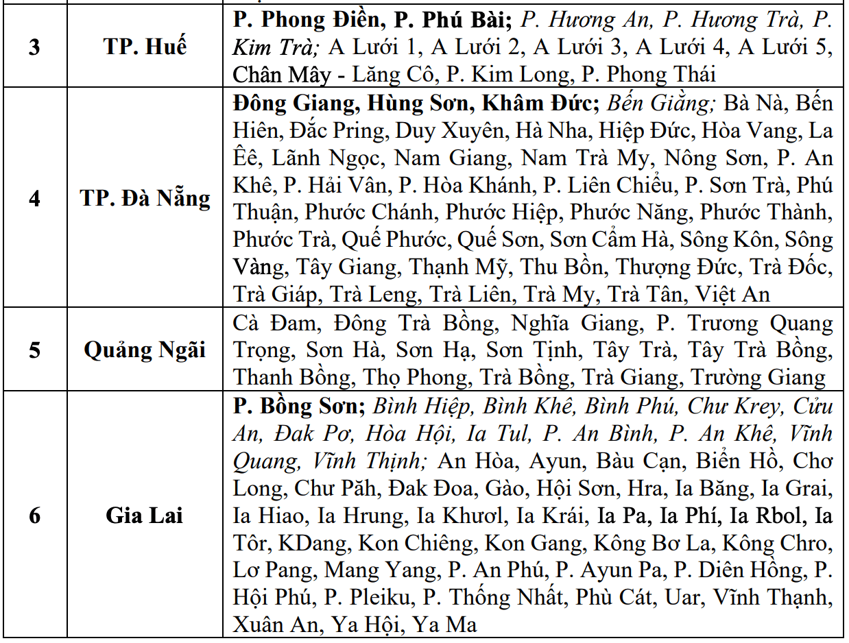
The meteorological agency warns of the natural disaster risk level 1; in Ha Tinh area, Hue city, Da Nang city at level 2.
Flash floods and landslides can have a very negative impact on the environment, threaten people's lives; cause local traffic congestion, affect the movement of vehicles; destroy civil and economic works, damage production activities and social life.
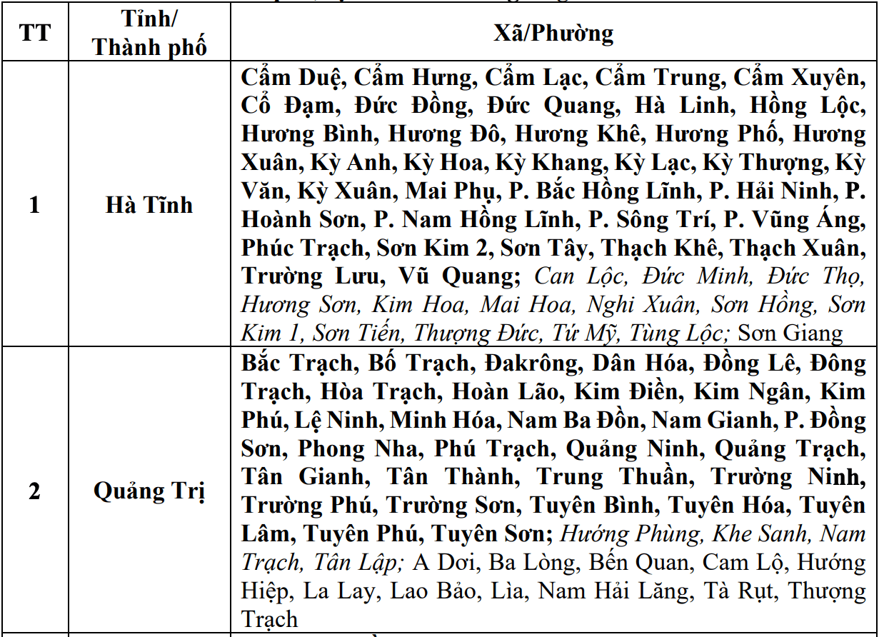
The meteorological agency recommends that local authorities need to review flow bottlenecks and vulnerable locations in the area to take proactive measures to prevent and respond promptly.