According to the National Center for Hydro-Meteorological Forecasting, the eastern sea of the North East Sea has strong winds of level 7-8, the area near the storm center has winds of level 9-10, gusting to level 12. Ly Son Island Station (Quang Ngai) has strong winds of level 6, gusting to level 7.
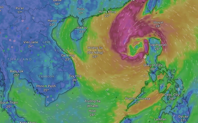
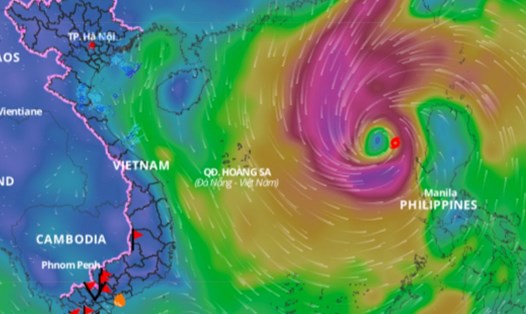
The eastern sea area of the North East Sea has storms.
During the day and night of October 25, the eastern part of the North East Sea will have strong winds of level 8 - 9, near the storm's eye level 10 - 12, gusting to level 15. The sea will be rough, with waves 5 - 7m high, near the storm's eye 7 - 9m.
The western sea area of the North East Sea (including the sea area of the Hoang Sa archipelago) and the northern area of the central East Sea have strong winds of level 6 - 7, gusting to level 8 - 9. The sea is rough, with waves 5 - 7m high.
The sea area from Quang Tri to Khanh Hoa, south of the Central East Sea area has strong winds of level 6, sometimes level 7, gusting to level 8 - 9. The sea is rough, waves are 3 - 5m high.
The eastern part of the South China Sea has strong winds of level 5, sometimes level 6; gusts of level 7 - 8. Rough seas, waves 2 - 4m high.
The Gulf of Tonkin has strong winds during the day at level 5, sometimes level 6; at night level 6; gusts at level 7 - 8. Rough seas, waves 2 - 3m.
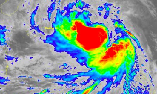
The North East Sea has storms; the Central and South East Sea (including the Spratly Islands) also has scattered showers and thunderstorms. There is a possibility of tornadoes and strong gusts of wind during thunderstorms.
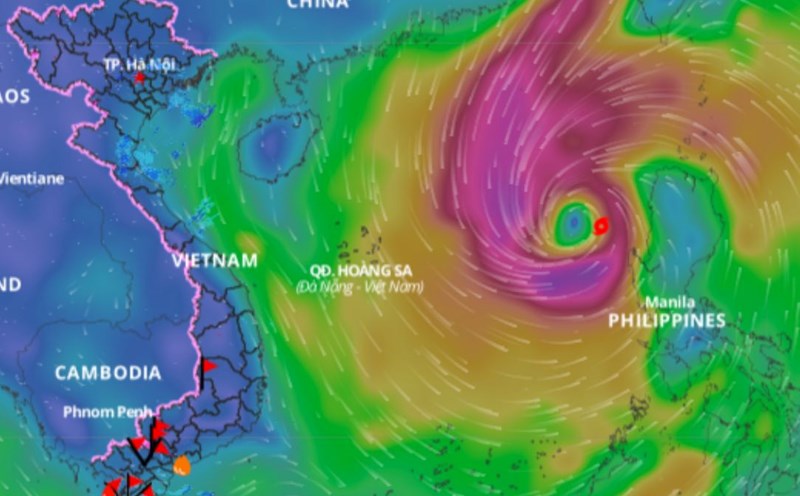
On the day and night of October 26, in the North East Sea (including the waters of Hoang Sa archipelago), strong winds of level 9-10, near the storm's eye level 11-12, gusting to level 15; waves 6-8m high, near the storm's eye 8-10m; rough seas.
The northern sea area of the central East Sea has strong winds of level 7 - 8, gusting to level 9 - 10; very rough seas; waves 5 - 7m high.
The Gulf of Tonkin, the southern sea area of the central East Sea, the southern East Sea area (including the sea area of Truong Sa archipelago) has strong winds of level 6, sometimes level 7, gusting to level 8 - 9; rough seas; waves from 3 - 6m high.
The sea area from Quang Tri to Quang Ngai (including the sea area of Ly Son island district) has strong winds of level 6 - 7, then increasing to level 8 - 9, gusting to level 11; very rough seas; waves from 5 - 7m high.
The sea area from Binh Dinh to Ca Mau has strong southwest wind level 5, sometimes level 6, gusting to level 7-8; rough sea; waves from 2 - 5m high.
The meteorological agency warned that the level of natural disaster risk due to strong winds at sea is level 2, and the North East Sea area (including the east of Hoang Sa archipelago) is level 3.
All vessels operating in the above areas are at high risk of being affected by cyclones, strong winds and large waves.