The Northwest Pacific storm center in general and the East Sea in particular are entering the most active tropical cyclone period of the year, under the activity of the tropical convergence zone, low-pressure areas are continuously forming and developing into tropical depressions/storm.
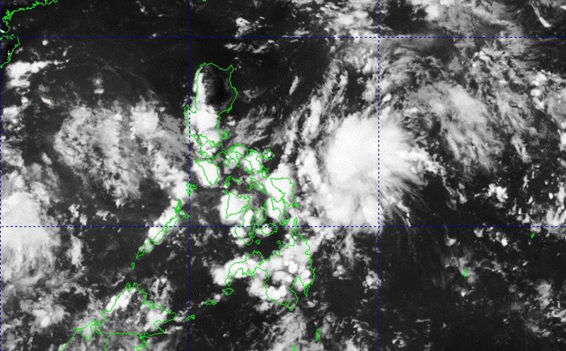
The Philippine Atmospheric, Geophysical and Astronomical Services Administration said that at 3:00 a.m. on September 16, the low pressure area in the central East Sea (side 09c) was at about 12.6 degrees North latitude, 116.0 degrees East longitude, 460km west of Coron, Palawan.
It is forecasted that in the next 24 hours, the low pressure area will move in the West Northwest direction, traveling about 15km per hour and is likely to strengthen into a tropical depression.
Due to the influence of the low pressure area circulation, which is likely to strengthen into a tropical depression later, in the central East Sea area, there will be showers and thunderstorms, the wind will gradually increase to level 5, sometimes level 6, gusting to level 8. Waves are 2.0-3.0m high, rough seas.
In addition, there is a low pressure area designated 09d in the eastern area of the Philippines. At 2:00 a.m. on September 16, the center of this low pressure area was at 13.1 degrees North latitude, 125.8 degrees East longitude, 200km east of Juban, Sorsogon.
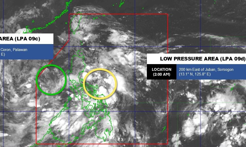
It is forecasted that in the next 24 hours, this low pressure area will move northwest and is likely to strengthen into a tropical depression, entering the East Sea area on September 18-19. After entering the East Sea, it is not ruled out the possibility of strengthening into a storm.
Meanwhile, another low pressure is forming outside, far east of the Philippines. Based on the wind forecast map, the low pressure is likely to enter the Philippine Forecast Area (PAR) on September 19-21, and is also likely to make landfall or impact Cagayan Valley, crossing the North and North poles of Luzon.
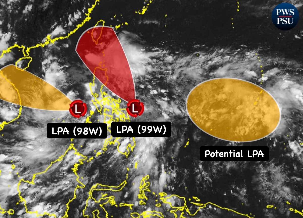
The low pressure is expected to make landfall if there are strong southern winds and rain in western Luzon and the Visayas. It is also not ruled out that this low pressure may enter the East Sea in the period of September 23-24.
The development of low pressure/storm in the East Sea and Northwest Pacific in the second half of September will be extremely complicated, most of the fishing grounds in offshore areas will be very bad, vessels operating in the above area need to pay attention to proactively preventing and ensuring safety.