The latest storm and low pressure information from the Philippine Atmospheric, Geophysical and Astronomical Services Administration said that the low pressure area in the Philippine Forecast Area (PAR) is likely to "average" strengthen into a tropical depression today.
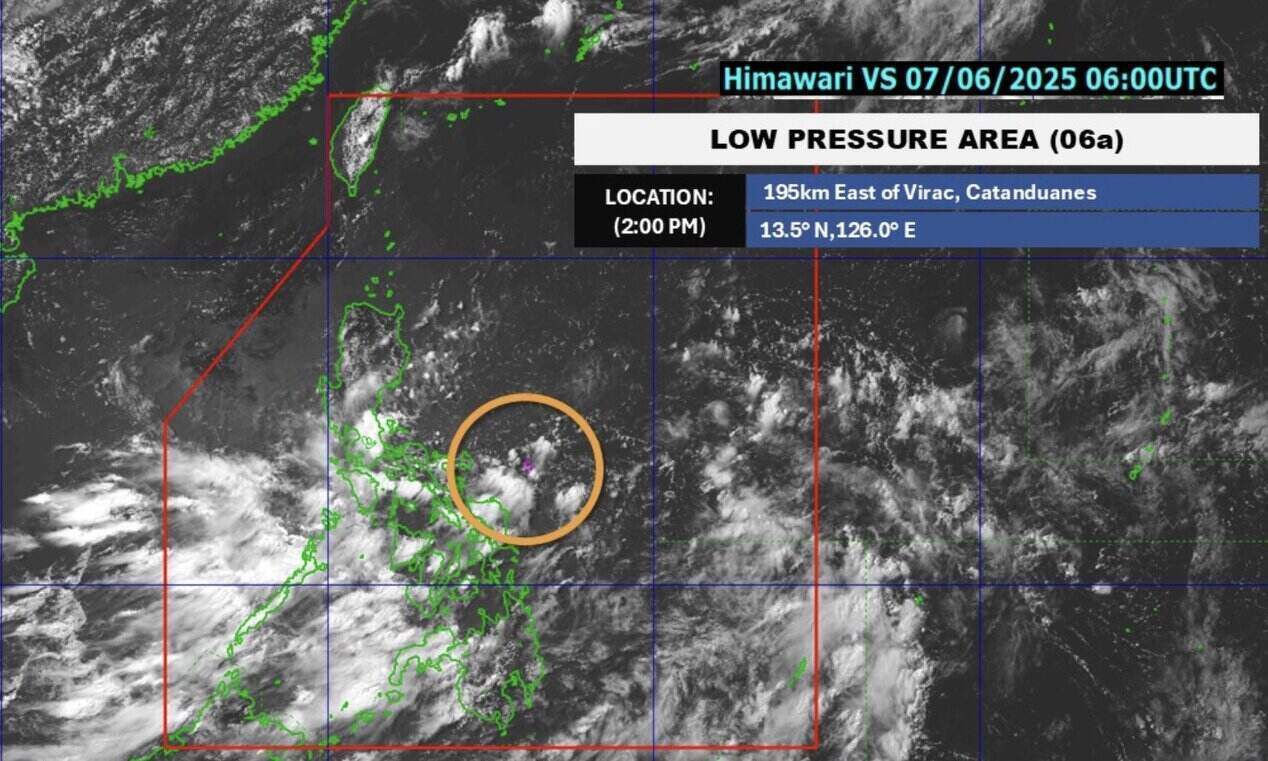
According to the forecast released at 4:00 p.m. on June 6, PAGASA determined that this low pressure near the East Sea is 340 km east of Virac, Catanduanes, Philippines.
Based on our latest analysis, if it strengthens into a tropical storm, the system is unlikely to make landfall in any part of the Philippines, said PAGASA weather forecaster Grace Castaneda.
She noted that the southwest monsoon and low pressure near the East Sea will cause rain in many areas of the Philippines until June 9.
PAGASA's bulletin stated that the low pressure trough is expected to cause cloudy skies with scattered showers and thunderstorms in Quezon, Bicol and some areas of Visayas and Mindanao.
Due to the influence of low pressure, moderate to heavy rain can lead to flash floods and landslides in these areas.
At the same time, the southwest monsoon will also affect the weather in the western part of the Philippines. Cloudy weather with scattered showers and thunderstorms is forecast in Metro Manila, Cavite, Laguna, Batangas, Rizal, Mimaropa, Western Visayas, Negros Island, Zamboanga Peninsula, Barmm and Soccsksargen.
In the typhoon forecast released on June 7, PAGASA said that there may be 11 to 19 storms entering the Philippine forecast area from now until November 2025. One to two storms may enter the PAR in month 6; two to three in July and August; two to four in September and October; and two to three other in November.
Philippine forecasters warn that these storms could be stronger than the 21 storms that occurred during the 2024 typhoon season.
The 2024 typhoon season in the Philippines is considered unprecedented in history, with an unprecedented attack of 6 storms in just 30 days.
Super Typhoon Pepito (international name Man-yi) is the strongest storm of the year with peak winds of 195 km/h, making landfall in the Philippines on November 16, 2024 in Panganiban, Catanduanes. This is the 24th named storm of the season and the 6th storm to hit the Philippines in just one month.
The Japan Meteorological Agency said that the simultaneous appearance of four typhoons in the Pacific Ocean was the first time since records in 1951. Starting with super typhoons Kristine (international name Trami) and Leon (Kong-rey) at the end of October 2024, the series of destructive reactions continued until November with the winds of 240 km/h of typhoons Marce (Yinxing), Ofel (Usagi) and Nika (Toraji).