
On August 20, according to new weather news from the Philippine Atmospheric, Geophysical and Astronomical Services Administration (PAGASA), many turbulent weather zones may still form on both sides of the Philippines in the next 2 weeks.
According to PAGASA, a low pressure area may form in the east of the Philippines in the week from August 20-27. However, the possibility of this system continuing to develop into a tropical cyclone during this period is assessed at a low level.
Next week, from August 27 to September 2, this weather region is likely to develop into a low to moderate tropical cyclone. According to current forecasts, the system may move northwest towards southern Japan.
PAGASA also warned that 2 other disturbance zones could form in the area monitored by this agency. Both systems are assessed to have the potential to develop into low-level tropical cyclones.
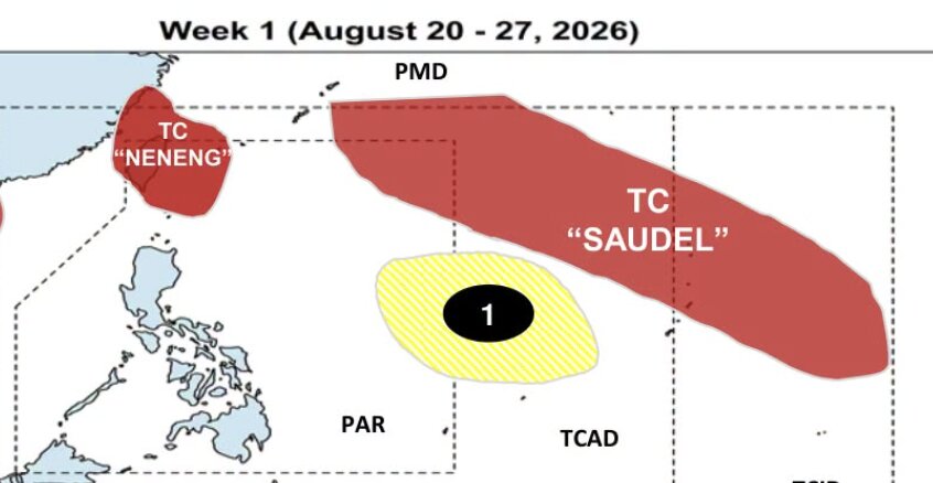
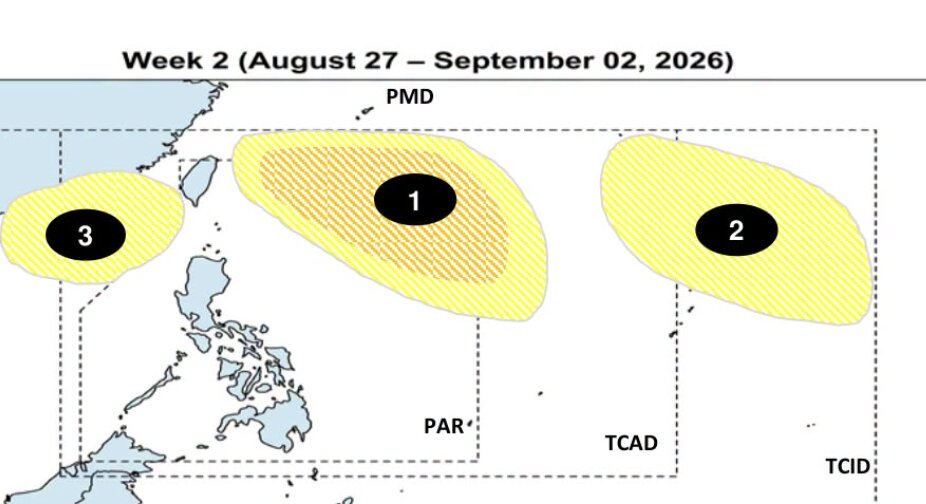
Thus, in the next 2 weeks, a total of 3 turbulent weather zones may form in the PAGASA monitoring area. Among them, the system forecast to form in the east of the Philippines is the most noteworthy area due to the possibility of developing into a tropical cyclone that may increase to a low to medium level in the week from August 27 to September 2.
People in the Philippines are advised to continue to follow official updates, as weather forecasts may change over time as new information and data are added.


