The latest storm and low pressure information on the afternoon of December 1 from the Philippine Atmospheric, Geophysical and Astronomical Services Administration (PAGASA) said that new low pressure 12a was detected at 2:00 p.m. the same day.
Low pressure 12a is outside the Philippine Forecast Area (PAR) and is currently 1,445km east of Eastern Visayas, Philippines.
Philippine typhoon forecasters say the new low pressure has a moderate chance of strengthening into a tropical depression in the next 24 hours.
If it strengthens into a storm, the system would be the 23rd typhoon in the Philippines and would be locally named Wilma.
The location of Depression 12a is also consistent with another PAGASA forecast bulletin released on December 1.
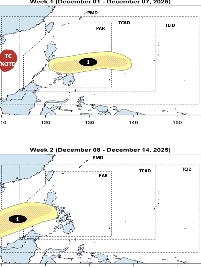
The bulletin said that while Typhoon No. 15 Koto is active in the East Sea, a new low pressure will form at the western boundary of PAGASA's TCAD forecast area during the week of December 1 to December 7.
This low pressure is expected to make landfall in the Caraga - Visayas - Southern Luzon area, Philippines with the possibility of strengthening into a storm or tropical depression from low to moderate.
PAGASA weather forecasters predict that this low pressure will enter the East Sea during the week of December 8 to December 14 after passing through the Mindoro - Palawan area of the Philippines.
During its operation in the southern East Sea, this low pressure will still maintain the possibility of strengthening into a storm or tropical depression from low to moderate level.
On the same day, in the December storm forecast bulletin, PAGASA said that there could be 1 to 2 more tropical storms entering the PAR during the month.
This December, we expect one to two tropical storms to form or enter the Philippine forecast area, said PAGASA weather expert Obet Badrina.


