On November 30, the weak low pressure area, marked Invest 93W, appeared near Guam and gradually moved towards the Philippines. The system is not yet complete, however, the interaction between the system and the wind convergence zone - where cold air from the North meets moist air from the Pacific Ocean - is expected to bring widespread heavy rains over the next few days.
The Guam Meteorological Agency has now recorded large waves and rain bands accompanied by weak circulation of the system. When approaching the Philippines, 93W will immediately encounter areas with strong wind shear, significantly reducing the likelihood of developing into a storm.
According to storm and low pressure forecast models, heavy rain will occur. The GFS and ECMWF models both show that the chance of a low center of pressure is clearly low, due to strong wind shear. A weak trough may appear as 93W approaches the shore.
The main impact is not strong winds or major storms, but increased rain due to the northeast monsoon and wind convergence zone.
Weather forecasts are very worrying. The cold air mass from Siberia is moving down, perfectly combined with the northeast monsoon and wind convergence zone to create a strong lieslide heading straight to the eastern edge of the Philippines. This means: Northern Luzon will have strong northeast winds, little rain.
Bicol, Eastern Visayas, Eastern Mindanao: Risk of heavy rain from December 3-6, which could cause localized flooding and landslides in wind-receiving areas.
According to the Philippine Atmospheric, Geophysical and Astronomical Services Administration (PAGASA), the country is still likely to see 1-2 typhoons in December. The next two names are Wilma and Yasmin.

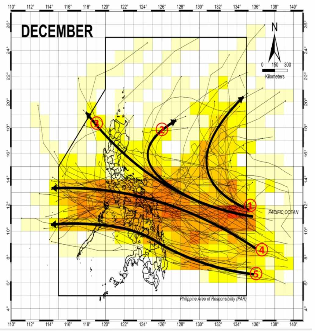
Climate data shows that the roadmap scenarios are very diverse:
Some storms entered the Philippine Forecast Area (PAR) and then moved up to Japan without making landfall.
Others can scan through Luzon or the Visayas, then head to Hong Kong (China) or Vietnam.
Southern systems are likely to go to Thailand.
Thus, December weather is still likely to fluctuate, especially if a new low pressure develops more strongly than expected.
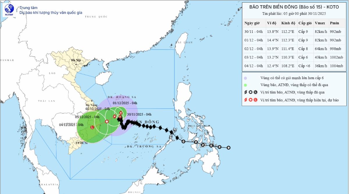
Meanwhile, the storm bulletin No. 15 of the Vietnam National Center for Hydro-Meteorological Forecasting (NCHMF) said that at 4:00 a.m. on November 30, the center of the storm was at 13.8 degrees north latitude, 112.2 degrees east longitude, in the northwest of the central East Sea. Wind force level 9, gust level 11. Moving north-northeast, 3 km/h.

Forecast in the next 24-72 hours:
4:00 a.m. on December 1: Moving north, 3 km/h, location 14.4 degrees north latitude, 112.3 degrees east longitude; about 340km from the Gia Lai - Dak Lak coast. Level 9, gust level 11.
4:00 a.m. on December 2: Moving west-southwest, 3-5 km/h, location 13.9 degrees north latitude, 111.4 degrees east longitude; about 230 km from shore. The storm weakened to level 8, gusting to 10.
At 4:00 a.m. on December 3: Moving west-southwest, 5-7 km/h, location 13.2 degrees north latitude, 110.3 degrees east longitude; about 120km from shore. Continue to weaken to level 6, gusting 8; epidemic danger zone to the west.
After 72 hours, the storm weakened into a tropical depression, continuing to move west-southwest, 10 km/h, the intensity decreased further.
Due to the influence of the storm, the northwest area of the central East Sea will have winds of level 7; near the center of the storm, level 8-9, gusting to 11.
Waves are 3-5m large; near the center of the storm 5-7m, the sea is very rough.
Danger for ships: easily encounter thunderstorms, whirlwinds, strong winds, and large waves in the entire danger zone.


