The latest storm news on the afternoon of September 3, Hurricane Kiko continues to strengthen in the eastern Pacific, about 2,700km from Hilo, Hawaii, USA. Currently, the storm is moving westward at a speed of 11 km/h.
Kiko is expected to continue to strengthen through September 4, after reaching the intensity of a Category 4 hurricane.
By the night of September 5 or early morning of September 6, Hurricane Kiko will move into the central Pacific. During that time, Kiko will gradually weaken and continue towards Hawaii.
The impact of the typhoon during this time is currently unknown, however, there is a high chance that islands in Hawaii will have light rain and wind next week, starting from September 9 to 11.
Due to the impact of Kiko, rain and wind are forecast to be near or below tropical depression level.
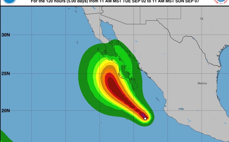
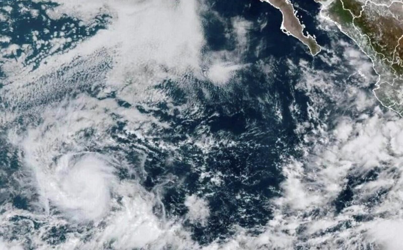
Meanwhile, Lorena has strengthened into a hurricane off the Pacific coast of Mexico since September 3.
The latest hurricane report from the US National Hurricane Center said that Hurricane Lorena, with maximum sustained winds of up to 120 km/h and stronger gusts, is about 165 km from Cabo San Lucas, a popular tourist destination in Mexico.
The storm is moving north at a speed of 24 km/h and the center of the storm is forecast to move parallel to the west coast of Baja California until the night of September 4. The center of Lorena will then move ashore overnight on September 4 and September 5.
Lorena is a Category 1 hurricane on the Saffir-Simpson hurricane scale. Lorena is forecast to bring heavy rains to Baja California Peninsula and "lead to life-threatening flash flooding and landslides, especially in high-terrain areas."
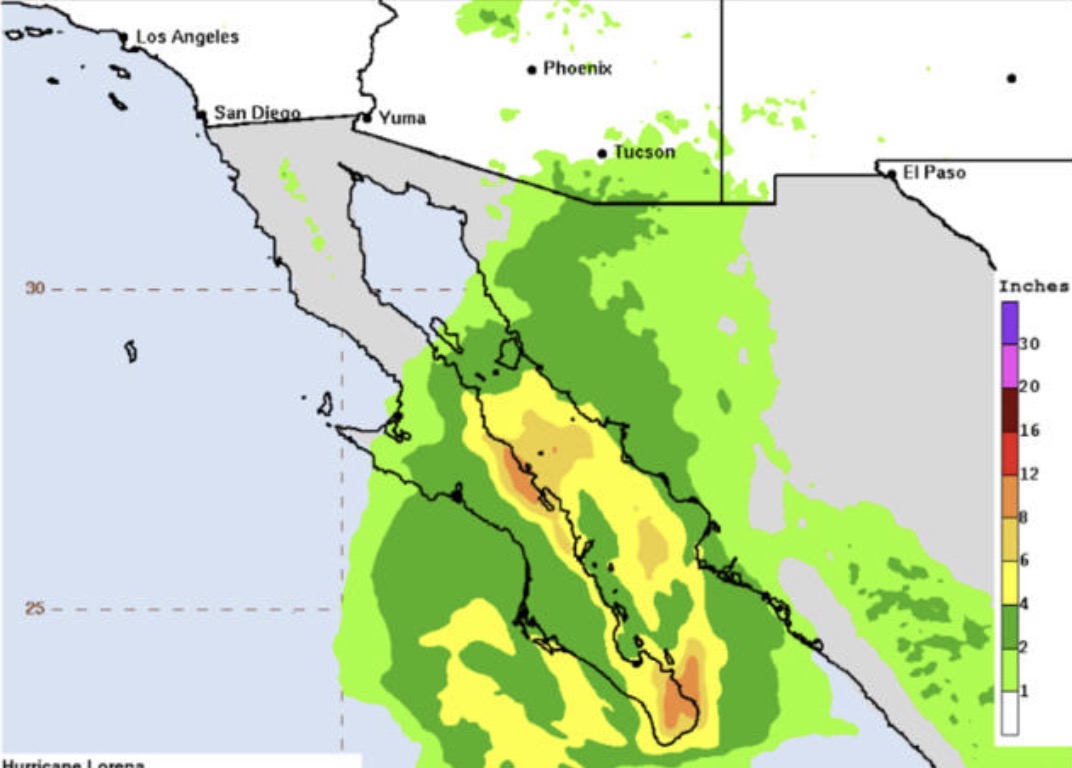
Forecasters say heavy rains are expected to affect Baja California Sur and move into southeastern Baja California and southwestern Sonora on September 4. The rain is expected to last until September 5. Heavy rain can cause flash floods and life-threatening landslides, especially in high-altitude areas.
Rainfall of 25 to 76mm is forecast, with total locally as much as 102mm occurring in northwestern Mexico's states of Sinaloa and Sonora extending north into Arizona, US until September 5, increasing the risk of local to scattered flash floods.
The Mexican government has issued a hurricane warning and monitored the storm's developments for Baja California Sur, which is home to major tourist destinations such as Los Cabos.
Comparparina rapidly strengthened overnight on September 3 and is expected to weaken rapidly, becoming a tropical storm on September 5.