
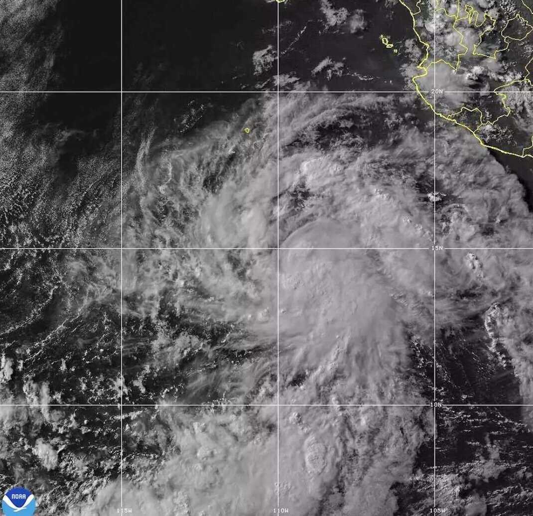
The latest storm news on the morning of July 16 from the US National Hurricane Center in Miami said that storm Elida is about 940km south-southwest of the southern tip of the Baja California peninsula of Mexico. The storm has maximum sustained winds increasing to about 80 km/h, according to the latest storm forecast bulletin.
It is expected that the latest storm in the 2026 storm season will gradually strengthen and will become a typhoon on July 17.
US storm forecasters noted that the structure of Hurricane Elida continues to improve, with some dry airflows and mid-level gusts affecting Elida's development at this time.
According to satellite data, Typhoon Elida is moving northward compared to the previous forecast path. A clear arc of subtropical high pressure in the north of Typhoon Elida will cause the storm to move in this direction throughout the day of July 16.
Typhoon Elida is located in a very warm sea area, with abundant environmental humidity. It is expected that a faster intensification rate may occur within 36-48 hours if the typhoon forms an inner core.
Along with Typhoon Elida, the Pacific Regional Hurricane Center (CPHC) and the US Navy's Joint Typhoon Warning Center (JTWC) are monitoring 4 low pressure areas in the Pacific.
Depression 91C in the middle of the Pacific Ocean. This low pressure has a 10% chance of strengthening into a tropical depression or tropical storm in the next 2 days and a 10% chance of strengthening in the next 7 days.
Nearby, low pressure 90C is also located in the middle of the Pacific Ocean with 50% strengthening into a tropical depression or storm in the next 2 days and 50% chance in the next 7 days.
The 3rd low pressure area of 90W is located in the western Pacific, with little chance of strengthening into a storm or tropical depression in the next 24 hours.
Depression 91W is also located in the western Pacific and is unlikely to strengthen in the next 24 hours. Currently, 91W has maximum sustained winds of about 45-50 km/h.


