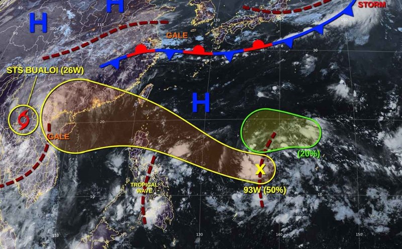
The Philippine Atmospheric, Geophysical and Astronomical Services Administration (PAGASA) said that at 3:00 p.m. this afternoon (October 1), the center of tropical depression Paolo - predicted to be the predecessor of storm No. 11 in the East Sea - was at 14.5 degrees North latitude, 130.5 degrees East longitude, in the Philippine Sea, about 685km east of Virac Island (Catanduanes).
The strongest wind near the center of the tropical depression is 55 km/h, gusting to 70 km/h, moving in the West Northwest direction at a speed of 25 km/h.
According to initial assessments, tropical depression Paolo is likely to cause heavy rain, strong winds and coastal flooding in the areas of Northern Luzon and Central Luzon from October 3.
No storm warnings have been issued yet, but PAGASA forecasts that a No. 1 warning may be issued early tomorrow afternoon or evening (October 2) for the eastern coastal provinces.
The meteorological agency also warned that during its movement, Paolo could strengthen into a severe tropical storm on the morning of October 3, even reaching typhoon level before making landfall. If this scenario occurs, the affected area may have to upgrade the warning to level 3, or even level 4.
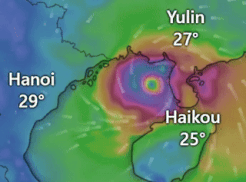
Typhoon Paolo is forecast to make landfall in the Isabela area or north of Aurora province (Philippines) on October 3, then continue to move deep into the Luzon mainland and then enter the East Sea, becoming storm No. 11, international name Matmo, towards Hainan Island (China) and the North (Vietnam).
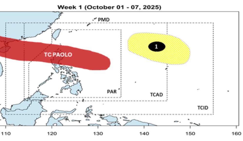
PAGASA forecasts that in addition to Typhoon Paolo, a low pressure area will appear in the eastern Pacific Ocean during the week of October 1-7, but the probability of strengthening into a storm this week is quite low.
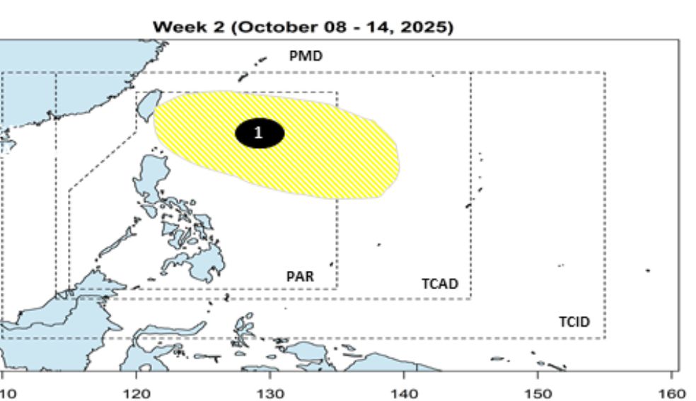
From October 8-14, the low pressure area may enter the Northeast Philippines but the possibility of strengthening into a storm is still low.
Experts warn people in Northern and Central Luzon to be ready to cope with heavy rains, the risk of landslides, flash floods and coastal rises. At the same time, neighboring countries in the East Sea area, including Vietnam, also need to closely monitor the developments of this potential storm No. 11.
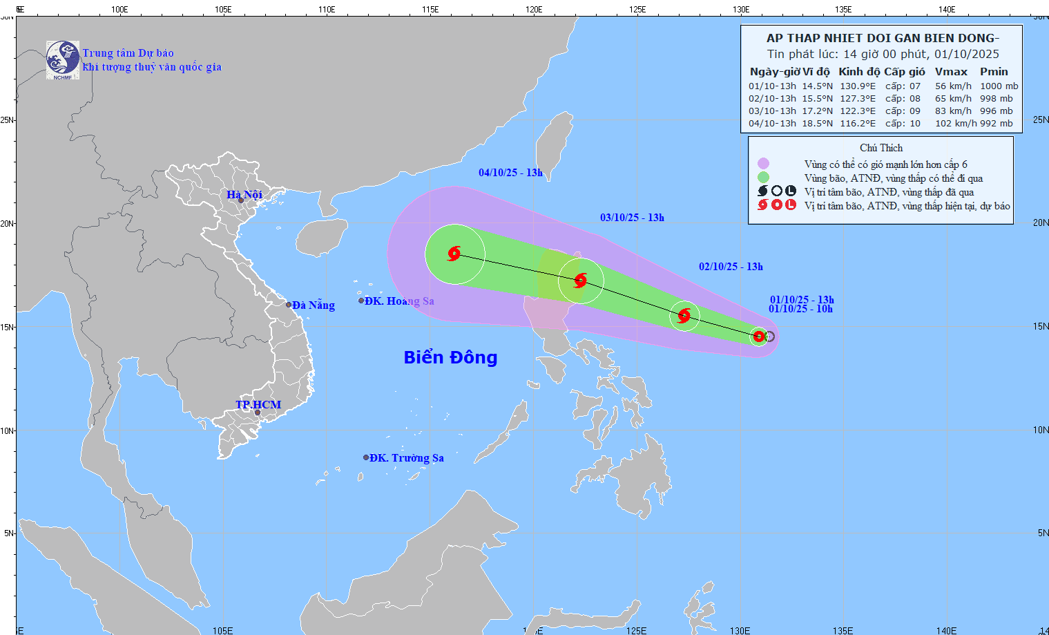
The Vietnam Center for Hydro-Meteorological Forecasting predicts that from October 3, the eastern sea area of the North East Sea will have winds gradually increasing to level 6-7; the area near the storm center will have strong winds of level 8, gusts of level 10; waves 2.5-4.5m high, rough seas.
Warning, around October 4-6, the North East Sea area (including Hoang Sa special zone) is likely to be affected by strong winds of level 10-11, gusting to level 14.
Ship operating in the above-mentioned dangerous areas are likely to be affected by thunderstorms, whirlwinds, strong winds, and large waves.