The Philippine Atmospheric, Geophysical and Astronomical Services Administration (PAGASA) storm/low pressure information said that at 2:00 a.m. on December 19, low pressure (12a) being monitored within the Philippine forecast area (PAR) has a high possibility of developing into a tropical depression within the next 24 hours.
This low pressure system had previously weakened from tropical depression Querubin on the afternoon of December 18.
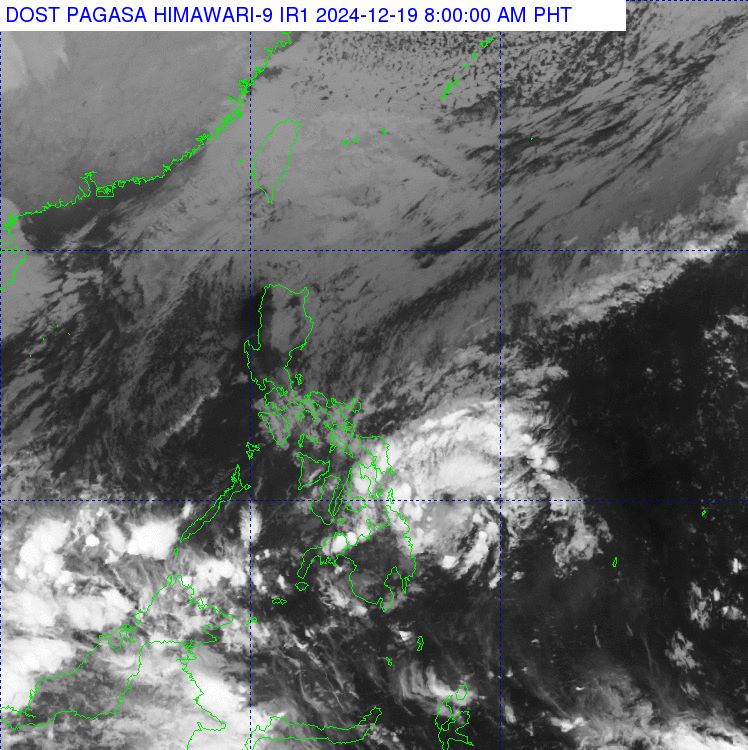
At 3:00 a.m. on December 19, the center of the low pressure was located at approximately 9.8 degrees north latitude, 127.7 degrees east longitude, 245 km east of Surigao City. The low pressure and shear line affected the eastern part of Southern Luzon. The northeast monsoon affected the rest of Luzon.
Meanwhile, according to the storm forecast of the US Joint Typhoon Warning Center (JTWC), low pressure 96W (Philippines calls it 12a) has the strongest wind speed of 45 km/h, pressure of 1,004 hPa. Currently, the low pressure is almost stationary.
Although the tropical depression off the eastern coast of Mindanao was downgraded to a depression by PAGASA, the system has improved considerably in terms of organization, consisting of a compact center with thick bands surrounding an obscured circulation center.
These spiral bands are clearly visible on satellite imagery. It is likely that the system is more powerful than currently indicated.
The JTWC forecasts the low pressure will begin moving westward in the next few hours before moving inland over Mindanao late on December 19 or early on December 20.
The system will cross Mindanao into the Sulu Sea by the weekend, before being absorbed by another low pressure system below. The system is likely to bring heavy rains to parts of Mindanao, Central and Eastern Visayas, as well as Palawan.
Also on December 19, the JTWC is monitoring Low Pressure Area A over the coast of Borneo. A broad and elongated low pressure area has formed along the northwest coast of Borneo and is producing disorganized showers and thunderstorms. The system may intensify into a tropical depression on December 23 as it passes west of Borneo and Palawan.
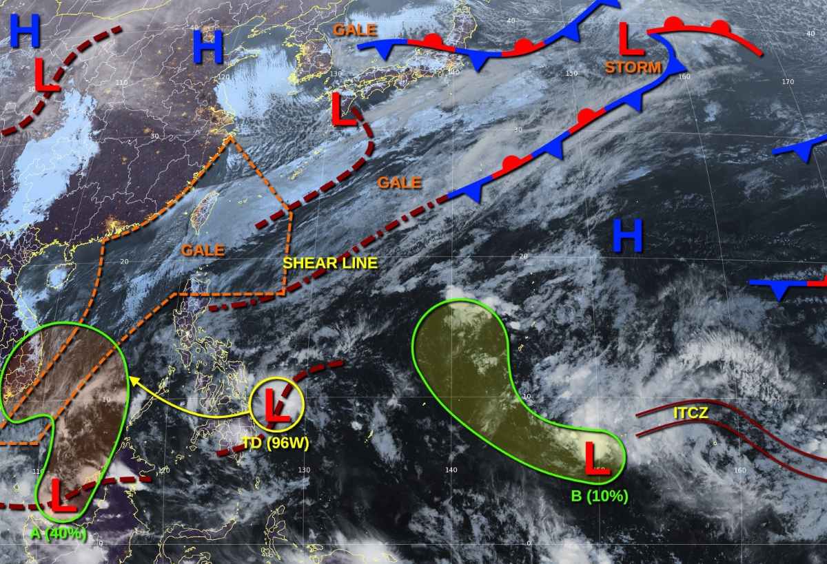
By mid-next week, the system is likely to absorb low 96W as upper-level winds begin to become unfavorable for further development. The 7-day chance of formation is at 40%.
In addition, a weak low pressure area (Trough B) located southwest of Chuuk (Federated States of Micronesia) is producing disorganized showers with a 7-day chance of formation at only 10%.
JTWC also issued a high wind warning for the South China Sea east of Vietnam, north and west of the Spratly Islands, northeast of the waters around Hong Kong/Macau (China), east of Taiwan (China), the Luzon Strait (including the northern coast of Luzon, Philippines) and surrounding waters.
According to the Vietnam National Center for Hydro-Meteorological Forecasting, on the day and night of December 20, the North East Sea (including the Hoang Sa archipelago) will have strong northeast winds of level 6, sometimes level 7 during the day, gusting to level 8-9. The sea will be rough; waves will be 4-6m high.
The sea area from Binh Dinh to Ca Mau, the central East Sea area, the sea area west of the South East Sea area (including the sea area west of Truong Sa archipelago) has strong northeast wind level 6, sometimes level 7, gusting to level 8-9. The sea is rough; waves are 3-5m high.
Disaster risk level due to strong winds at sea: level 2.


