According to the latest storm information from the Philippine Atmospheric, Geophysical and Astronomical Services Administration (PAGASA), at 8:00 a.m. on July 8, the center of the low pressure was at about 22.6 degrees north latitude, 140.5 degrees east longitude, 1,935 km east of the northernmost tip of Luzon.
However, PAGASA said the low pressure has a low chance of developing into a tropical storm.
The southwest monsoon will continue to affect some parts of the Philippines.
Cloudy skies with scattered rain and thunderstorms are forecast for Metro Manila, Ilocos Region, Cordillera Administrative Region, Central Luzon, CALABARZON, Zamboanga Peninsula, BARMM, Batanes, Occidental Mindoro, Palawan, Antique, Aklan, Sultan Kudarat and Babuyan Islands.
Cloudy weather with scattered showers or thunderstorms could occur in the rest of the country.
PAGASA also warned of the possibility of flash floods or landslides in low-lying areas due to rain.
The weather forecast at 10:00 on July 8 of the Vietnam National Center for Hydro-Meteorological Forecasting said that the Gulf of Thailand will have showers and thunderstorms. In Phu Quy special zone, strong southwest winds are recorded at level 5, sometimes level 6.
Forecast for the day and night of July 8, scattered showers and thunderstorms occurred in the eastern sea area of the North and Central East Sea; the sea area from Lam Dong to Ca Mau; Ca Mau to An Giang; Gulf of Thailand.
During thunderstorms, there may be tornadoes and dangerous strong gusts of wind.
In the sea area from Khanh Hoa to Ho Chi Minh City and the Central East Sea area, southwest winds of level 5, sometimes level 6, gusting to level 7-8. Waves are 2-3m high, rough seas.
Regarding the forecast of heavy rain during the day and night of July 8: The mountainous areas of the North will have scattered showers and thunderstorms, with some places having heavy rain. The common rainfall is 15-30mm, some places over 80mm (concentrated in the late afternoon and night).
In the afternoon and night of July 8, in the Central and Southern highlands, there will be scattered showers and thunderstorms. The common rainfall is 10-30mm, in some places over 70mm.
Typhoon No. 2 ( Typhoon Today) left the East Sea on the evening of July 6 and July 8 and is heading straight to the east coast of China after devastating Taiwan (China), killing 2 people and injuring more than 600 others.
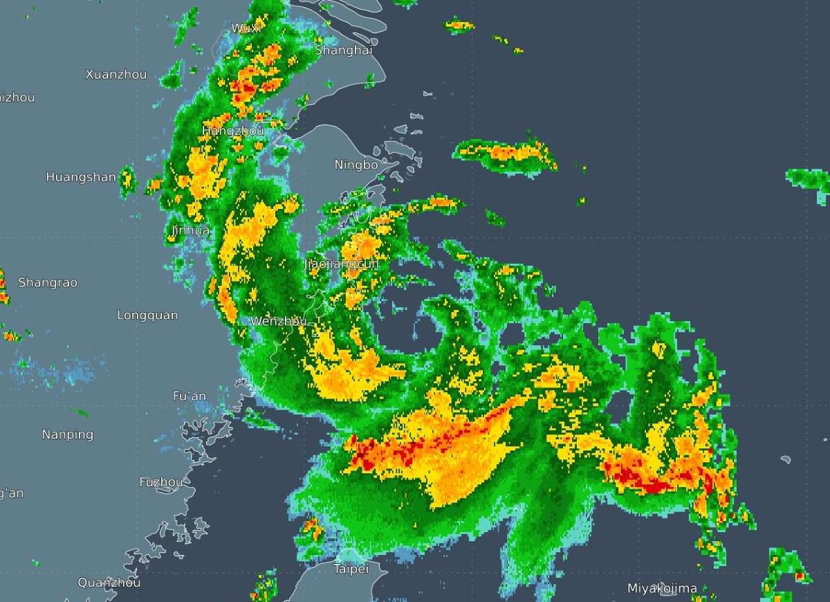
With winds of about 80 km/h, storm Today is expected to make landfall in the port city of Taizhou in Zhejiang Province, then continue moving into Jiangxi Province, China.