The storm forecast bulletin of the Philippine Atmospheric, Geophysical and Astronomical Services Administration said that the low pressure is unlikely to strengthen into a storm in the next 24 hours.
However, due to the influence of the low pressure combined with southwest winds, areas such as Pangasinan, Zambales, Bataan, Occidental Mindoro, Batanes and Babuyan Islands... on July 9 will have showers, the risk of flash floods and landslides due to moderate to heavy rain.
Also related to the above low pressure, the US Joint Typhoon Warning Center (JTWC) named it Invest 91W. The JTWC said that the large high-altitude low pressure area with weak signs on the ground is currently located in the area north of the Philippine Sea, east of Okinawa Island (Japan).
This low pressure area interacts with the monsoon trough, forming a large monsoon cyclone, causing a large area of scattered and unorganized thunderstorms. Upper winds may create favorable conditions for this system to gradually develop in the next few days as it moves towards the East China Sea.
Whether it strengthens or not, the system will still bring widespread heavy rain to the area, including the Ryukyu Islands (including Okinawa), Yaeyama Islands and Taiwan (China) for much of this week.
The JTWC assessed the possibility of the low pressure intensifying over the next 7 days at 30%.
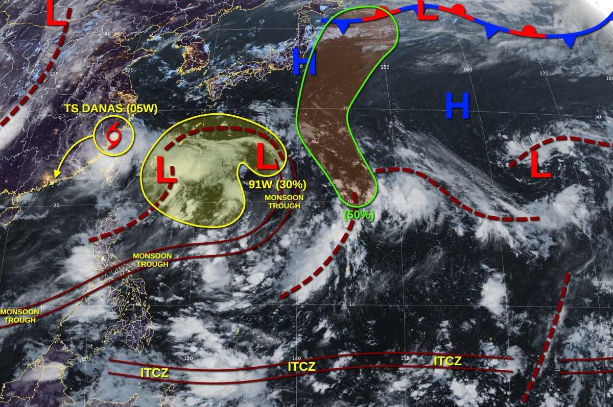
The JTWC is also monitoring District A (near the northernmost tip of the Northern Mariana Islands). A large-scale disturbance is forming due to the interaction between two ground-level low pressure troughs and a high-level low pressure area.
Environmental conditions are favorable for the development of this system, and it is likely that a subtropical or tropical depression may form around September 10 or 11 as it moves north.
The possibility of a low pressure forming in the next 7 days is 50%.