The latest forecast of storms and depressions on 7.2 of the Philippine Astronomy, Geophysics and atmosphere (Pagasa) said a new low pressure capable of forming in the southern region of PMD forecasting PAGASA.
The Philippine weather forecasts said that the low pressure in the South China Sea is less likely to become a storm.
Pagasa's 7.2 forecast news also stated that in the week from February 14 to February 20, it is less likely to have low pressure or storms formed in the PMD forecast area.
The Philippine Storm Forecasts also announced the expected path of the storm near the East Sea in February, although it is less likely to form this month.
There are 2 common storms in the Philippine Par forecast area in February: The storm formed in the Western Pacific into Par and then returned; The storm formed in the Western Pacific, went into PAR and moved towards the mainland of the Philippines but immediately before landing.
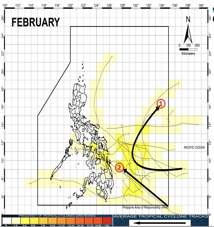
In the forecast of February, Pagasa said that there may be no or only one tropical storm near the Philippines in February.
Weather experts Pagasa Grace Castasta stated forecast on 1.2. "This February, it is likely that there is no or only one tropical storm formed or entered the Philippines forecast area," she said.
According to the February forecast model, if the storm is formed, it is likely to affect Visayas and Mindanao.
"Forecast, the storm will go around and located away from the mainland of the Philippines," Pagasa expert pointed out.
If the storm is formed in February and entered the Philippines's Par forecasting area, the storm will be named ARING. This is the first storm for Pagasa's 2025 storm.