In the early morning of August 24, the Philippine Atmospheric, Geophysical and Astronomical Services Administration (PAGASA) said that storm No. 5 in the East Sea Kajiki (formerly local name: Isang) is active outside the Philippine Forecast Area (PAR).
Meanwhile, another low pressure area (LPA 08f) in the PAR is being closely monitored as it is likely to become a tropical depression or storm in the next 24 hours and will likely be named Jacinto.
At 3:00 a.m. on August 24, the center of the low pressure was located about 445 km east of Hinatuan City, Surigao del Sur (Philippines), at 8.4 degrees North latitude, 130.4 degrees East longitude. Observations show that the circulation of this system is quite clear, with the strongest wind speed of about 28-37 km/h.
Forecasters from the US Joint Typhoon Warning Center said the low pressure area is likely to strengthen into a tropical depression in the next 24 hours, then make landfall in Samar and Luzon from now until midweek.
The possibility of storm formation in the next 7 days is assessed at 60%. If named Jacinto, it will be the 10th typhoon to active in the Philippines in 2025, and could become the sixth typhoon in the South China Sea after the five-story typhoon.
In Vietnam, the National Center for Hydro-Meteorological Forecasting is continuing to closely monitor the developments of storm No. 5 in the East Sea. At 4:00 a.m. on August 24, the center of the storm was at about 17.6 degrees North latitude; 111.7 degrees East longitude, in the northern sea of Hoang Sa special zone, about 660km East Southeast of Nghe An, about 640km East of Ha Tinh.
The strongest wind near the storm center is level 12 (118-133km/h), gusting to level 15; moving west at a speed of about 20km/h.
It is forecasted that by 4:00 a.m. on August 25, the center of the storm will be at 18.3 degrees North latitude, 107.8 degrees East longitude; in the South Gulf of Tonkin; about 230km from Nghe An, about 210km east of Ha Tinh, wind level 12-13, gusts level 15 and may increase. The storm is moving in a West-Northwest direction, about 20km/h.
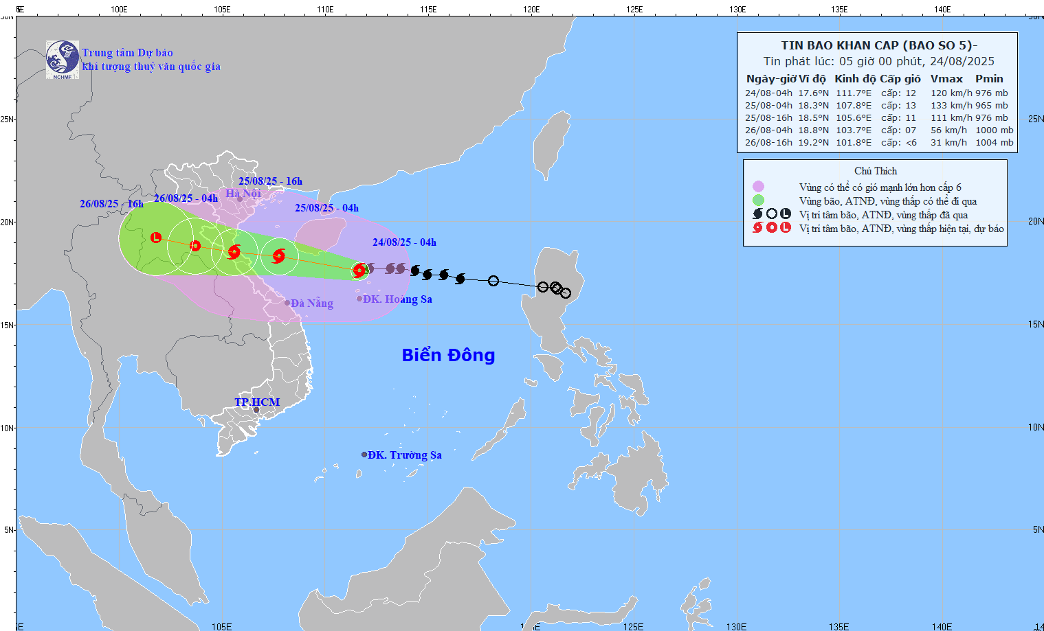
Due to the impact of storm No. 5, the sea area west of the North East Sea (including Hoang Sa special zone) will have strong winds of level 8-10, the area near the storm's eye will have winds of level 11-13, gusts of level 15, waves 5.0-4.0m high, the area near the storm's eye will have winds of 7.0 9.0m, the sea will be very rough.
Regarding rain forecast, from the night of August 24 to the end of August 26, in the Northern Delta, South Phu Tho and from Thanh Hoa to Hue City, there is a possibility of a widespread heavy rain with common rainfall of 100-150mm, locally over 250mm; Thanh Hoa to North Quang Tri will have heavy to very heavy rain with common rainfall of 200-400mm, locally over 700mm.
From August 25-26, the capital Hanoi and Da Nang City will have moderate rain, heavy rain and thunderstorms; Ho Chi Minh City will have rain, showers and thunderstorms in the late afternoon and evening. During thunderstorms, it is necessary to be on guard against the risk of tornadoes and strong gusts of wind.
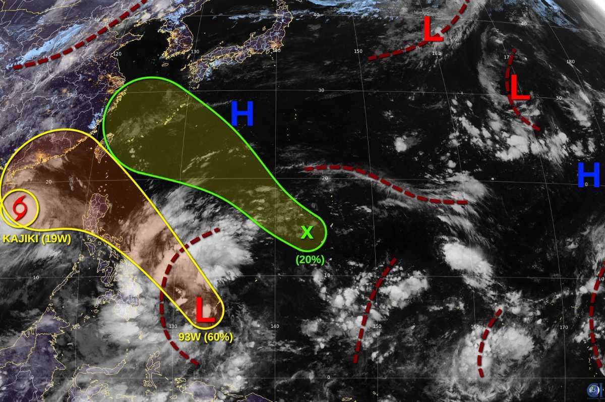
In addition to Typhoon No. 5 and the low pressure near the Philippines, another tropical disturbance is showing signs of forming west of Guam. The system is forecast to develop into a depression this week, but the likelihood of storm formation is only low, around 20%.