The Atlantic is becoming cramped with a series of new storm sources, as the US National Hurricane Center (NHC) continues to monitor three tropical disturbance areas alongside major storm Erin as it moves off the U.S. East Coast.
On August 22, Hurricane Erin continued to move slowly off the central Atlantic coast, creating large waves, dangerous offshore currents and coastal rises. At the same time, meteorologists are monitoring three other systems that could potentially become tropical storms in the coming days.
The most promising system has just been identified as Invest 90L, located a few hundred kilometers east of the Leeward Islands. The thunderstorm is likely to strengthen into a tropical depression, even becoming Hurricane Fernand, as it approaches the northeastern Caribbean this weekend.
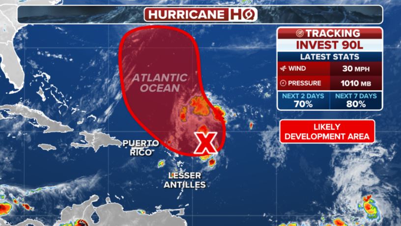
FOX Weather forecaster Bryan Norcross said: Gromromatic models suggest the system could form a low pressure or tropical storm after passing north of the archipelago, but further close monitoring is needed.
Another disturbance, Invest 99L, is moving in the central Atlantic, a few hundred kilometers from the Cabo Verde Islands. The NHC said that 99L has signs of organization but only under favorable atmospheric conditions and the possibility of long-term development is quite low. It is likely to only rise to a short-term tropical depression before weakening due to adverse environments.
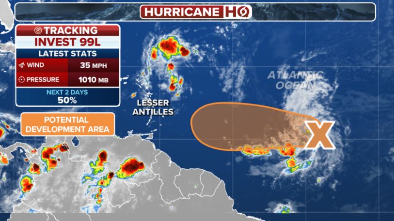
If it is lucky enough to overcome the difficult period and reach tropical storm level, the system will be named Gabrielle (in case 90L takes Fernand's name first).
The third hot spot closing the "three corners of the storm" is a small low pressure area located about 1,900km southwest of the Azores. This area is currently only causing scattered thunderstorms, the possibility of development is still low, but contributing to the formation of a " triangle of storms" on the Atlantic map.
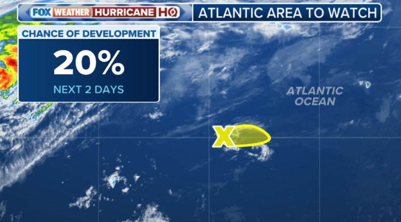
The US Meteorological Agency said upper-level winds will only provide minimal support, causing the system to move slowly eastward over the next few days, with a low chance of development within a week.
The Atlantic hurricane season is entering its peak, but experts stress that any forecast of systems that have not yet formed or are just starting to form has great potential errors and can change at any time. However, the simultaneous appearance of Erin and three new monitoring areas shows that the Atlantic is entering the most active phase of the 2025 hurricane season.