
According to the latest storm and low pressure forecast from the Philippine Atmospheric, Geophysical and Astronomical Services Administration (PAGASA), the risk of tropical cyclone formation is still maintained in the first 2 weeks of September. Some systems that are forming or are forecast to develop are likely to enter the Philippines area, then head towards the East Sea.
In the week from September 3-9, Typhoon Pilandok has left the Philippine Area of Responsibility (PAR) but is still located on the northernmost part of the forecast area. This system is forecast to move around the northeast of Taiwan (China).
Meanwhile, Typhoon Saundel is forecast to weaken as it moves towards the northwest boundary of the Philippine forecast area.
A tropical cyclone-like zone (TCLV) is also forecast to appear in the east of the tropical cyclone monitoring area. This system is likely to enter the northeast PAR but the probability of developing into a tropical cyclone in the first week is underestimated.
The risk of tropical cyclone activity continues to be maintained from October 10-16. 9. PAGASA forecasts 3 more TCLV zones likely to form or enter the monitoring area.
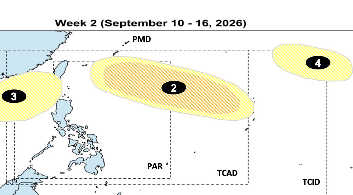
A TCLV may appear in the east of the monitoring area and advance northeast of PAR, with the possibility of developing into a low to moderate tropical cyclone.
Two other systems are forecast to form in the west and northeast of the monitoring area, but the possibility of developing into a tropical cyclone is underestimated.
PAGASA's climate forecast shows that September is a period when tropical cyclones may operate in many different directions in the region.
A system group formed in the east of PAR tends to move northwest and then change direction towards Japan and South Korea.
With Vietnam, there may be two scenarios with paths to the northwest. Accordingly, a tropical cyclone may form in the east of PAR, move northwest and pass through the northern Luzon Island area before heading south to China or Vietnam.
Another direction is the system formed in the east of PAR, going northwest, passing through the central and southern Luzon regions and then towards southern China or Vietnam.
Thus, although it is not yet possible to determine the specific path of the systems in the coming weeks, the East Sea is still in the area to be monitored in September.


