The Philippine Atmospheric, Geophysical and Astronomical Services Administration (PAGASA) typhoon forecast bulletin on December 27 said that during the week from December 27, 2024 to January 2, 2025, a low pressure system is expected to appear in the southwest of the Philippine Forecast Area (PAR), near the southern part of the East Sea. The low pressure system is unlikely to strengthen into a storm.
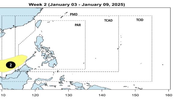
During the week from January 3 to January 9, 2025, low pressure will continue to appear in the southwest of PAR, near the southern East Sea. This low pressure is also unlikely to strengthen into a storm.
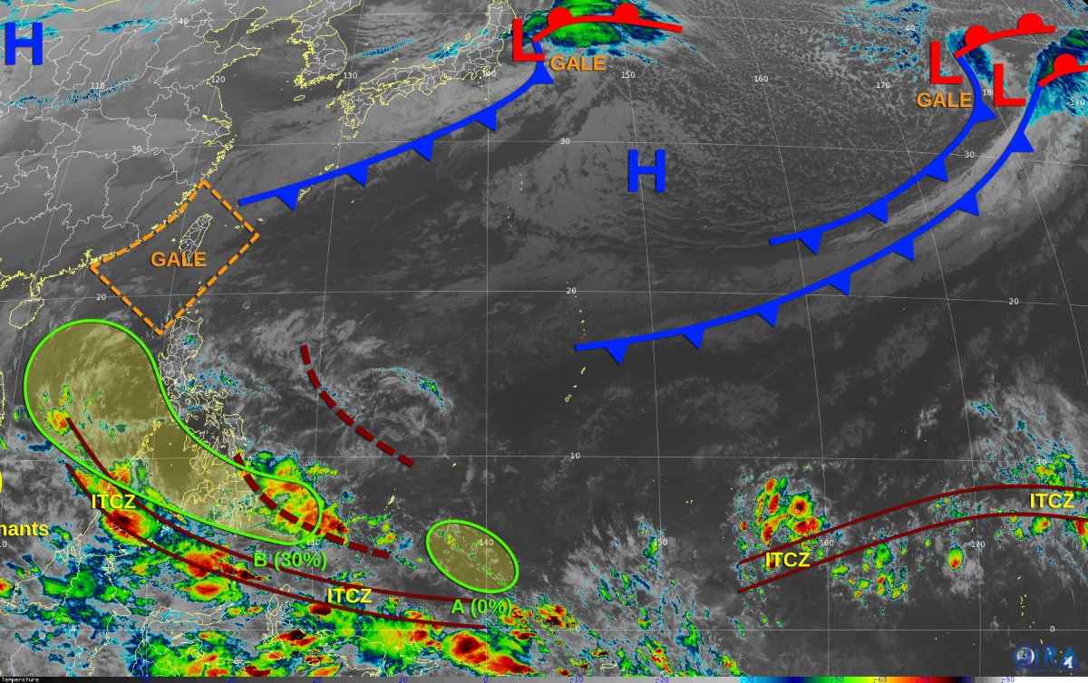
Meanwhile, according to the US Joint Typhoon Warning Center (JTWC), on December 28, the remnants of Storm No. 10 Pabuk were located off the southern coast of Vietnam. Although it is generating intermittent convection, environmental conditions are not favorable for any redevelopment of this system.
JTWC forecasts a low pressure system (Low Pressure A) to likely form southeast of the Republic of Palau over the weekend. Upper-level winds are unlikely to favor any significant development of the system as it slowly moves northwestward into early next week.
The JTWC also warned of an area of disturbed weather off the eastern coast of Mindanao (Philippines) associated with a low pressure trough (Trough B). The system is expected to pass over the Philippines without significant development over the weekend.
However, by next week, environmental conditions in the South China Sea could become favorable for the formation of a short-lived tropical depression or tropical storm. By New Year's Day, upper-level winds will become much less favorable for development. The 7-day chance of a B depression forming is 30%.
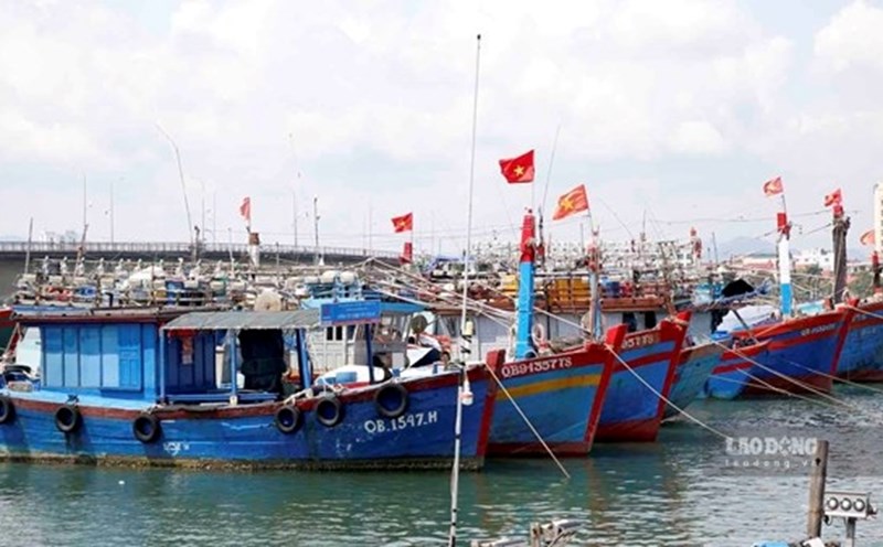
The Vietnam National Center for Hydro-Meteorological Forecasting predicts that on the night of December 28 and December 29, the North East Sea (including the Hoang Sa archipelago) will have strong northeast winds of level 6-7, gusting to level 8-9. The sea will be rough. Waves will be 4-6m high.
The sea area from Quang Ngai to Ca Mau, the central East Sea area, the sea area west of the South East Sea area (including the sea area west of Truong Sa archipelago) northeast wind level 6, sometimes level 7, gusting to level 8-9. Rough sea. Waves 3-6m high. Level 2 risk of natural disasters due to strong winds at sea.