
According to the latest weather reports, tropical storm Bertha is continuing to move over the Gulf of Mexico but is strongly affected by the phenomenon of high-level wind fault, causing the strengthening process to take place slower than forecast even though the sea area still maintains high temperatures.
According to the US National Hurricane Center (NHC), as of 8:00 PM on July 21 (local time), the center of Hurricane Bertha is about 635km northwest of Cape Coral city (Florida) and is moving at a speed of about 10km/h. The storm maintains maximum winds of 95km/h, central pressure of 997mb.
Meteorologists say Bertha once stood almost still in the Gulf of Mexico due to weak guidance. In the next 24 hours, the storm is forecast to begin accelerating and continue to head towards the southern coastal area of the United States.
Despite moving in high-temperature waters, Bertha is still unlikely to strengthen further. According to the NHC, upper-level gusts from the northeast along with dry air in the middle atmosphere are making it difficult for convective clouds to concentrate around the eye of the storm, making the intensity increase process slower than forecast.
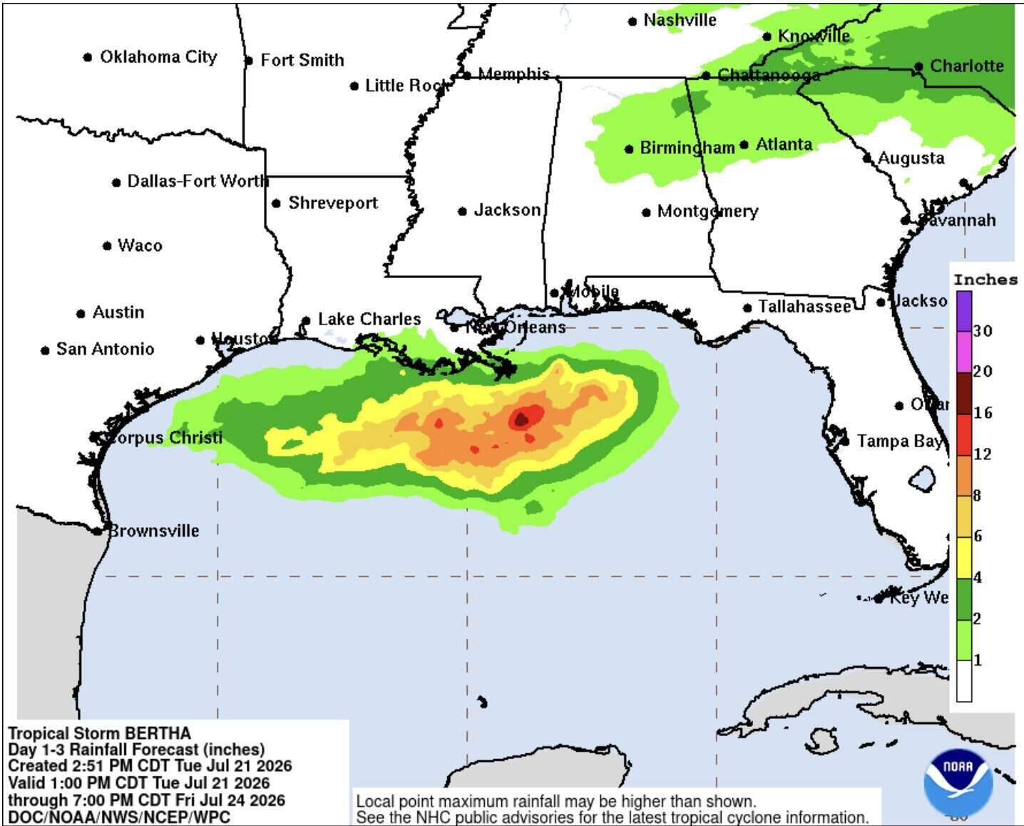
According to the latest trajectory, Florida Panhandle, Alabama, Mississippi and eastern Louisiana are the areas most likely to be affected by Bertha with heavy rain, strong winds and rough seas.
The US Meteorological Agency has issued a tropical storm warning for many coastal areas in these states. The NHC said dangerous weather conditions could occur within 36 hours.
Bertha is not forecast to directly affect the southwest of Florida. However, the meteorological agency still warns of the risk of increased offshore currents at beaches, which could be dangerous for swimmers.
Current forecast models show that Bertha will continue to move northwest, then gradually weaken as it enters the mainland and is likely to dissipate by the end of the week.
According to the NHC, this year's Atlantic hurricane season is forecast to have lower storm numbers than the multi-year average due to the impact of El Nino, a phenomenon that often reduces storm formation and development conditions in the Atlantic region.


