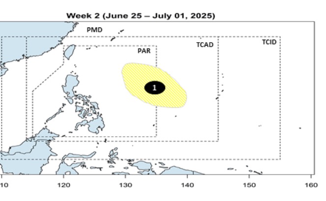
The latest storm and low pressure information from the Philippine Atmospheric, Geophysical and Astronomical Services Administration (PAGASA) said that from June 20 to July 1, a low pressure is expected to appear near the East Sea.
Forecast models show that the low pressure will form at the eastern boundary of the Philippine Forecast Area (PAR) and TCAD. This low pressure near the East Sea is unlikely to strengthen into a storm.
According to PAGASA's June typhoon forecast model, typhoons near the South China Sea in June typically have four expected paths.
First, the storm enters the PAR forecast area, heading towards the Philippine mainland but does not make landfall but loops towards Taiwan (China) or Japan.
Second, the storm entered PAR but did not make landfall but instead circles towards Japan.
Third, the storm makes landfall north of Luzon Island, Philippines, then moves into the East Sea, heading north of Vietnam or Hong Kong (China).
4th, the storm makes landfall northeast of Visayas, Philippines then moves into the East Sea, heading north of Vietnam or Hong Kong (China).
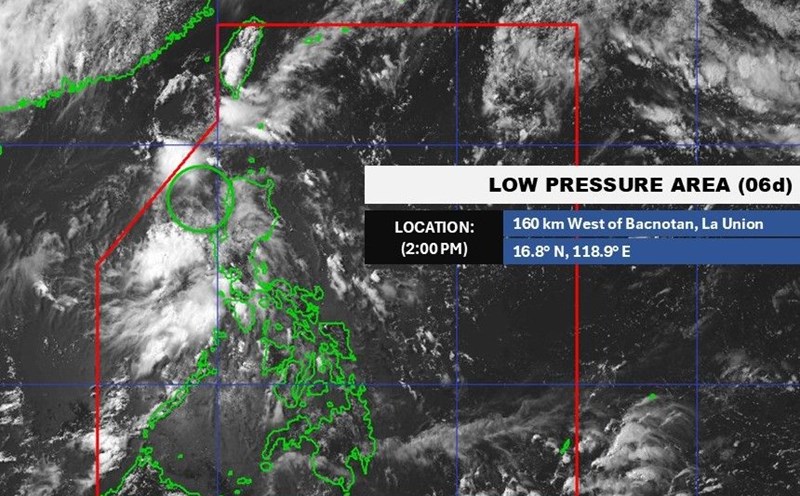
PAGASA's June 20 bulletin said two weather systems brought cloudy skies, causing scattered showers and thunderstorms across the Philippines on June 20.
According to PAGASA, the tropical convergence zone will affect Mindanao while the easterly winds will operate across other parts of the Philippines.
In particular, Caraga, Davao, Zamboanga Peninsula, Sultan Kudarat, Sarangani, Basilan, Sulu, Tawi-Tawi and Palawan are expected to experience cloudy skies with scattered showers and thunderstorms due to the tropical convergence zone.
Similar weather patterns will affect Aurora and Quezon in Luzon due to the easterly winds.
PAGASA weather forecasters have also warned that flash floods and landslides could occur in areas with moderate to heavy rain.