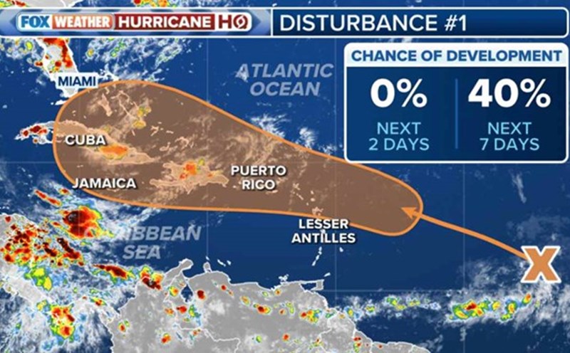
Forecasts from the US National Hurricane Center (NHC) on July 31 said that a system combined with tropical waves could develop into a tropical depression over the Greater Antilles archipelago by the end of the week.
This system has a 60% chance of developing into a tropical depression, up from a 50% chance on July 30 and a 40% chance earlier this week.
The US National Hurricane Center's storm forecast shows that waters warming up to 26 degrees Celsius could be the driving force for increased storm activity and create the opportunity to become a tropical depression by the end of the week.
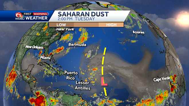
However, the NHC also noted that the system is located right in the middle of the dry Saharan dust air mass - something that appears to be hindering storm development at this time.
NHC predicts that the tropical depression's area of influence will become wider as it moves through the Greater Antilles archipelago.
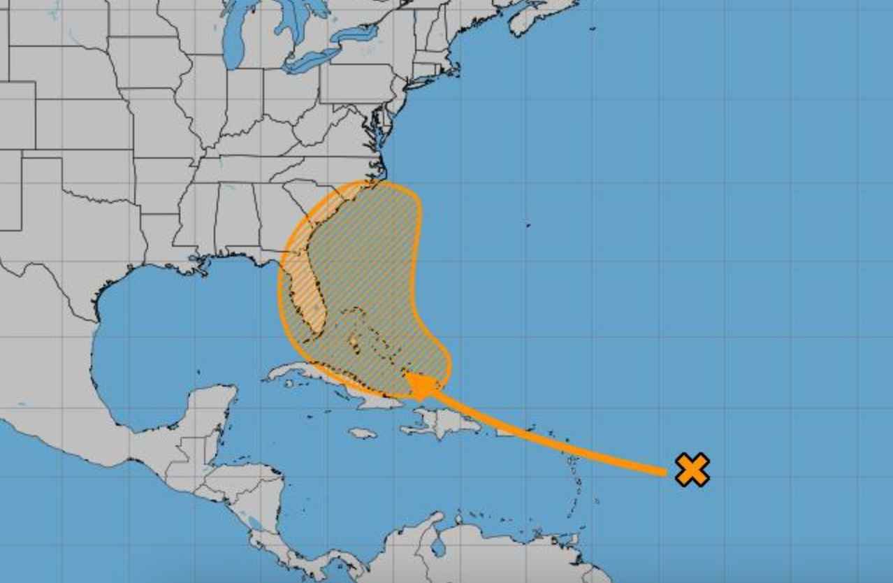
Next, computer forecasts showed the system being drawn into a clockwise circulation around the Bermuda High and moving it away from the southeast coast of the United States.
The forecast does not describe the tropical depression as becoming a very powerful storm if it moves toward the east coast of the United States rather than into the Gulf of Mexico, where landfall is likely.
Currently, the majority of data shows the potential tropical low pressure system moving south of Florida, then being pulled north through the influence of the Bermuda high causing it to move away from the southeast coast of America.
Currently, there is little chance that southeast Louisiana will be affected by this tropical depression.
In May, the US National Oceanic and Atmospheric Administration (NOAA) predicted the 2024 Atlantic hurricane season would have 15 to 25 named storms, including 8 to 13 hurricanes and hurricanes. 4 to 7 major storms. Storm season lasts from June 1 to November 30. NOAA's revised hurricane forecast is expected to be released in early August.
Hurricane season usually peaks in mid-August and lasts until late September.