Hurricane Melissa moves windingly over the Caribbean Sea at an unbelievable speed, only about 3.2 km/h, although it is forecast to strengthen into a hurricane. This speed is slower than the speed of a normal walking person.
Hurricanes are strong storms that need the impact of other weather systems such as cold air masses or the decline of rays to determine the intensity and direction of movement of the storm.
However, these weather impacts are weak or absent for Meliss. Therefore, the storm can move around and around for many days, causing extremely heavy rain.
Storms move slowly, weak upper-level winds can also help a storm like Melissa accelerate into a major hurricane, a Category 3 or higher hurricane.
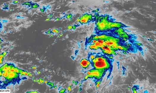
Currently, the Caribbean has some of the hottest waters of any Atlantic region, and the 13th storm of the Atlantic hurricane season could have the opportunity to harness that energy.
"The potential extreme intensity in the Caribbean at this time of year is quite high, compared to the average for the 1979-2023 period," said Kerry Emanuel, a meteorologist at the Massachusetts Institute of Technology, USA.
He pointed out that the Caribbean has not yet had a hurricane because upper-level winds prevent new storms from forming and intensifying. But now, conditions are expected to be favorable for Melissa to maintain a "slow as a lot".
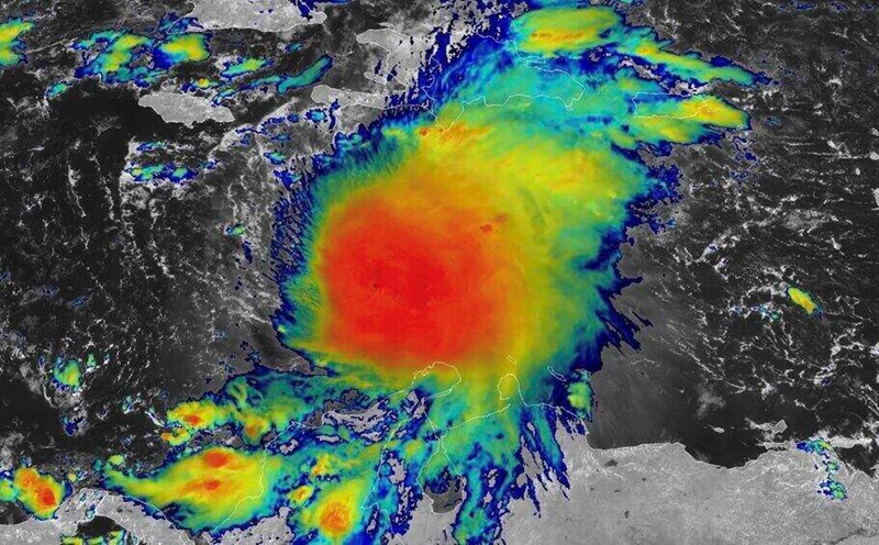
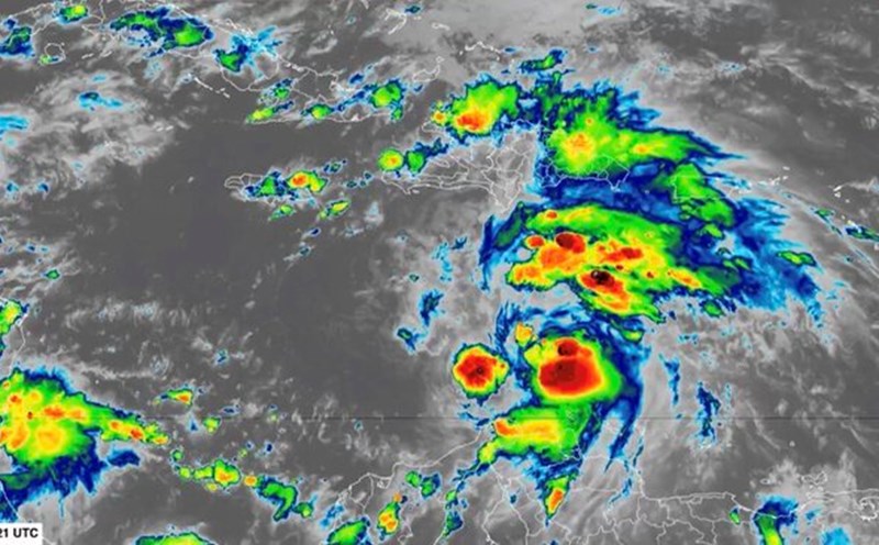
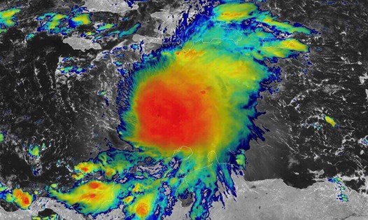
The latest storm news says, Melissa is a tropical storm with winds of 80 km/h. The storm is moving northwest, with the center of the storm about 345km southeast of Kingston, Jamaica.
The latest Atlantic storm continues to see strong wind shear, leading to continuous deviation. The wind shear is expected to ease by the weekend. Forecasters say that at that time, Shelter will become an extremely strong storm.
Several computer models predicting hurricanes have simulated Melissa as reaching Category 5 hurricane strength, super typhoon strength. Melissa could rapidly intensify starting on October 25 and lasting until October 27.
feedback is forecast for approaching or making landfall south of Hispaniola and Jamaica later this week. The storm is expected to cause flash floods in Haiti and Jamaica, even if it does not make landfall officially.
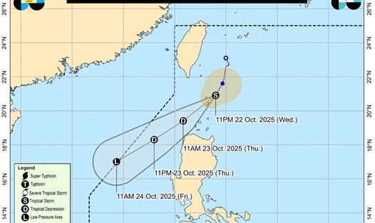
After that, Melissa is expected to explode strongly this weekend. Earlier next week, the National Hurricane Center predicted that Hurricane No. 13 Melissa would strengthen to Category 4, or even higher. Starting on October 27, the storm will move north, possibly sweeping across Cuba and eventually the Bahamas.
The delay in Melissa's movement is expected to extend the impact period and give the storm more time to intensify. There is a good chance of a Category 5 storm, which could even be among the strongest on record in the Atlantic, said Andy Hazelton.