Tropical depression Wilma is forecast to enter the East Sea and is likely to strengthen into storm No. 16. Meanwhile, the Philippines is racing against time as this weather system accelerates, bringing heavy rain, strong winds and rough seas, threatening the Visayas region in just a few hours.
Tropical depression Wilma is moving slowly but gradually strengthening, currently less than 250km from the Philippine coast, creating a multi-layered risk: heavy rain, strong gusts of wind and extreme waves right before the forecast time of landfall.
According to the latest storm information issued at 5:00 a.m. on December 5, 2025 by the Philippine Atmospheric, Geophysical and Astronomical Services Administration, Wilma is moving west-southwest at a speed of 20 km/h, tightening its trajectory towards the Visayas region.
The sustained winds of 45 km/h and 55 km/h, showing that the tropical depression is intensifying, forcing coastal localities to quickly deploy response.
Wilma's strong wind range has expanded significantly, with a radius of up to 220km from the center, putting almost the entire central and southern Philippines under warning.
Most important forecast: Wilma is likely to make landfall or sweep near the Eastern Visayas or Dinagat Islands from tonight to tomorrow morning (December6,). The tropical depression will then continue to cross the Visayas region through Sunday (December 7) before moving out to the Sulu Sea.
The severity of this weather system is clearly demonstrated through the wind warning (TCWS) level 1: Strong winds of 39-61 km/h, forecast time 36 hours in advance - showing the risk of light to moderate damage in many localities. The areas under warning include: Luzon, Visayas, Cebu, Mindanao.
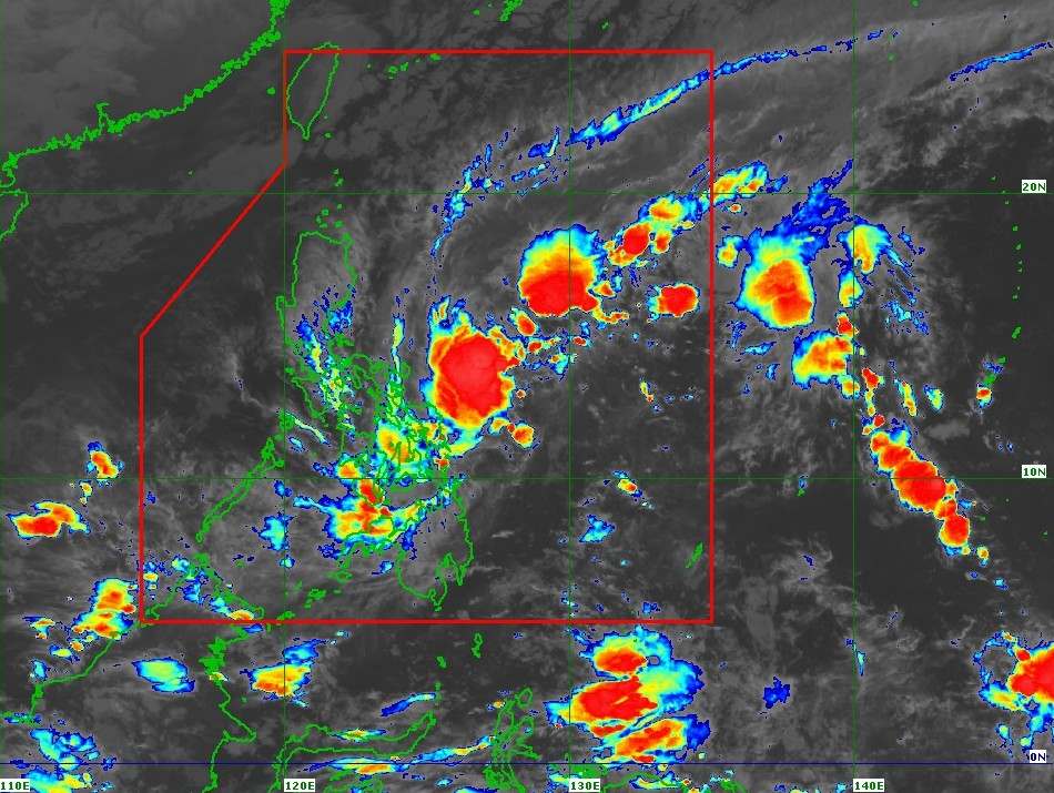
In addition to strong winds on land, coastal residents and fishermen are facing great risks. A high-level monsoon warning is in place for most of the northern, western and eastern seas of Luzon and the Visayas.
Waves are forecast to reach 5.5m in Catanduanes and Northern Samar; about 4.5m in Isabela, Aurora and Eastern Samar. The Philippine Coast Guard requires all ships to absolutely not go to sea.
Small ships and motorboats are also advised to stay in their original position or seek safe shelter, even when conditions in some areas "only" reach the waves of 3m.
Although Wilma is expected to remain in the tropical depression as it passes across the Philippines, PAGASA warned that the system could strengthen slightly before making landfall.
More worryingly, the northeast monsoon will interact with Wilma, causing widespread gusts, spreading across Luzon and Visayas today, then expanding to Zamboanga Peninsula and Misamis Occidental this weekend.
The Philippine government has warned that heavy rains and strong winds may occur both in areas outside the storm's center and outside the main forecast area. Places at risk of flash floods and landslides must maintain the highest vigilance.
Disaster prevention centers are required to implement measures to protect lives and property; people need to strictly follow evacuation instructions and warnings from local authorities.
Wilma's journey is not over yet as he leaves the mainland. The system is forecast to continue to strengthen when it enters the East Sea early next week, potentially becoming storm No. 16, requiring Vietnam and countries in the region to closely monitor the next developments.


