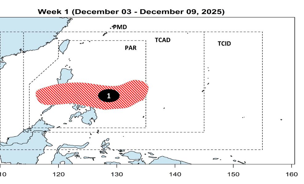
According to the Philippine Atmospheric, Geophysical and Astronomical Services Administration (PAGASA), low pressure 12a in the east of the country entered the Philippine Forecast Area (PAR) at 2:00 p.m. on December 3.
The center of the low pressure is located at 14.5 degrees north latitude, 134.4 degrees east longitude, 1,105km east of southeast Luzon.
PAGASA forecasts that the low pressure may strengthen into a tropical depression within the next 24 hours and will be locally named Wilma.
Wilma is forecast to strengthen into a tropical storm as it passes through the Philippine Sea.
However, the strong intensity of the northeast monsoon will prevent the storm from strengthening and turning southwest.
Wilma may make landfall in the Eastern Visayas-Bicol region on December 6 or 7, then pass through the Southern Luzon - Visayas region from December 8-9.
During the week of December 10-16, the storm may enter the East Sea, becoming storm No. 16, heading towards the South Central Coast of Vietnam.
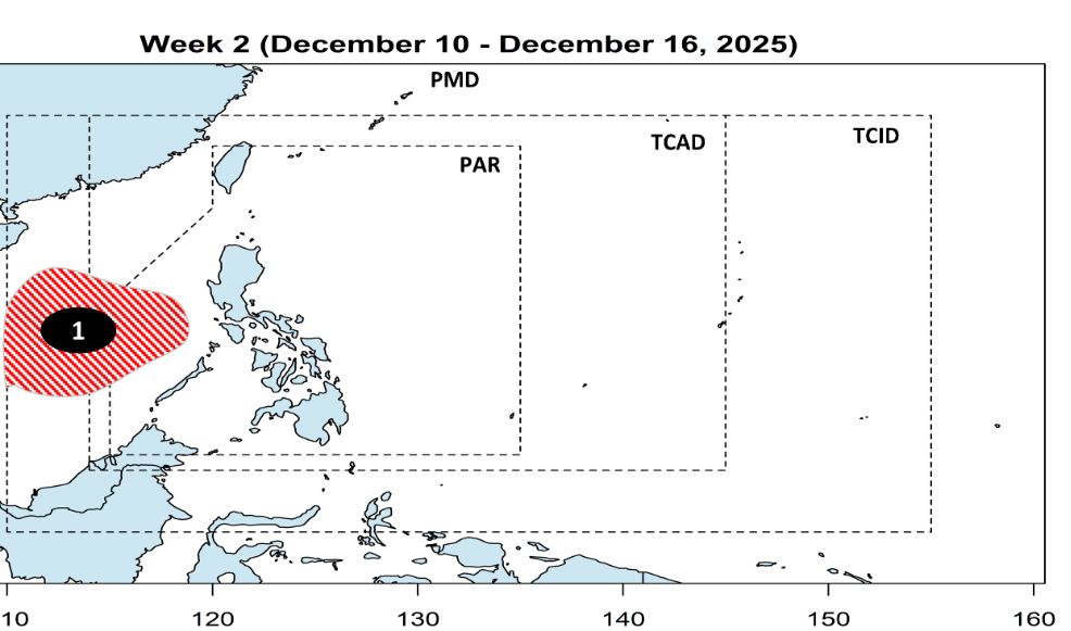
From December 11, Wilma may begin affecting Bicol and Eastern Visayas. The wind signal may also increase at that time.
The storm will bring heavy to very heavy rains, especially along the direct path of the storm. Rain caused by increased wind shear will also affect the eastern areas of Northern and Central Luzon.
Severe and widespread flooding and landslides may occur in many areas.
However, uncertainty over the intensity and path of the storm remains high, so people are advised to continue monitoring updates on the potential tropical storm.


