Noi Bai International Airport (HAN) summarizes the announcement of storm No. 12 (Fengshen) according to the Official Dispatch dated October 19, 2025:
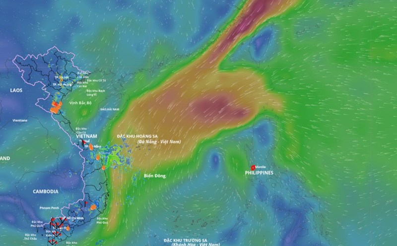
Current status on October 19: Location: East of the Central Philippines; intensity: Level 8 (34-40kt), gust level 10 (48-55kt); Mobility: West Northwest, 20 km/h.
Forecast: In the next 24-48 hours: The storm will enter the East Sea, moving northwest, likely to strengthen to level 10-11, gusting to level 13.
48-72 next hours: Storm goes West Southwest, intensity level 10, gust level 13, in the sea area west of Hoang Sa area.
Assessing the impact on the Vietnam Sky Area (FIR 2). In the next 24-48 hours, the storm is unlikely to directly affect the two FIRs of Vietnam.
Noi Bai Airport recommends: Passengers and airlines are advised to closely monitor flight information to proactively plan their travel.
According to the meteorological agency, storm Fengshen entered the East Sea and became storm No. 12 around this evening, October 19, and was forecast to increase in intensity, with the strongest gust reaching level 13.
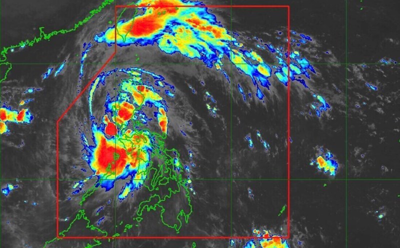
According to the National Center for Hydro-Meteorological Forecasting, at 1:00 a.m. on October 19, the center of the storm was at about 13.7 degrees north latitude; 122.7 degrees east longitude, in the area east of the central Philippines. The strongest wind near the storm center is level 8 (62 - 74 km/h), gusting to level 10. The storm is moving west-northwest at a speed of about 20 km/h.
According to Mr. Mai Van Khiem, Director of the National Center for Hydro-Meteorological Forecasting, this afternoon and evening, October 19, storm Fengshen will pass through Luzon Island (Philippines) and enter the East Sea, becoming storm No. 12.
"It is forecasted that after moving into the East Sea, storm No. 12 will move mainly in the west-northwest direction with increasing intensity, then continue to strengthen" - Mr. Khiem said.
At 1:00 a.m. on October 20, the center of the storm was at about 17.1 degrees north latitude; 118.9 degrees east longitude, in the sea east of the northern East Sea. Strong wind level 9, gust level 11.
The dangerous area in the East Sea in the next 24 hours will be north of the latitude of 15 degrees north; east of the longitude of 117.5 degrees east. The natural disaster risk level is level 3 for the eastern sea area of the northern East Sea.
It is forecasted that in the next 48 hours, the storm will continue to move northwest at a speed of about 20 km/h and is likely to strengthen.
At 1:00 a.m. on October 21, the center of the storm was at about 19 degrees north latitude; 114.8 degrees east longitude, in the eastern sea of the northern East Sea. Strong wind level 10, gust level 13.
The danger zone is north of latitude 15.5 degrees north; east of longitude 113 degrees east. Level 3 natural disaster risk for the northern East Sea area.
It is forecasted that in the next 72 hours, the storm will move west-southwest at a speed of about 10 km/h and is likely to strengthen.
In the next 72 to 120 hours, the storm will move mainly southwest, traveling about 10 - 15 km per hour and tend to weaken gradually.