Dozens of landslides on river and sandbank dykes
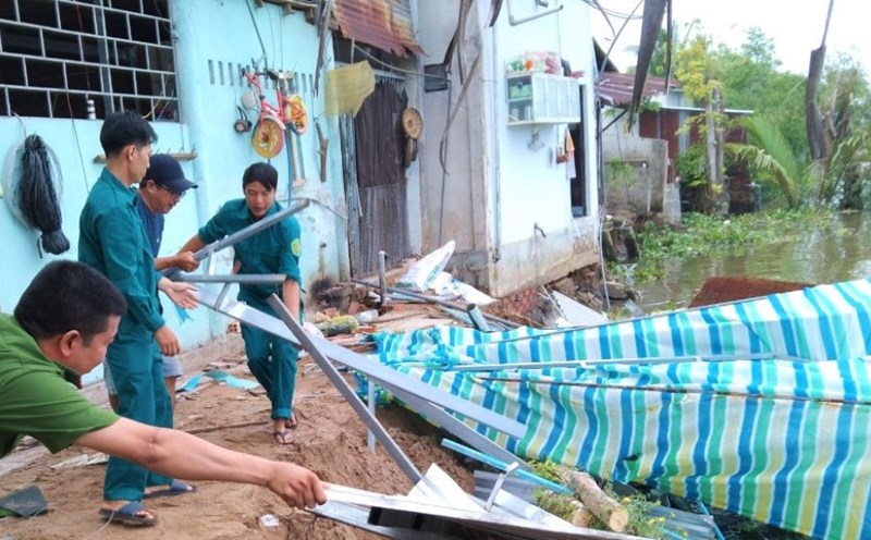
According to the People's Committee of Ke Sach district (Soc Trang province), the landslide situation in the district is increasingly serious, affecting people's lives and production.
According to statistics, from 2015 to present, on average each year there has been a total landslide length of 2km, 3-10m deep into embankments, dikes, roads, and orchards, with the area of land lost due to landslides and subsidence being about 1ha/year.
Similarly, the dike system has also recorded landslides. For example, at An Tan and An Cong islets in An Lac Tay commune (Ke Sach district, Soc Trang province), since the beginning of the year, 11 landslides have been recorded, with a length of 259m. After checking, there are still 35 dike sections with a total length of 1,048m at very high risk of landslides.
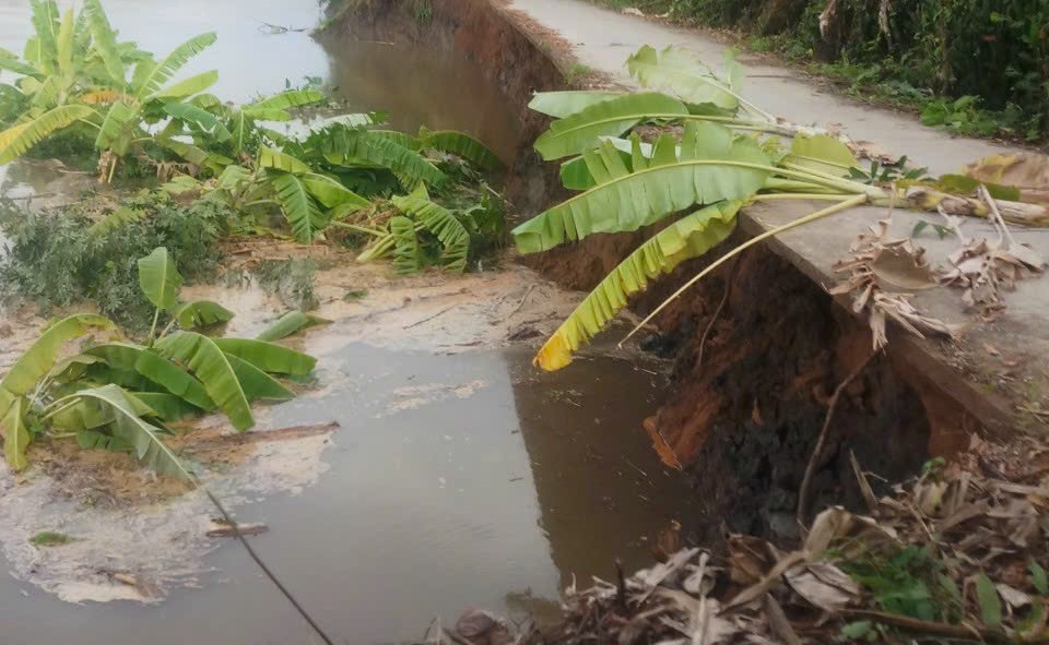
In Phong Nam commune, there are also 26 dike sections with a total length of 921m at risk of landslides that need to be upgraded to stabilize people's lives and production.
In Cu Lao Dung district, more than 30 serious landslides were recorded on the Ta Huu dike in An Thanh Dong commune, Xom Day area, Dai An 1 commune.
In My Tu district, the flow caused serious erosion of the Nhu Gia riverbank, eroding the Tam Soc sluice gate area. The People's Committee of Trang province also issued an Order to build a project to urgently handle the dangerous landslide of the Nhu Gia riverbank and the Tam Soc sluice gate area to fundamentally handle the landslide situation, ensuring the safety of people's lives and property.
According to the Department of Agriculture and Rural Development of Soc Trang province, since the beginning of the year, the area has recorded 59 landslides on dikes and embankments with a total length of 1,514m.
880 billion VND needed to build the project
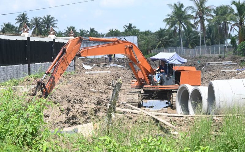
According to Mr. Pham Tan Dao - Manager of Soc Trang Province Irrigation Department - recently, from central and local capital sources, the agricultural sector has coordinated with districts and towns to reinforce embankments in Cu Lao Dung and the sandbanks on Hau River to ensure safety, prevent salinity, and protect production areas against high tides.
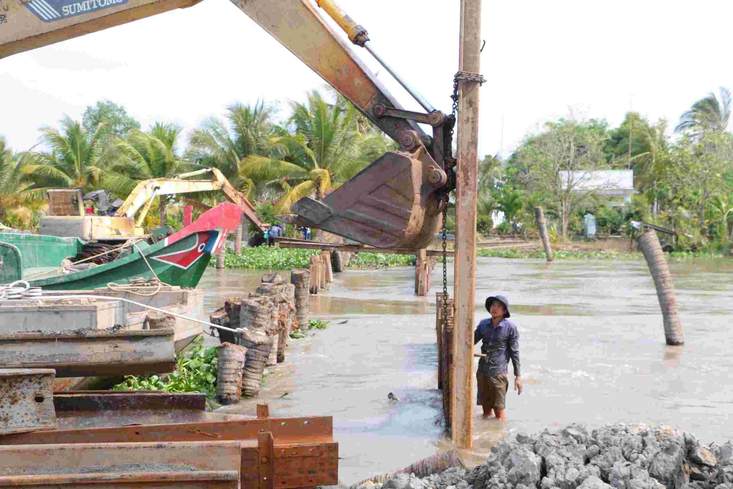
The province has also put into use the Rach Vop riverbank erosion control project in Trinh Phu commune (Ke Sach district). The underground embankment to prevent coastal erosion in Lai Hoa commune (Vinh Chau town) is 2.2 km long, part of the urgent project to handle riverbank and coastal erosion in the Mekong Delta region in 2022 with a budget of 130 billion VND. The underground wave-breaking embankment to protect the coast from culvert No. 2 to culvert No. 4 (2km) was completed and put into use with a cost of 66 billion VND and the K41 area (1.4km) was costed at 77 billion VND, under the socio-economic recovery program with a total budget of 143 billion VND.
The province has also started the K39-K45 wave-breaking underground embankment project in the coastal area of Vinh Chau town with a total cost of 330 billion VND. In the near future, the construction of an emergency project to handle dangerous riverbank erosion of the Nhu Gia river dike, Tam Soc sluice area, My Thuan commune (My Tu district) will be carried out with a total cost of 13.7 billion VND.
Mr. Dao added that in order to respond to climate change and riverbank and coastal erosion in the coming time, and to focus on and thoroughly handle serious landslides in the area, the province has also proposed to ministries, branches, and the Central Government to support 3 urgent projects to prevent and overcome riverbank and coastal erosion, with a total cost of about 880 billion VND.