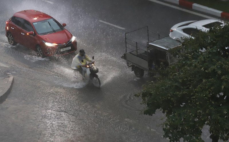
Latest update from the National Center for Hydro-Meteorological Forecasting, today, October 13, the Northeast and North Central regions will have rain, moderate rain and scattered thunderstorms, locally heavy rain. The area from Quang Tri to Hue city, the South Central Coast, the Central and Southern Plateau will have scattered showers and thunderstorms, locally heavy rain.
Rainfall from 7am to 3pm on October 13 locally, there are monitoring stations measuring over 60mm such as Yen Loc station (Ninh Binh) 72.2mm, Cau Rom station (Hanoi city) 66.2mm, An Binh station (Phu Tho) 64.2mm, Bac Son station (Thanh Hoa) 64.0mm, Tang Thanh station (Nghe An) 115.6mm, La To hydropower station (Quang Tri) 83.2mm, Ho Tam Bo station (Ho Chi Minh City) 78.4mm,...
Hanoi has places with heavy rain over 90mm in the next 3 days
The Northern Delta and Thanh Hoa - Ha Tinh provinces from the evening of October 13 to the end of October 15 are forecast to have moderate rain, with common rainfall of 40 - 80mm, locally heavy rain over 150mm.
The midland and mountainous areas of the Northeast from the evening of October 13 to the end of October 15 are forecast to have showers and thunderstorms, with common rainfall of 30 - 60mm, locally heavy rain over 100mm.
The Hanoi area will have rain, moderate rain and thunderstorms with rainfall of 30 - 70mm from the evening of October 13 to the end of October 15, with some places having heavy rain over 90mm.

According to Mr. Mai Van Khiem - Director of the National Center for Hydro-Meteorological Forecasting, Department of Hydro-Meteorology, the cause of the rain is the influence of weak cold air combined with the easterly wind from the subtropical high pressure circulation encroaching on the west, the weather in the North is about to change.
"During the period from October 13 to 15, the Northern region, especially the Northeast, is likely to experience rain, moderate rain, and cloudy skies. The forecast for accumulated rainfall in 24 hours is generally below 50mm, so the possibility of flooding on river systems is very low" - Mr. Khiem said.
However, the Director of the meteorological agency also warned that during this time, there may still be local showers and thunderstorms, with a heavy rainfall of 30 - 50mm/hour, which can cause flooding, flash floods and landslides in some mountainous areas.
In the area from Quang Tri to Lam Dong and the South in the evening and night of October 13, there will be scattered showers and thunderstorms with rainfall of 10 - 30mm, locally heavy rain over 80mm. Thunderstorms in these areas will continue for many days to come.
The meteorological agency warns that thunderstorms may cause tornadoes, lightning, hail and strong gusts of wind. Localized heavy rains are likely to cause flash floods on small rivers and streams, landslides on steep slopes and flooding in low-lying areas.
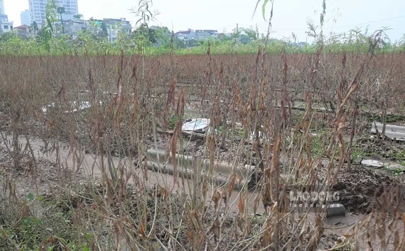
Flooding continues locally in some communes and wards of the North
Regarding the hydrological situation, the flood on the Cau and Thuong rivers (Bac Ninh) is currently receding. At 3:00 p.m. on October 13, the water level on the Thuong River at Phu Lang Thuong Station was 5.57m, 0.27m higher than alert level 2; on the Cau River at Dap Cau Station was 4.84m, 0.46m lower than alert level 2.
In the next 12 hours, floods on the Thuong River at Phu Lang Thuong station will continue to decrease and remain below alert level 2.
In the next 12 to 24 hours, floods on the Thuong River at this station will continue to decrease and remain above alert level 1. Meanwhile, floods on the Cau River at Dap Cau station are forecast to continue to decrease and are likely to be below alert level 1 in the next 24 hours.
Flooding in Thai Nguyen, Bac Ninh provinces and Hanoi city continues, especially in communes and wards along the river and low-lying areas. In the coming days, the risk of riverbank erosion, landslides and steep slopes in the above areas will remain high.
The Hydrometeorological Agency recommends that people monitor warning information on areas at risk of flash floods and landslides updated in real time on the website https://luquetsatlo.nchmf.gov.vn and in separate bulletins.
The risk level of natural disasters due to floods is determined at level 2. Floods on the Thuong and Cau rivers caused flooding in low-lying areas along the river, affecting waterway transportation, aquaculture, agricultural production, daily life and socio-economic activities. In addition, it is necessary to be on guard against environmental pollution and epidemics in areas where flood waters have receded.